Severe Weather Possible for SE Colorado
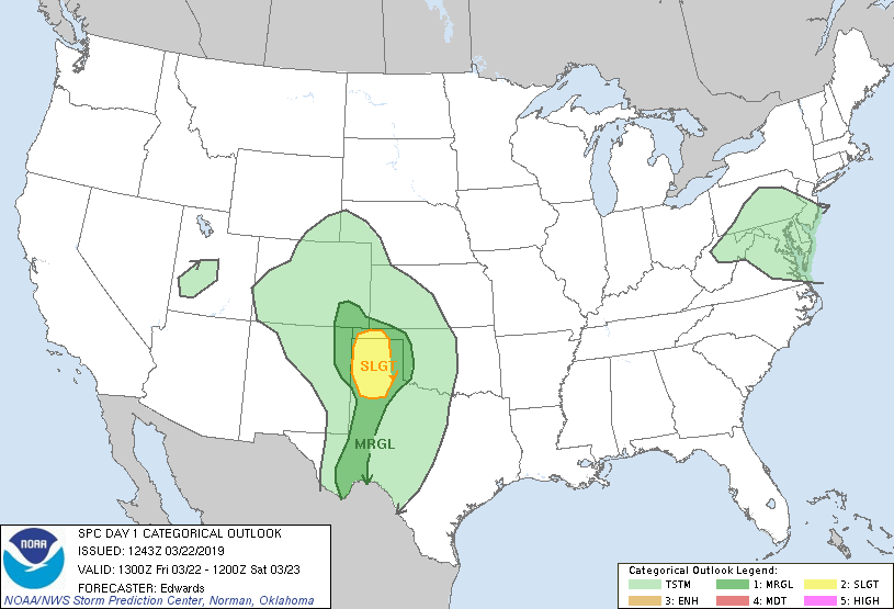
SPC Day 1 Severe Wx Outlook
Today will feature a large variety of weather across Colorado. The first thing that came out this morning is the Storm Prediction Center outlook and has far Southeastern Colorado under a marginal risk for severe weather. This means that a few storms may become strong or severe but we aren't expecting a widespread severe weather event.

SPC severe hail probabilities
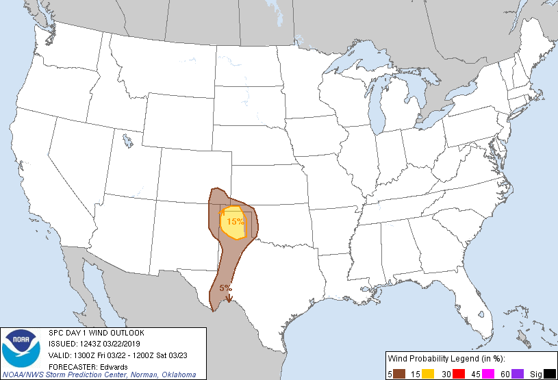
SPC severe wind probabilities
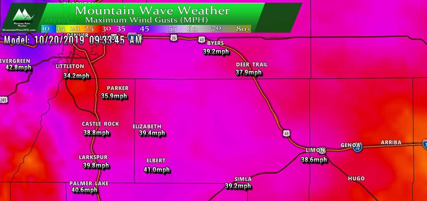
The main threats with a lot of these storms that become strong or severe will be large hail and damaging winds. Hail will be possible with stronger storms along the Palmer Divide but it is not expected to reach severe levels for many areas. The lower atmosphere is simply not going to get warm enough to support large amounts of severe storms. The instability will establish and that will help storms develop with heavy rain and potentially areas of heavy snow.
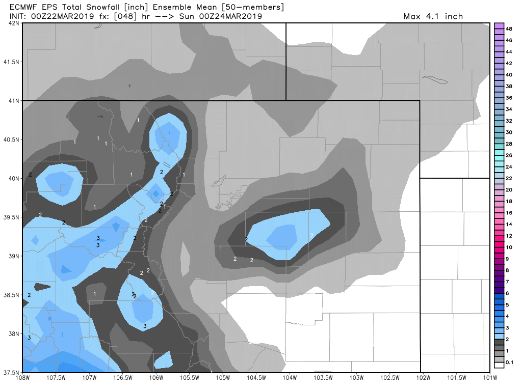
Palmer Divide Snow
Honestly, this will be a tricky forecast folks. I have a good feeling the models don't have a decent handle on temperatures and thusly who sees snow and how much of it sticks. I'll start out by saying from a snow accumulation standpoint this storm looks nothing like the last, temperatures will be too warm for many areas to see decent snow accumulation...even along the higher elevations is questionable.
Here's a quick timeline of what to expect:
Timeline
- Thunderstorms possible after 12-2PM, initially precipitation will be rain. Small hail will be possible with stronger storms
- Expect rain to transition to snow in the evening/overnight hours. Roads will be warm so not expecting a major impact to the evening commute but conditions will be wet
- Overnight all snow will fall mainly along the Palmer Divide and especially East into Elbert County. Again, with warm temperatures there is a lot of mixed data on how much snow actually accumulates.
- Storm looks to begin moving out in the early morning hours of Saturday. Expect clearing on Saturday morning.
Nam3k Model Snapshots:
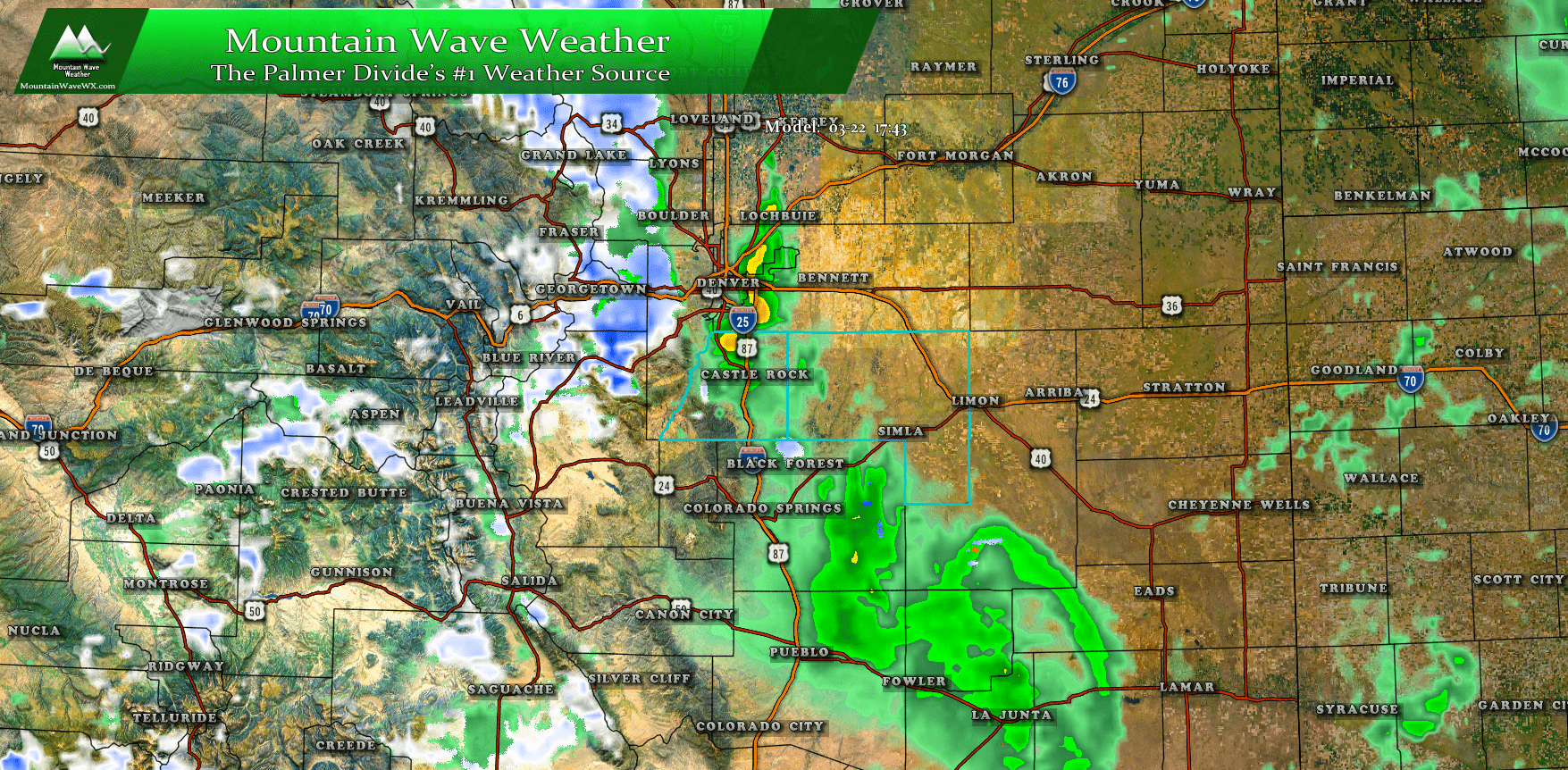
Nam3k Precip Type Snapshot at 6PM
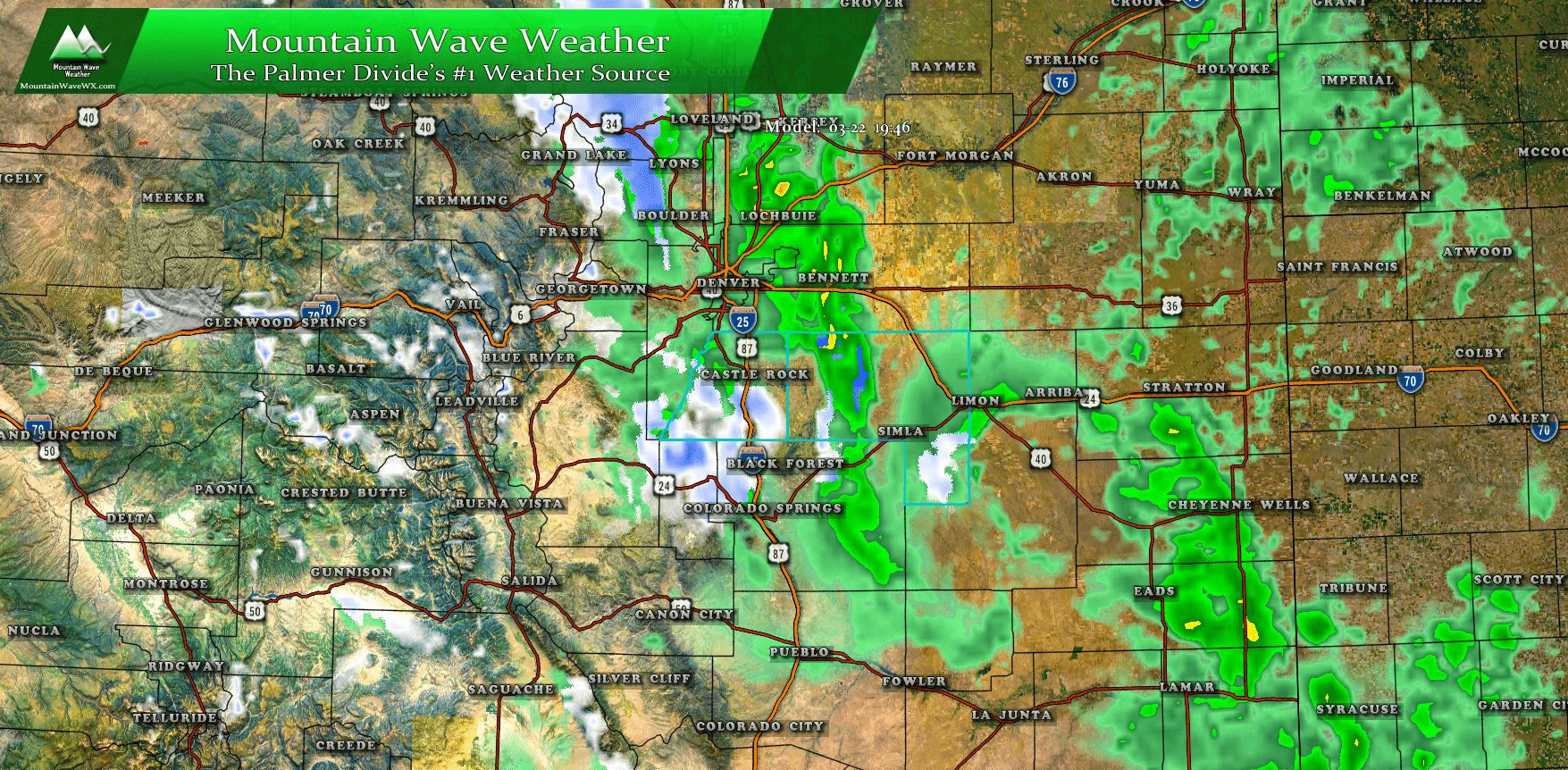
Nam3k Precip Type Snapshot at 8PM
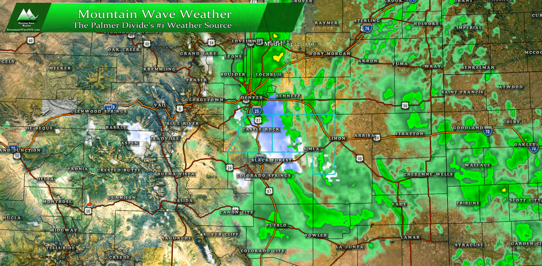
Nam3k Precip Type Snapshot at 10PM
Snowfall
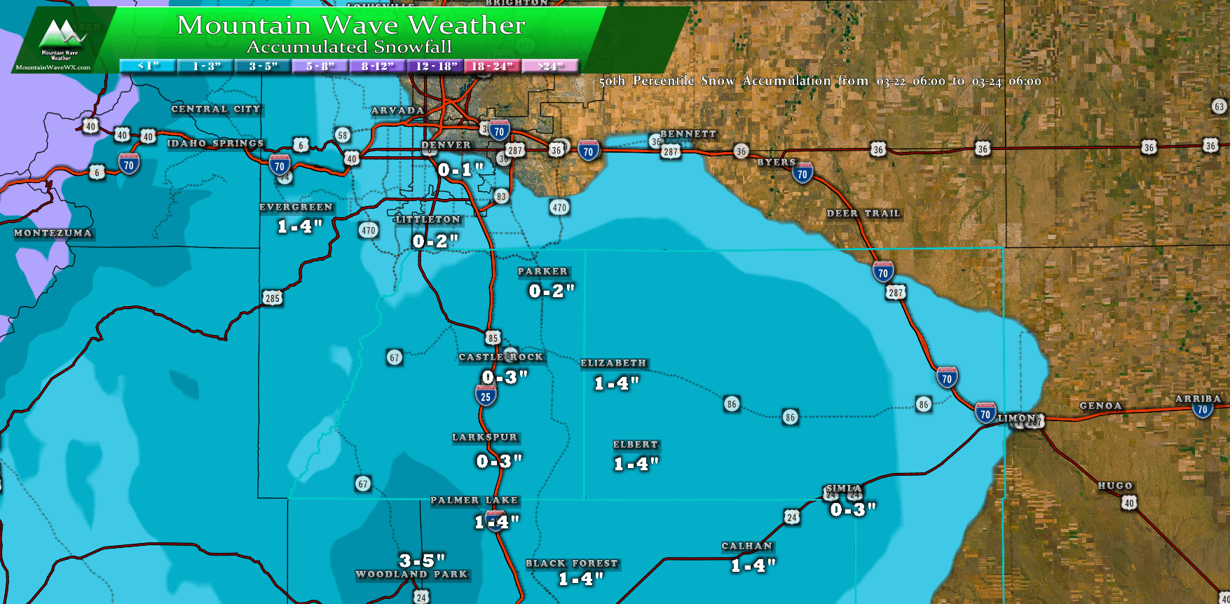
**Biggest chance for snow accumulation over-performance is in the higher elevations of Elbert and El Paso County
Tornadoes?
A lot of folks have heard from someone (no idea who...) that there is a potential for tornadoes along the front range of Colorado tomorrow. Not sure who is saying that but they may need to go back to school... the atmosphere just wont' be supportive for such things. Here's the SPC tornado probability...
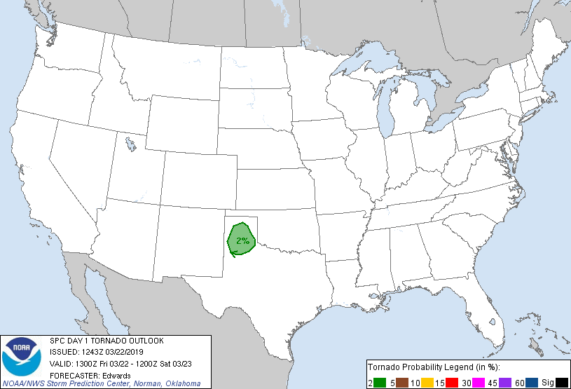
SPC tornado probabilities
If I were a storm chaser I honestly wouldn't be chasing anywhere near Colorado today... even that 2% probability in Texas is marginal at best.
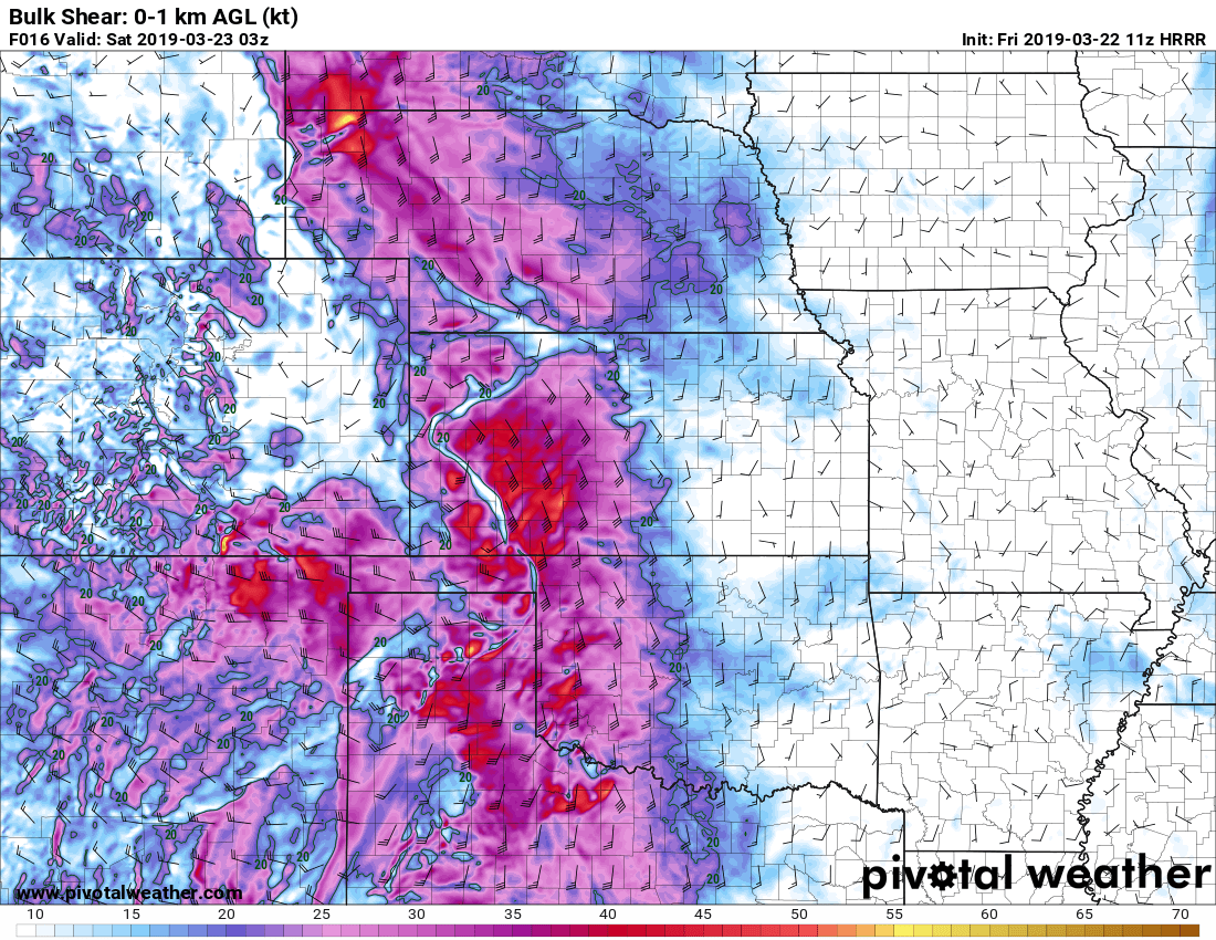
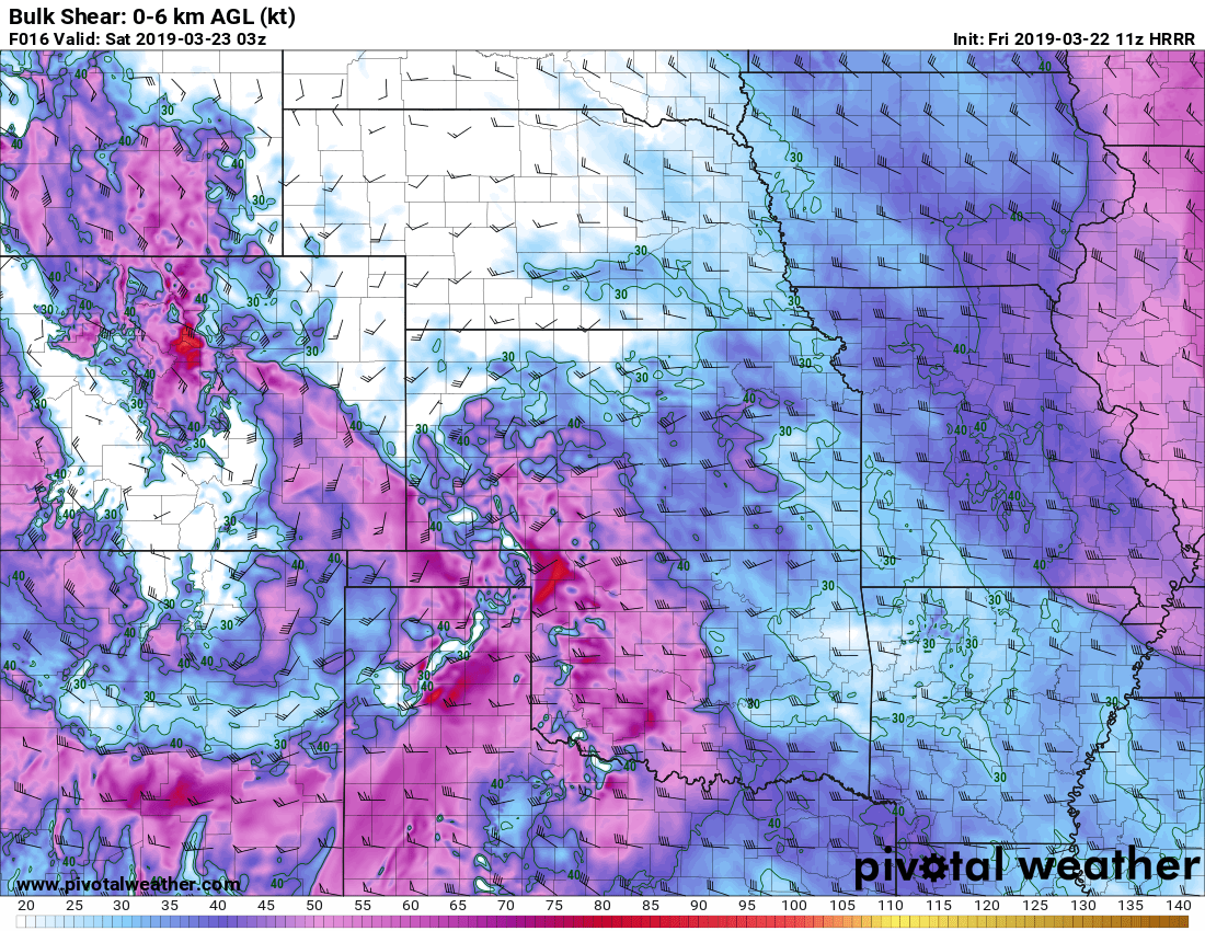
0-1KM Bulk Wind Shear

