As of this morning everything looks to be on track with our storm system. Models have been consistent in the snowfall amounts across the Palmer Divide so we have growing confidence in the forecast. That being said, I'm still not super excited about snowfall amounts just yet, we will see how the mid and late morning models do. I know they're ticking up but I still have concerns about the temperatures and how fast this storm system scoots out of here. Either way, should be an interesting day! Here's the latest:
Weather Watches/Warnings/Advisories

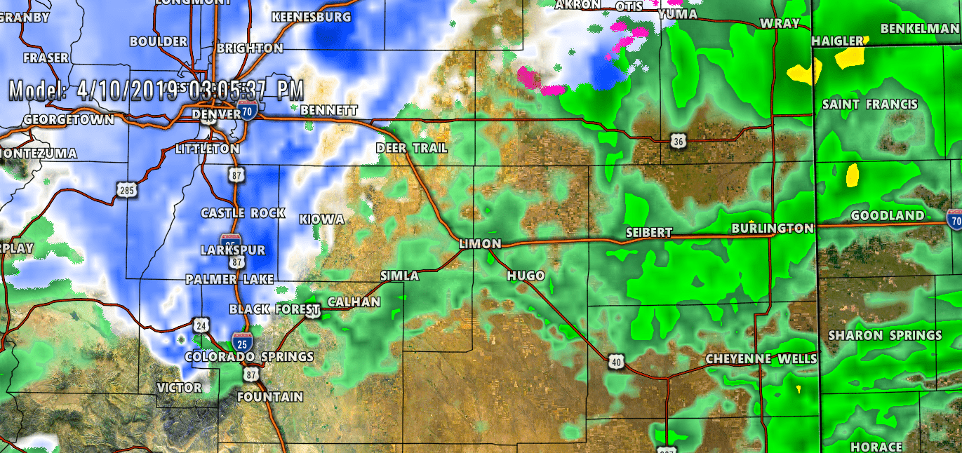
Blizzard warnings in red, high wind warnings in brown and winter storm warnings in pink. Updated weather warning information as of 6AM 4/10/2019
Storm Update
Here's a couple of model snapshots
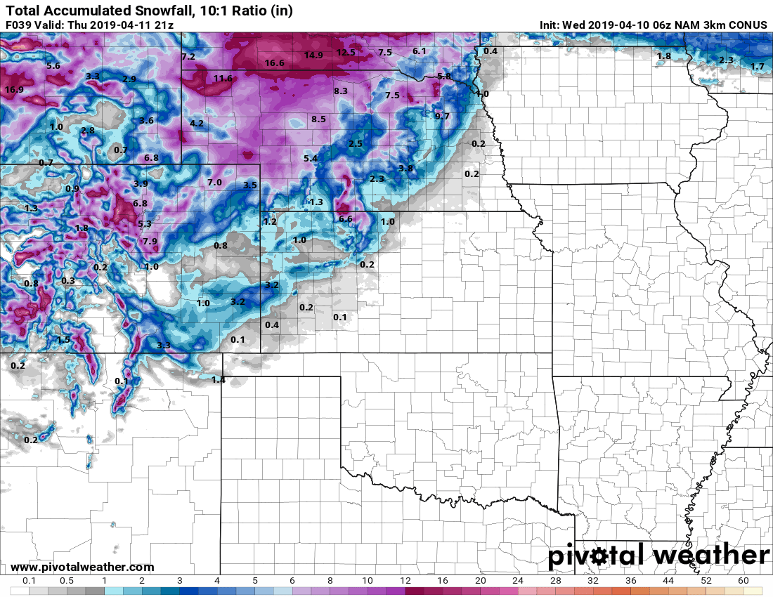
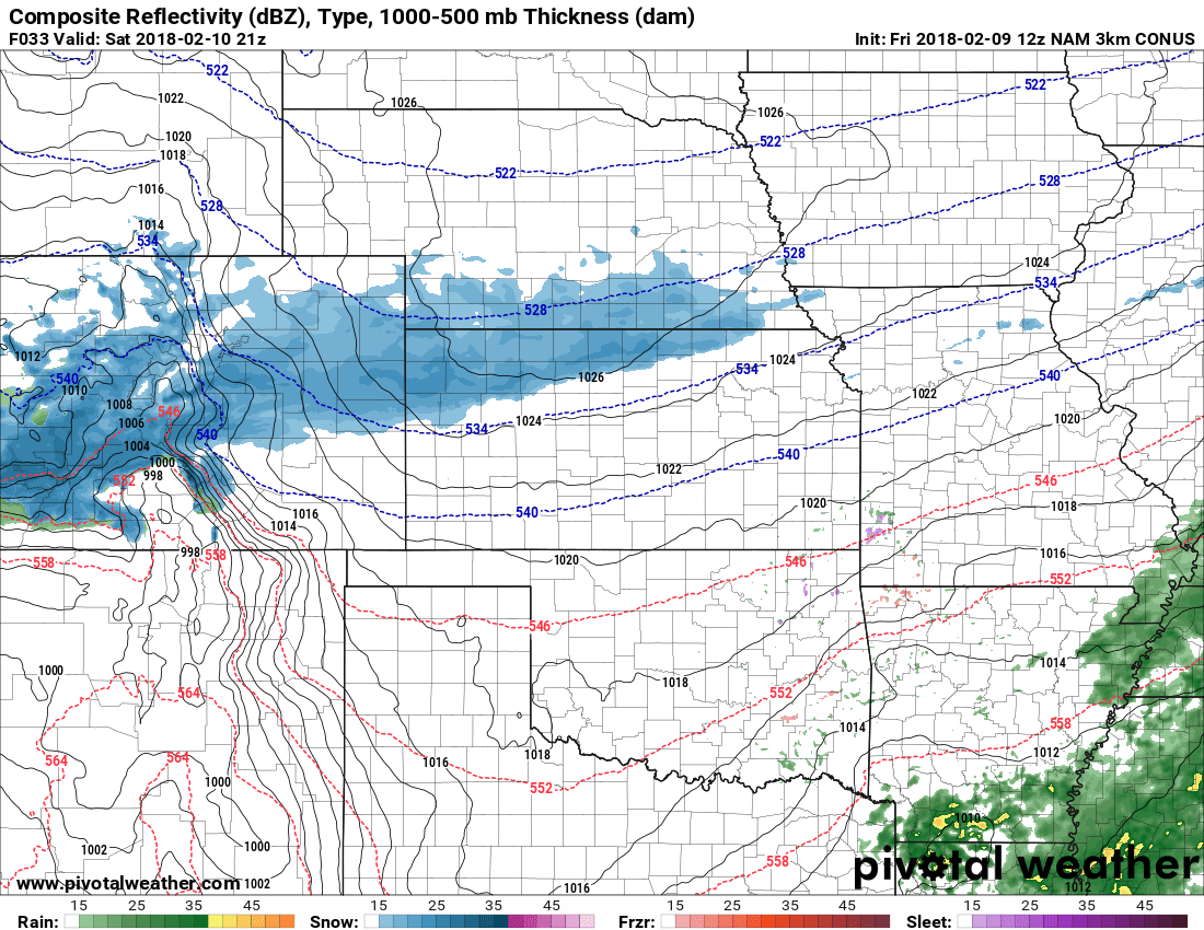
Nam3k snowfall through 3PM
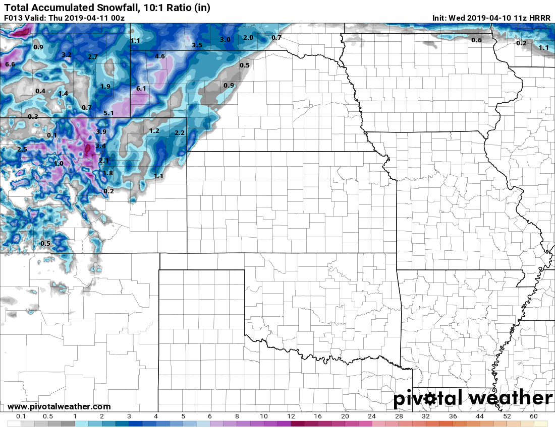
HRRR model through 6PM showing snowfall accumulation
Here's the latest model runs in this morning, the Nam3k has increased snow significantly and the HRRR seems to verify the higher snowfall accumulation numbers from what we can see of it so far. It's not completely in range yet, but the fact that it shows a couple inches accumulation by 6pm is good for forecast verification.
So far, everything looks on track so we won't be making a ton of changes to our forecast. Other than a few tweaks here and there, the forecast mostly remains the same.
***Potentially High Impact Storm!***
Our Forecast (As of this post) and What To Expect
Expected Snowfall (through Thursday 12PM)
*These are our forecast numbers and may not always match the NWS official forecast numbers*
- Castle Rock and surrounding areas
- 4-8 inches
- Parker, Lone Tree, Highlands Ranch areas
- 3-7 inches (locally higher amounts, especially in higher elevation areas)
- Elbert, Elizabeth, Kiowa
- 3-7 inches (expect extensive drifting of snow, some areas may see slightly higher accumulation)
- Larkspur, Monument
- 4-9 inches
- Woodland Park, Palmer Lake, W. Colorado Springs Foothills
- 4-9 inches
Some areas may see locally higher amounts. Models have pockets of heavier snow for specific areas but it is hard to forecast exactly where those set up. Keep checking back here for changes!
Timing
- Showers and storms kick off around mid-day on Wednesday, starting as rain for most areas
- Shorter term higher resolution models show a transition to snow after 12 PM, for the Palmer Divide the 1-3 PM time frame looks good for snow transition with snow showing up a bit later in Denver and lower elevation areas.
- Highest impacts for travel look to be in the late afternoon hours of Wednesday through Thursday morning
- Plan on potentially high impacts on travel. Areas of higher elevation South and East of Denver have the highest likelihood for severe travel impacts
Potential Impacts
- THE COMBINATION OF HIGH WINDS AND FALLING SNOW MEANS BLIZZARD CONDITIONS WILL BE LIKELY... HIGHEST CONCERN FOR TRAVEL RELATED IMPACTS IS EAST OF THE I-25 CORRIDOR AND INTO ELBERT COUNTY.
- This has the potential to be a high impact storm. Travel is not recommended later in the day Wednesday and into Thursday morning
- If you do have to travel, take winter survival gear and if you get stranded know that rescue could take a significant amount of time.
Summary
Everything looks to be a go this morning... I still have concerns about storms like this as the later in the spring we get the more curveball-ish they get. I'll be watching the temperatures and the storm track especially as any changes in those will have huge impacts for what this storm actually ends up as.
Stay tuned, I'll pass along any updates as needed throughout the day Wednesday.

Thanks for being on top of the Weather. We appreciate it. Elizabeth, Co
Thanks John from south Parker!
I am concerned about road conditions going on 15 into Utah, and I 70 going thru Vail, and Eisenhower tunnel to Denver over the weekend.