August 2016 was full of surprises and possibly indicates that our fall weather pattern is beginning to establish! September is one of our driest months of the year so should it behave normally we could be in for more dry weather ahead. Here's the latest on where August 2016 finished in terms of temperature and precipitation:
Summary
August 2016 surprised many of us watching the weather along the front range of Colorado. What we expected to be a warmer and drier month based on previous trends turned out to only be partially true. While the month ended extremely dry, the temperatures overall finished below average. As we began the first 2 weeks of August, it looked like another scorcher was on the way with daytime high temperatures consistently in the upper 80's and 90's. By the second half of the month, our weather pattern switched dramatically into what we would see as more of a "fall-like" weather pattern.
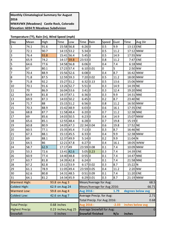
Temperatures
Mean temperature is an average of daytime high and nighttime low temps
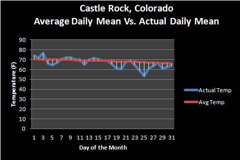
When we average out the temperatures for the month we can see that we spent a large part of the second half slightly or well below average. This is in contrast to the first part of the month where we saw at or above average temperatures more consistently. I mentioned this in an earlier article but the main difference between July and August this year was as soon as we hit the middle of the month in August, we began to see more and stronger cold fronts move into the area.
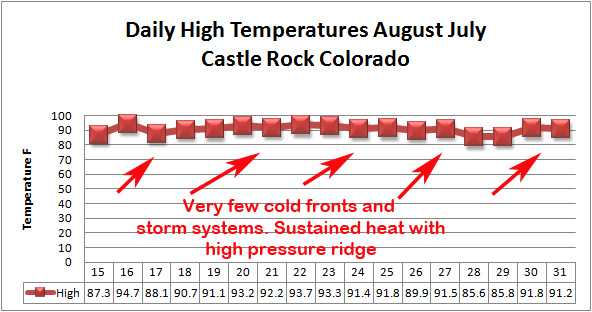
July 2016 high temperature trend
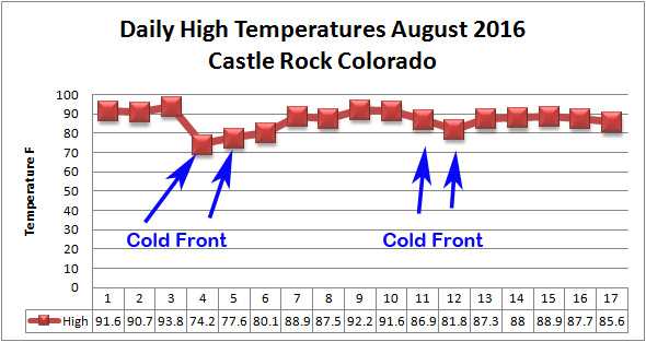
August 2016 temperature trend...notice the cold fronts?
For Castle Rock Colorado the temperature finished 1.79 degrees below average, breaking a streak of consecutive hotter than average months in place since June 2016
Precipitation
There were not many surprises when it came to how much rain we received this month. I expressed some concerns at the end of July about the monsoon which is the weather pattern is what gives us a majority of our precipitation for the year and usually kicks in later in July and into August. When we don't see the pattern establishing by late July and models don't look promising for August we get worried.

This weather pattern never did truly establish in August, despite the fact cold fronts moved through and brought us a bit of rain here and there.
![]()
The above graphic shows that while we did see rain (almost always accompanying those cold front systems) we never got storms that amounted to that much. Denver saw a similar setup, they were so dry that August 2016 will go down as their 8th driest August on record. In sharp contrast, our friends to the South in Colorado Springs and Pueblo received anywhere between 2-6 inches for the month... well above average for those areas!
For Castle Rock Colorado the measured precipitation finished 2.03 inches below average, July and August both finished with below average precipitation (these are normally 2 of our wettest months of the year!)
You can see the rest of this update (September 2016 outlook included) on our 2016 Climate Summary Page!
Happy first day of Meteorological Fall!
