A strong storm system is set to impact the area into Friday night bringing cold air and a bit of snow to the Castle Rock area. This storm looks very similar to the last in that the main impact will not be the snow, but the very cold temperatures that come with it. Here's a look at the latest data on this storm:
Snowfall
Snowfall Probabilities
| Location | At least | Likely | Potential for | >=0.1" | >=1" | >=2" | >=4" | >=6" | >=8" | >=12" | >=18" |
|---|---|---|---|---|---|---|---|---|---|---|---|
| Castle Rock, CO | 1 | 3 | 4 | 93% | 83% | 61% | 5% | 0% | 0% | 0% | 0% |
Just like the storm we had this past week, the Northwesterly track of this storm means it will leave most of the moisture associated with it to our North and West. Storms like this have a hard time hooking up with moisture again East of the Continental Divide so we don't generally see a ton of snow with them. You can see from the probabilistic table above, chances for snow accumulation drops off pretty significantly above 4 inches.
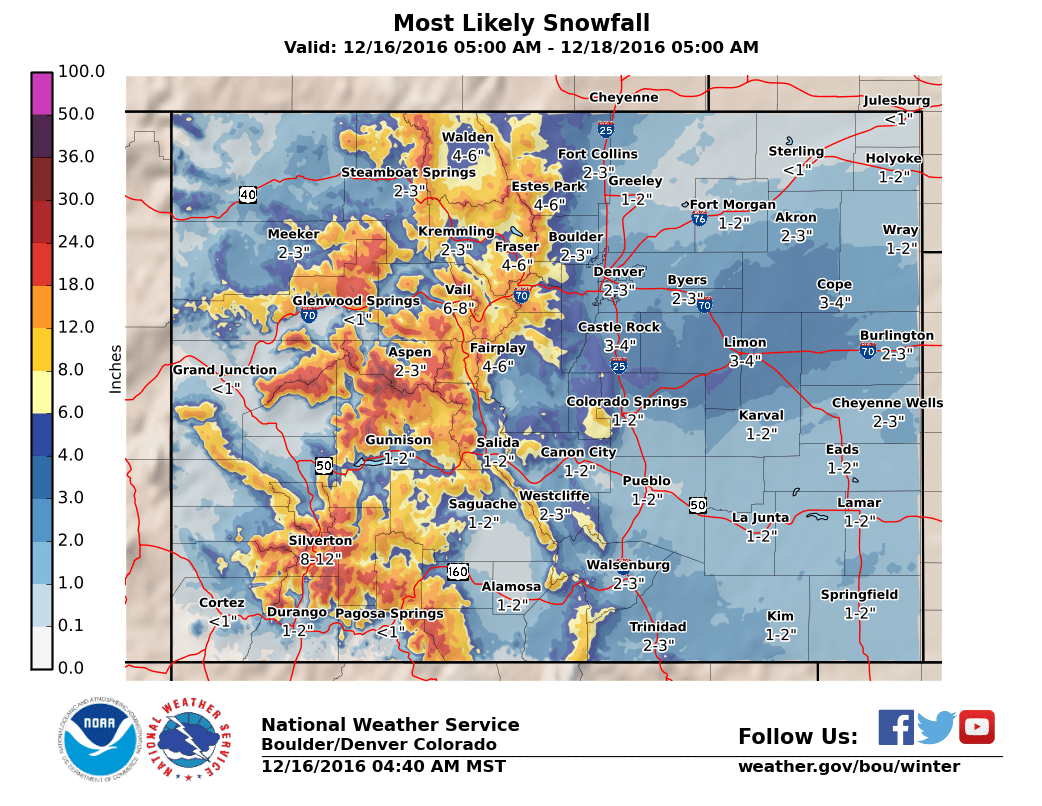
With the current data we have in, the best range of snowfall for the Castle Rock area looks to be in that 2-4 inch range again. There are a couple of caveats to that number though; the main energy from this storm comes with the passage of the front. We don't have a lot of upslope to work with so we will need to get to that 2-4 inch range quickly. There is a decent chance we could fall short (just as the last storm did.)
The other thing to watch for is banded snowfall, the strong jet stream overhead will enhance snow in only certain areas. This will mean some areas see more snow than forecast while others see less. I'd love to tell you exactly where those areas are, but models have little luck in predicting such things.
Temperatures
This will be the big story with this storm, like the last storm it is bringing a ton of cold air with it. The temperatures during the day on Friday won't be too bad:
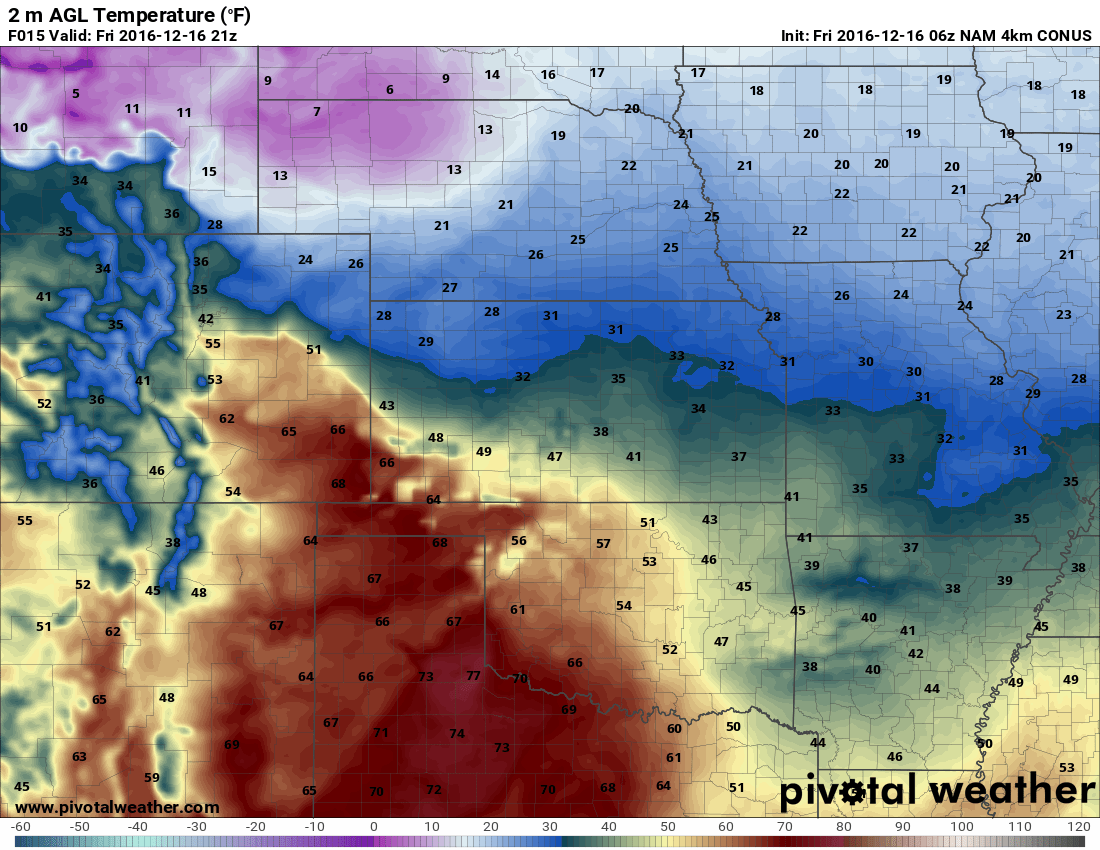
By the afternoon and evening hours however, we begin to see that front move through on the leading edge of the storm system. Expect a pretty sharp temperature drop as this air begins to move in and a ton of wind!
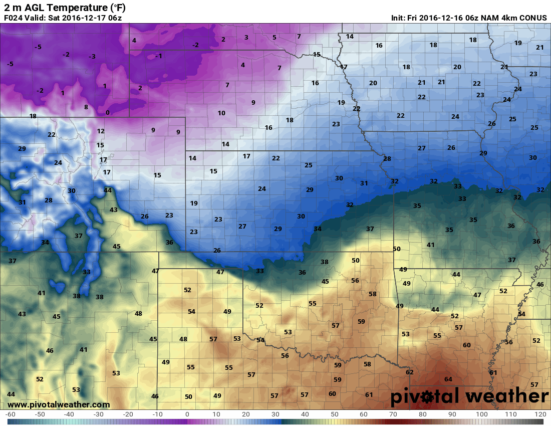
By Saturday morning the front has passed through and the cold air will settle into the area. Expect temperatures to be very cold through the day on Saturday and into Sunday.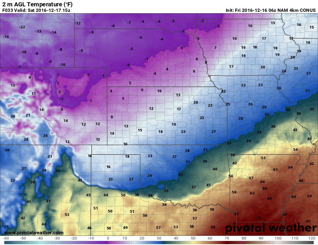
Summary
With the data we have at this point, this storm looks very similar to the last one. Snow won't be the major issue (although the cold temps could lead to some sticking on the roads late Friday night into Saturday morning) but the temperatures and wind will be. Expect windy conditions to move into the front range on Friday before the front moves in. After that the snow will begin late Friday into Saturday morning, generally moving out be later in the day Saturday.
I suspect we will see many below zero readings in the area on Saturday and Sunday morning so keep that in mind if you have outdoor plans. Saturday during the day will be very cold as well.
I hope to have another update on Friday evening so stay tuned!
