
Clouds often form along cold fronts as air gets lifted and the atmosphere destabilizes
Many of us saw alto-cumulus clouds this morning along the front range, these clouds are often a sign of a change in the atmosphere. This morning a cold front began moving from the North to South across Colorado ushering in much cooler air (compared to yesterday) and a bit of moisture at the surface in terms of higher humidity.
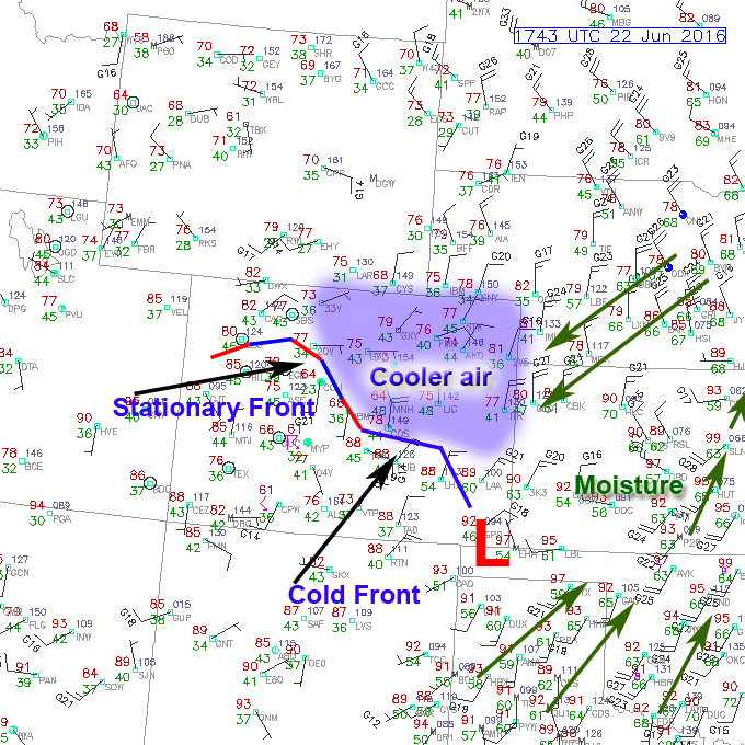
Surface observations as of 11:43AM Mountain Time
When you take a look at the surface map is is relatively easy to pick out where the front is, the associated low pressure system ahead of it (in this case a surface low). Temperatures in South and Southeast Colorado are already in the 90's at this hour but temperatures in Northern and Northeast Colorado are in the mid 70's.
Cold Front Effects for Wednesday June 22, 2016
Besides the fact that it will give us a nice break from the heat on Wednesday the moisture spinning into the state will also help form thunderstorms into the afternoon hours. I'm not terribly concerned about larger severe storms today as an inversion (or cap) will prevent storms from growing terribly large. When I look at forecast Skew-T's for the morning and afternoon the inversion and weak inability are quite apparent... values between 0-500 CAPE or pretty weak.
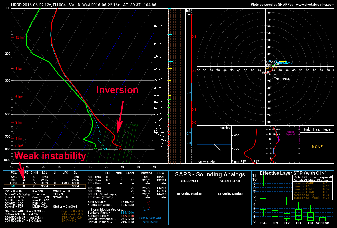
HRRR simulated Skew-T at 10AM
The HRRR model shows storms firing by 1-2PM and moving off the front range and over the plains. Again, none of these storms ever look like they grow too big and the meteorology supports that at this time.
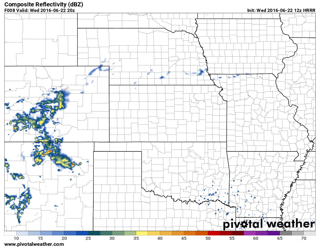
This HRRR model run shows thunderstorms around the 2PM hour
Expect the following threats from these storms today:
- Brief heavy rain
- Small hail (should mostly remain under severe limits)
- Lightning
- Gusty winds
The "Dreaded" Day 2 After A Cold Front
As is often the case in Colorado, we tend to see general "garden variety" thunderstorms the day a front arrives. Sometimes these storms are worth chasing but a day like today they are not. As the cooler air pools into the area and moisture continues to accumulate we tend to see more favorable severe weather conditions the day after a front moves through.
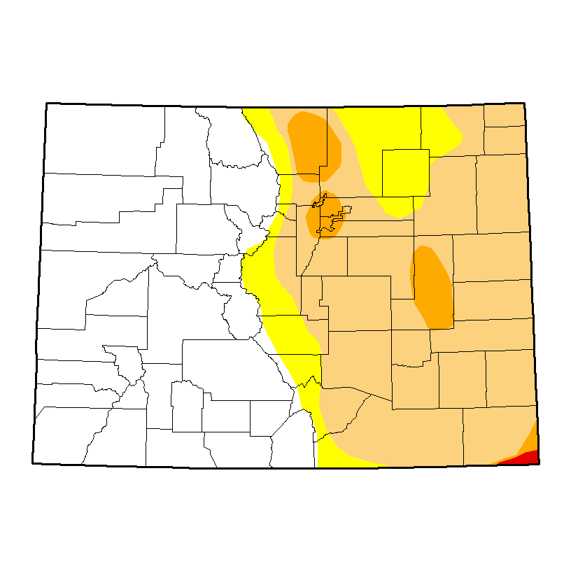
The Storm Prediction Center's Outlook for Thursday already includes Colorado in a Marginal Risk area for severe weather.
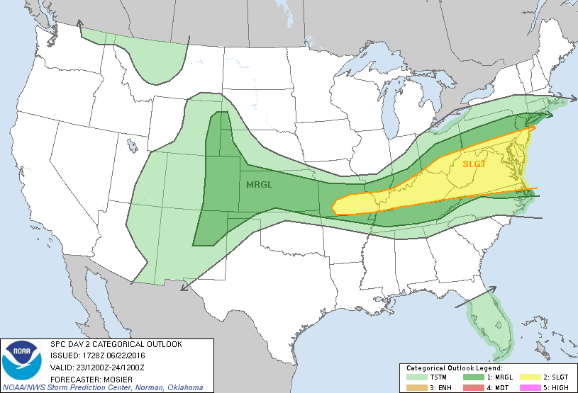
Storm Prediction Center Outlook for Thursday June 23, 2016
We will have to keep an eye out for the possibility of severe storms with hail on Thursday. Marginal Risk usually means any single area's probability of seeing severe weather is low, but with the way these things have been firing along the Palmer Divide the last week, it wouldn't surprise me if our area is the highlight again tomorrow.
We will keep an eye on the forecast and update with any changes or alerts. Happy Wednesday!
