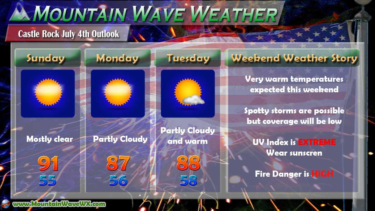
Thursday and Friday of this week showcased excellent spring weather along the front range of Colorado. We saw minimal thunderstorms, sunny skies and warm temperatures as a ridge of high pressure built over the Western part of the United States
Temperatures Cooling Off - Ridge Breaks Down
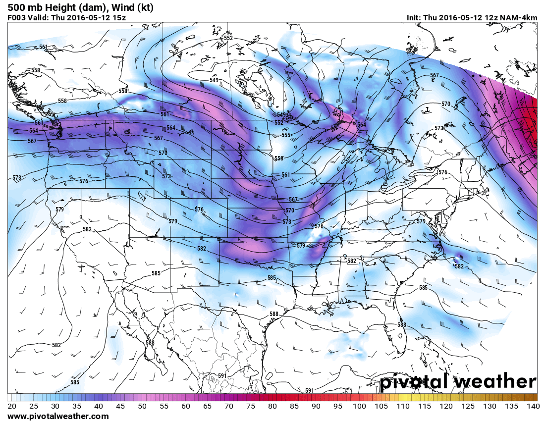
Ridge of high pressure to the West of Colorado brought us warm and dry weather for Thursday and Friday.
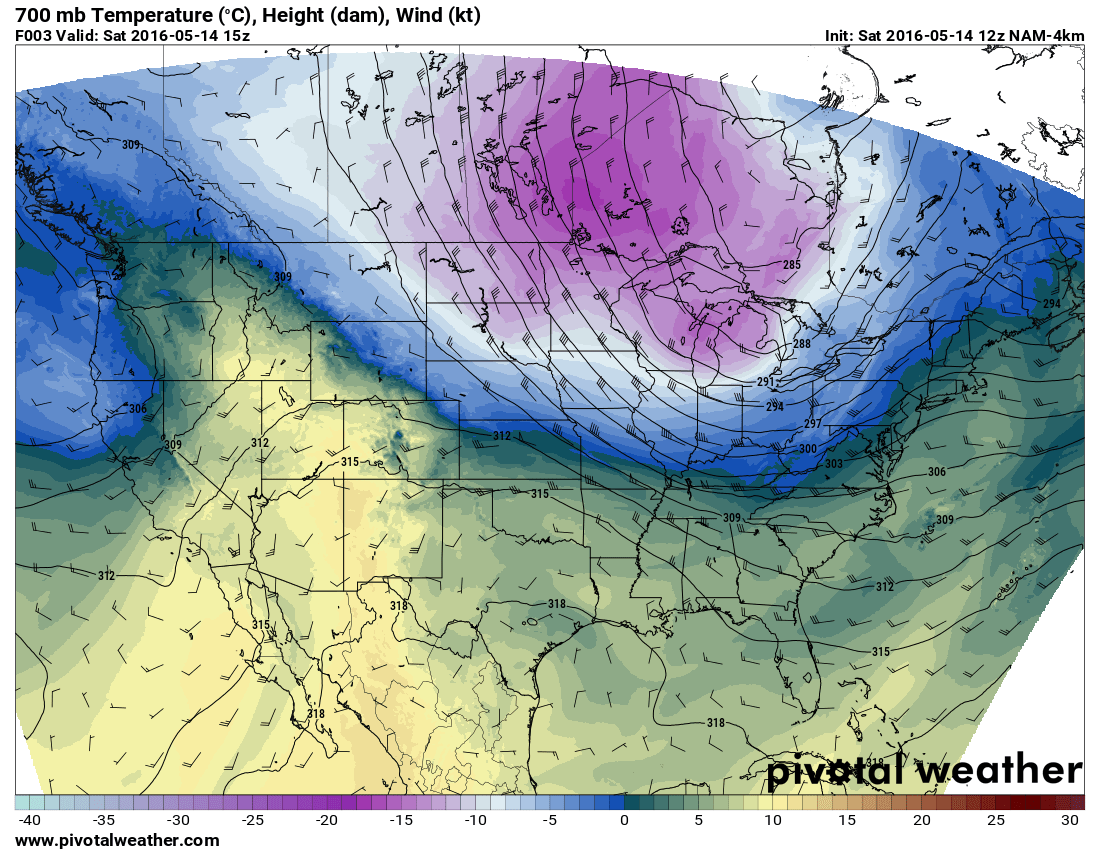
The ridge is beginning to break down as of Saturday morning and a cold front is moving through.
The front moving through today will bring cooler temperatures on Saturday and Sunday, many areas along the Palmer Divide will top out in the lower to mid 60's, but wouldn't be surprised to remain a bit cooler if the cloud cover lingers through the day.
The coldest of the air will save itself for Monday and Tuesday, many models projecting highs only in the low to mid 50's on Monday and Tuesday!
Here Comes the Rain!
Along with the colder air from the North, this storm system will also draw ample moisture into the state as well.
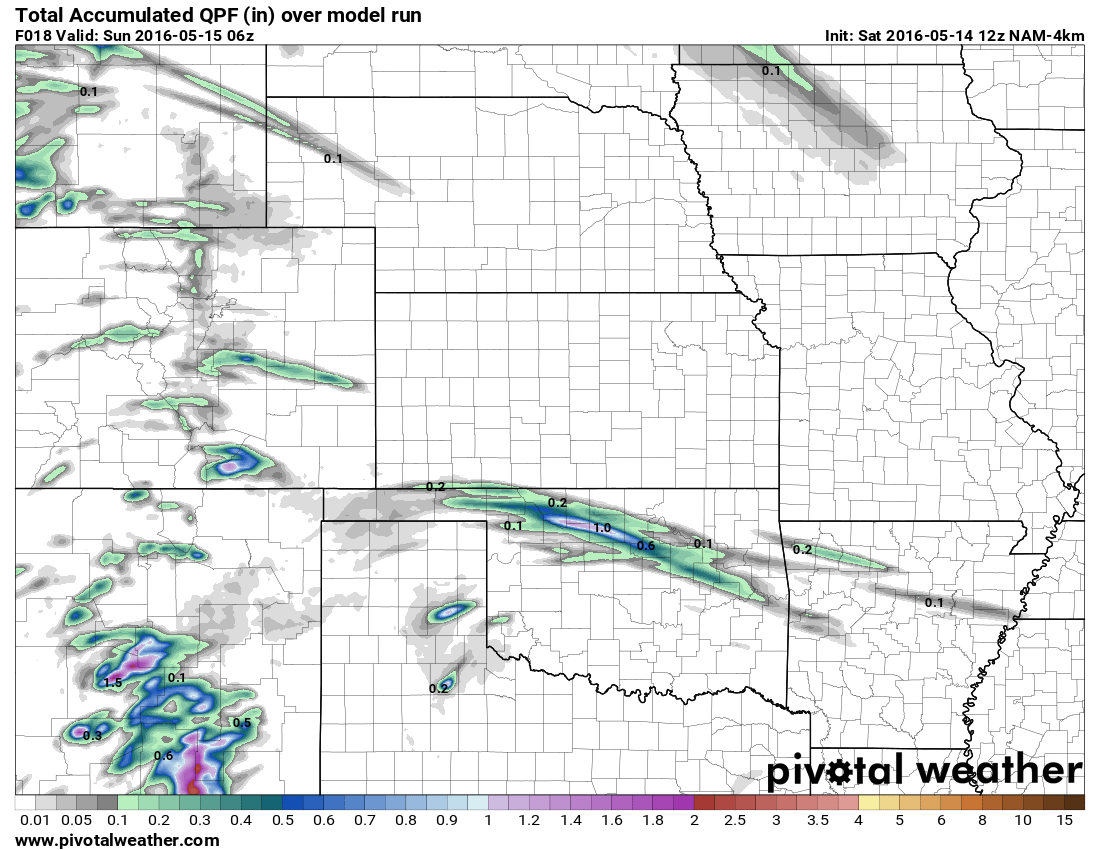
Total accumulated precip through Saturday night.
Saturday will be the driest day, relatively speaking. Thunderstorms are expected in the afternoon or evening hours if we can get enough heating or instability. Most models show these showers to be very spotty but some areas along the Palmer Divide could see the best chance. Overall most folks will remain dry on Saturday or only see a bit of rain.

Sunday total precipitation (added with Saturday's total)
Sunday will see a very similar setup to Saturday, cloudy skies in the morning with partial clearing later in the day. We will see a much better chance of showers and thunderstorms, most modeling has extended periods of precipitation after about 12-1PM and waves moving through 9PM.
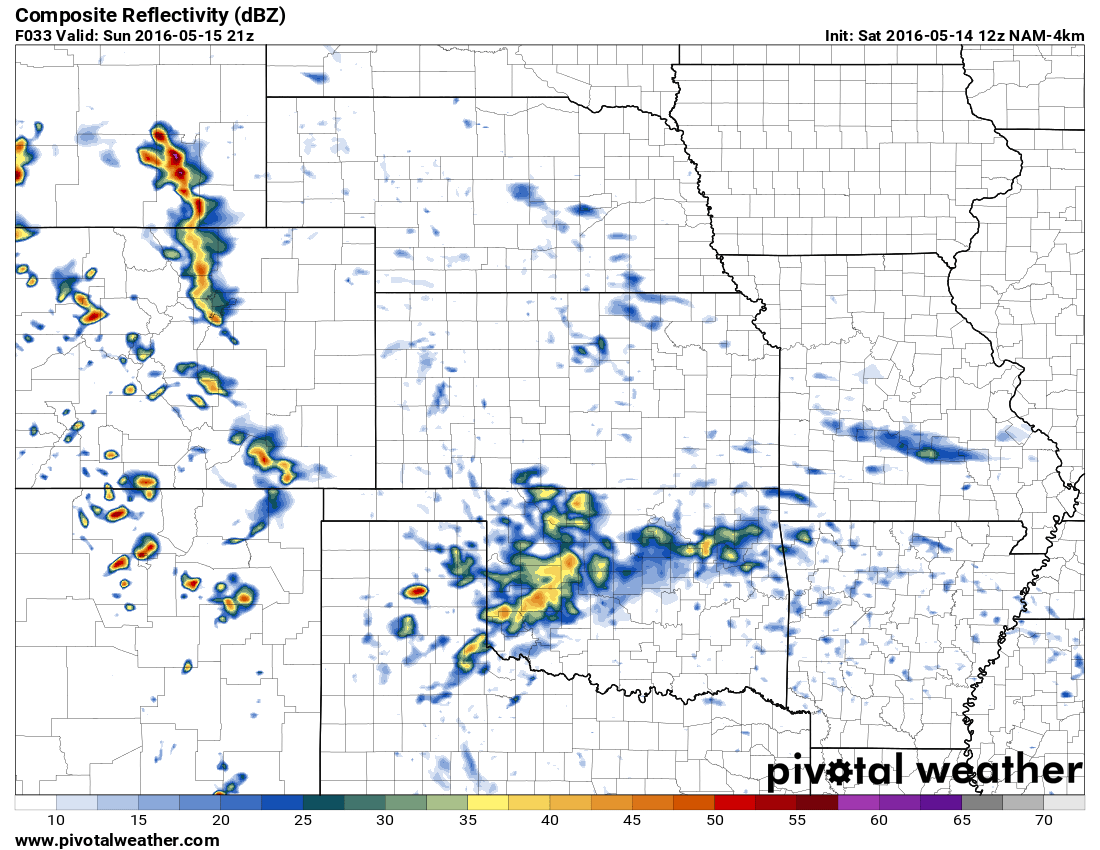
3PM Nam forecast radar for Sunday shows a line of storms. This is followed by extended showers through about 9pm
Outdoor Plans This Weekend? Be Prepared for Rain!
If you're looking to get things done outdoors this weekend, Saturday and early Sunday will be your best bet. By Sunday afternoon many models agree on soggy and cool conditions which may put a damper on outdoor plans. It won't be terribly cold on Saturday and Sunday overall though, so at least that is good news.
By Monday and Tuesday expect much cooler temperatures and sustained periods of rain showers and thunderstorms. (Some models have us picking up nearly an inch of rain total on Monday!) You can probably keep the sprinkler systems off for another week or so!
Enjoy your weekend everyone!

Thanks for the CR weather coverage!
Thank you for following! 🙂