July has started out mainly hot and dry, this isn't too much of a surprise as we usually see this between our wet springs and monsoon season. With the quiet weather you may have noticed how quiet it's been around Mountain Wave Weather. There is a good reason for that!
This year I am riding in my 8th Courage Classic. This bicycle tour raises money for Children's Hospital of Colorado out in Aurora. I have a very special and personal connection to this hospital and the people who work there. Over the last few weeks I've been training hard to make sure I'm in good shape for this year's event, it will be the first time I am doing both days in the event (and my first multi-day bike event ever!)
I'm looking to hopefully raise $1,000 or more, if I hit my goal I may do something special here on the site!

Please Consider Sponsoring Me for This Event!
Visit my rider donation page to learn about my story and why I ride every year for Children's Hospital:
John Braddock Courage Classic 2016
100% of this money goes straight to Children's Hospital, I do not keep any of it. Thanks for putting up with my plug and again thank you all for following Mountain Wave Weather, I really enjoy interacting with you all and chatting about weather!
Now, to the Weather Stuff!
The weather has been overall pretty quiet in July. A large ridge of high pressure has dominated the weather pattern keeping most of the storms away and keeping us hot as well!
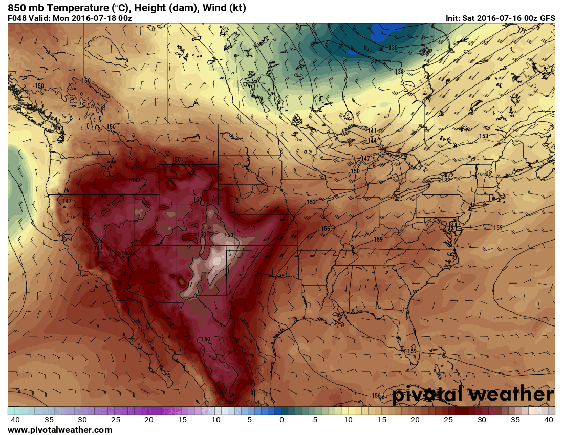
Monday low level winds and temps
When i look at the models from today (Saturday July 16, out for the next 5-7 days it looks like the above image every day save for one difference. It actually gets hotter through the week in the middle of the country and mountain west region.
I don't suspect the front range of Colorado will see the worst of this heat but we will be hot!
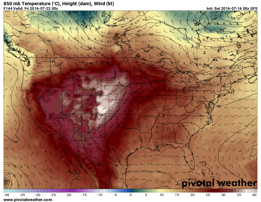
Thursday 6pm Projected Temperatures
Thursday especially looks scorching hot! (See the image above, the whites are temps at or above 100 degrees F!)
Sounds Scorching Hot Next Week, What About Rain?
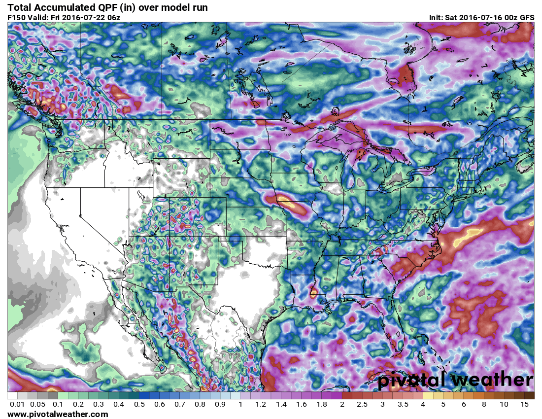
This image above shows total accumulated precipitation through 6PM Thursday. You can see most areas along the front range can expect 0.2-0.4 inches from today through Thursday. This is very dry, most of these areas won't see any moisture!
The one area to look at closer throughout the week though is the Palmer Divide region; you can see from the model snapshot above it has an uptick in precipitation. This seems feasible given our terrain and the conditions that set up on hot days. It's way too early to tell if any of these storms will be severe or there will be any hail, but we'll keep an eye on it through the week next week.
Have a great weekend and remember the sunscreen, it's going to be hot!
A quick uA quick

Donated for your ride. A worthy cause! Thanks for all the great weather updates!
Thank you so much Jacqui, it’s really appreciated!