A quick update tonight explaining the situation with this storm. A lot of folks are asking if this storm is a bust and some snow lovers are even getting a bit depressed that we don't have more in the Castle Rock/ Palmer Divide area. Here's the latest...
Is This Storm a Bust?
Absolutely not! At least not as of right now. The National Weather Service's Winter Storm Warning lasts until 11AM tomorrow, so that means they expect the snow totals to be in their forecast range by 11AM Thursday. This means that even though we haven't seen a ton of snow in our area we cannot discount this storm just yet. Their latest update as of 8:45PM confirms that they still think this storm is on track to hit their forecast amounts:
Area Forecast Discussion
National Weather Service Denver/Boulder CO
846 PM MST Wed Jan 4 2017

.UPDATE...
Issued at 845 PM MST Wed Jan 4 2017

Drier air noted on satellite recently passed overhead to weaken
snowfall over the area. Some areas have completely stopped
snowing. Do not be fooled and let your weather preparedness guard
down. Additional moisture is seen upstream, especially on radar
over the Salt Lake City area and pushing into western Colorado.
Colder air expected to push in overnight will combine with the
incoming moisture to ramp up snowfall, likely around or after
midnight. Due to this, will not be adjusting snowfall totals.
They do note the drier air that is moving through currently but they seem to believe this is just a lull before the next bit of energy and moisture pushes through with this storm. If we take a look at the visible satellite we can get a bit of a glimpse behind their thinking...
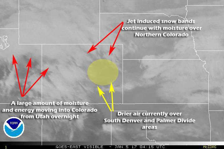
GOES visible satellite
That's Nice To Hear What the NWS Thinks, but What Do I Think?
If you've followed along here for any period of time, you know that I make my own forecasts. Some times I agree with the NWS and my forecast matches theirs quite closely but sometimes I deviate a bit based on what I perceive with my instinct or what I believe based on our terrain or other features in Castle Rock.
As of right now I believe the NWS in that this next piece of energy has the potential to dump enough snow on us to meet our forecast 5-10 inch range in Castle Rock. The SREF ensemble (a produce that factors in a bunch of models and averages them out) has been very insistent on decent snowfall along the Palmer Divide. The latest run came out at 2PM and slightly increased snow totals.
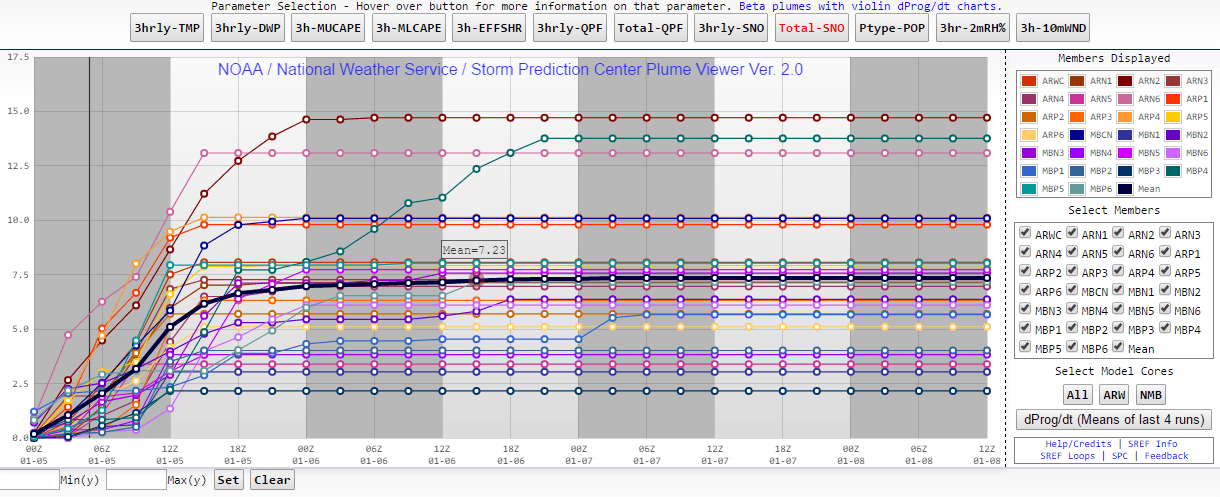
2PM SREF Ensemble Total Snowfall
The other models are still a bit all over the place but they show lesser amounts to a degree...

NAM4K using Kuchera Ratio
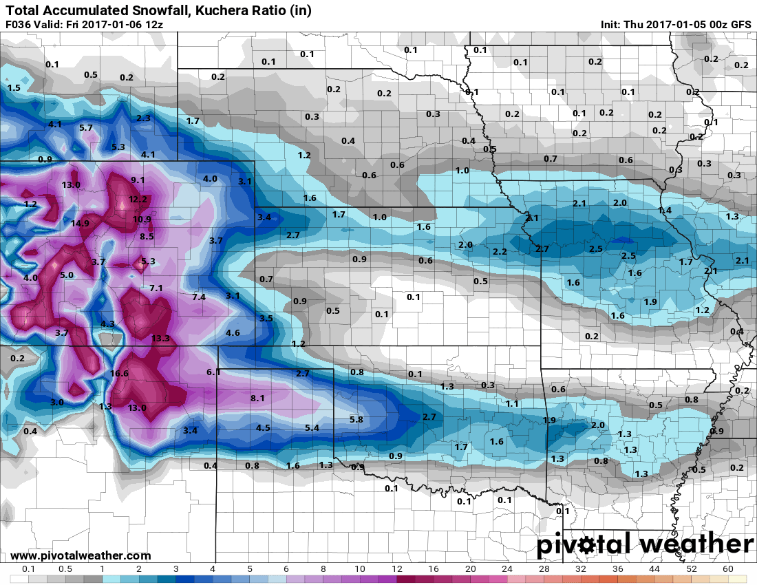
GFS using Kuchera Ratio
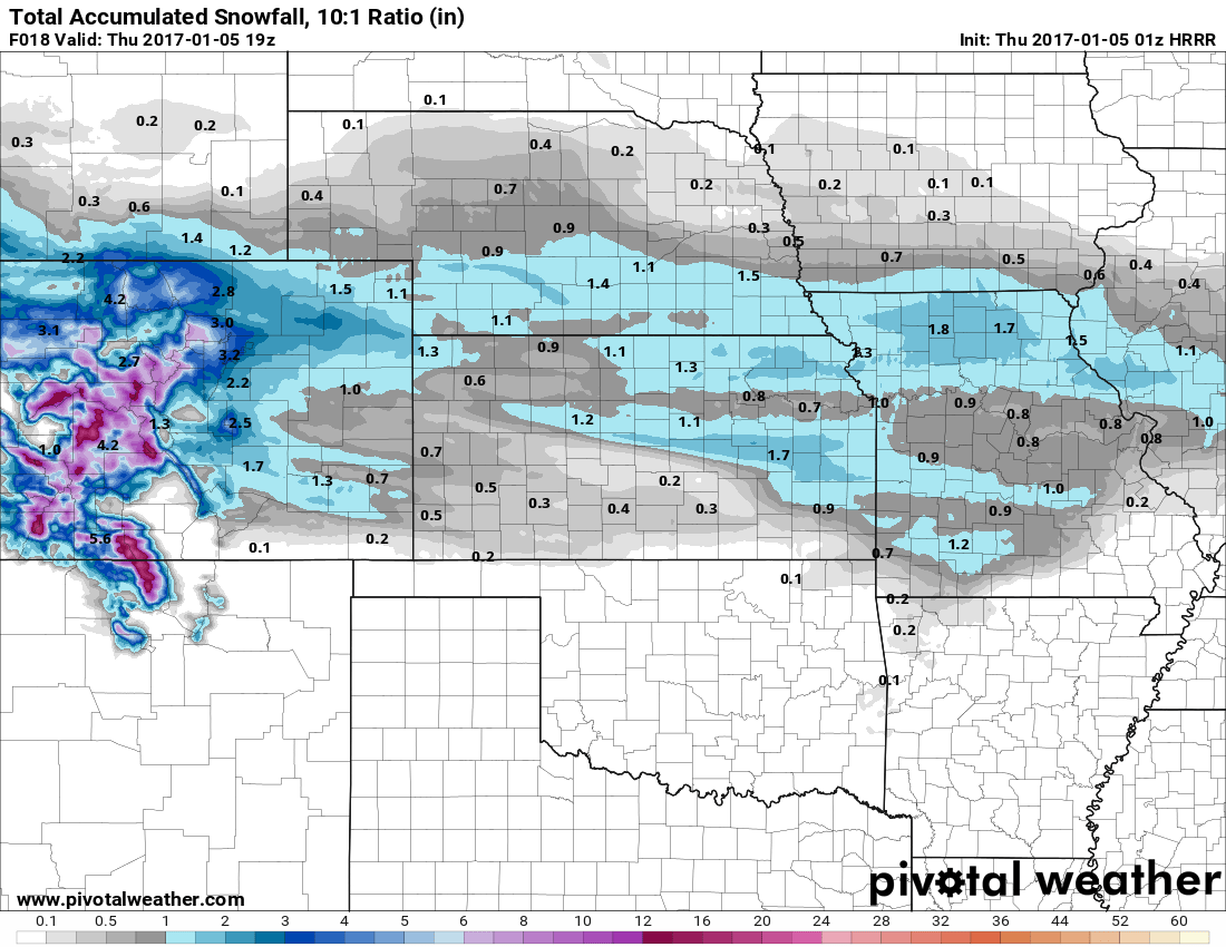
Latest HRRR using Kuchera Ratio
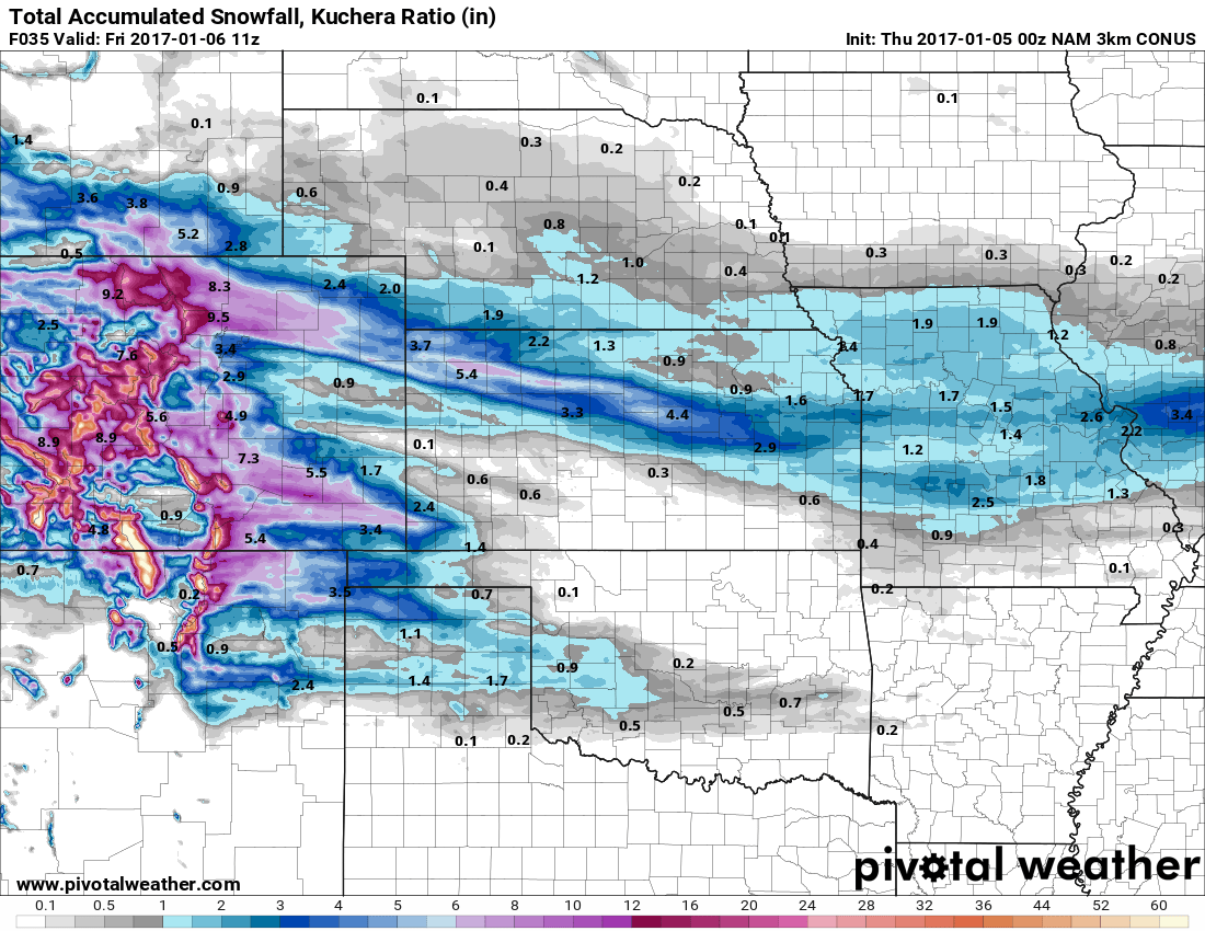
NAM3K Hourly with Kuchera Ratio
Now the maps are all numerical/operational models so they don't show the entire spectrum of each model but if we take all of them and average the snowfall amount out (treat them like an ensemble) we get a mean of 4.25 inches of snow for the Castle Rock area through Noon on Thursday.
So with that information and considering a drier and fluffier snow may bump that number up slightly, I'm not prepared to change the forecast just yet. The 5-10 inch range for storm total accumulation is still valid for Castle Rock at this time.
Read the Forecast: Winter Storm Warnings and Storm Forecast for Castle Rock/ Palmer Divide
Summary
So for now we are not changing our initial forecast but there is a lot of uncertainty. Even with the uncertainty we can't call the storm a total bust until we see what happens tomorrow morning. There is equal probability at this point that we make the 5-10 inch range or we bust out much lower, but it's too early to make that call.
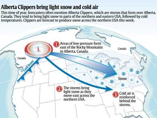
These Northwesterly "Clipper" type snow storms are among the hardest to predict in Colorado. Their ability to produce narrow snow bands means some areas may see a ton of snow while others only a few miles away get much less. This could be the case for us along the Palmer Divide this evening, the snow bands are favoring areas North of Denver at this time. We have to wait and see if those bands move South (like our early December snow storm) or if they miss us completely.
