Advertisements
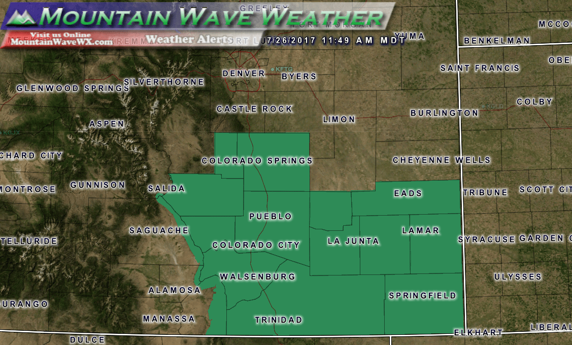
Flash Flood Watches for Southeastern Colorado
* From 3 PM MDT this afternoon through late tonight

* Deep monsoon moisture will result in widespread showers and
  thunderstorms producing heavy rain.

* Burn scars, urban areas, small streams and locations with poor
  drainage may flood. Water may flow over or damage roads making
  them impassable. Normally dry streams, arroyos and low water
  crossings may flood.

PRECAUTIONARY/PREPAREDNESS ACTIONS...

A Flash Flood Watch means that conditions may develop that lead
to flash flooding. Flash flooding is a VERY DANGEROUS SITUATION.

You should monitor later forecasts and be prepared to take action
should Flash Flood Warnings be issued.
Castle Rock Area Outlook
While the Castle Rock area is not part of the watch, our area bears close watching as heavy and slow moving thunderstorms could impact the area in the afternoon and evening hours. A large blob of monsoon moisture has increased dewpoints and precipitable water values across the area, this means any storms that form will have a large amount of moisture to work with and fall as rain.
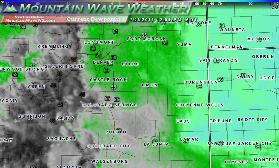 Dewpoints are very high today, does the air feel "sticky" to anyone?
What to watch for this afternoon:
- Slow moving thunderstorms with heavy rain may cause localized street flooding
- Frequent and dangerous cloud to ground lightning
- There is a small chance of hail with some of the strong storms
We'll keep an eye on things and pass along any urgent updates on our Facebook Page this afternoon.
