Advertisements
Weather warnings as of 4:00PM MDT
- Red Flag Warning (12PM – 6PM) Thursday
- Includes all of Eastern and Northeastern Colorado
- A Red Flag Warning means that critical fire weather conditions are either occurring now….or will shortly. A combination of strong winds…low relative humidity…and warm temperatures can contribute to extreme fire behavior.
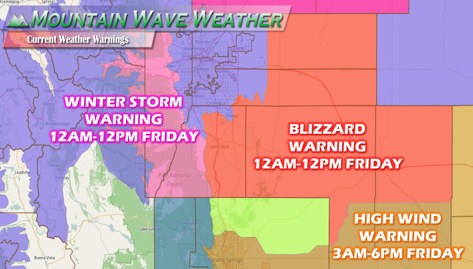
- Blizzard Warning (12AM – 12PM Friday)
- Includes Palmer Divide region: Douglas County above 6,000ft elevation, Elbert County, Lincoln County
- Castle Rock, Larkspur, Elbert, Limon, Elizabeth, Kiowa, Franktown, Monument are all included in the Blizzard Watch
- A Blizzard Warning means severe winter weather conditions are expected or occurring. Falling and blowing snow with strong winds and poor visibilities are likely. This will lead to whiteout conditions...making travel extremely dangerous. Do not travel. If you must travel...have a winter survival kit with you. If you get stranded...stay with your vehicle.
- Travel is not recommended after midnight tonight!
- Winter Storm Warning (12AM – 12PM Friday)
- Western Douglas County foothills, foothills west of Denver, extreme Western Palmer Divide region, continental divide region mountains.
- A Winter Storm Warning for heavy snow means severe winter weather conditions are expected or occurring. Significant amounts of snow are forecast that will make travel dangerous. Only travel in an emergency. If you must travel...keep an extra flashlight... food...and water in your vehicle in case of an emergency.
- Travel is not recommended after midnight tonight!
Our earlier Forecast from this morning is still on track!
Mountain Wave Weather Resources
Stay up to date with our weather information below:
-
Severe Weather Watches/Warnings/Advisories by Mountain Wave Weather
- Custom tailored weather alerts for Castle Rock and the Palmer Divide Region piped in straight from the National Weather Service
-
Significant Weather Page for Palmer Divide Region by Mountain Wave Weather
- Up-to-date forecast information for significant weather events in and around Castle Rock from NWS
-
Real-Time Weather Dashboard for Castle Rock Colorado
- Data straight from our weather station in Castle Rock. Phone apps and TV stations get their data from Centennial Airport, not us!
We'll continue to track this storm system and have updates as needed!

