Tonight we see some weather conditions in our neck of the woods that we don't often see. Freezing fog and freezing rain is expected to spread across the front range this evening and last through the morning hours on Thursday. Let's take a quick look at the weather advisories concerning this activity, then we'll explain what freezing fog and rain are, what it takes for those conditions to form and why we don't see it much in areas of Colorado near the front range.
Colorado Winter Weather Watch/Warning/Advisory Information
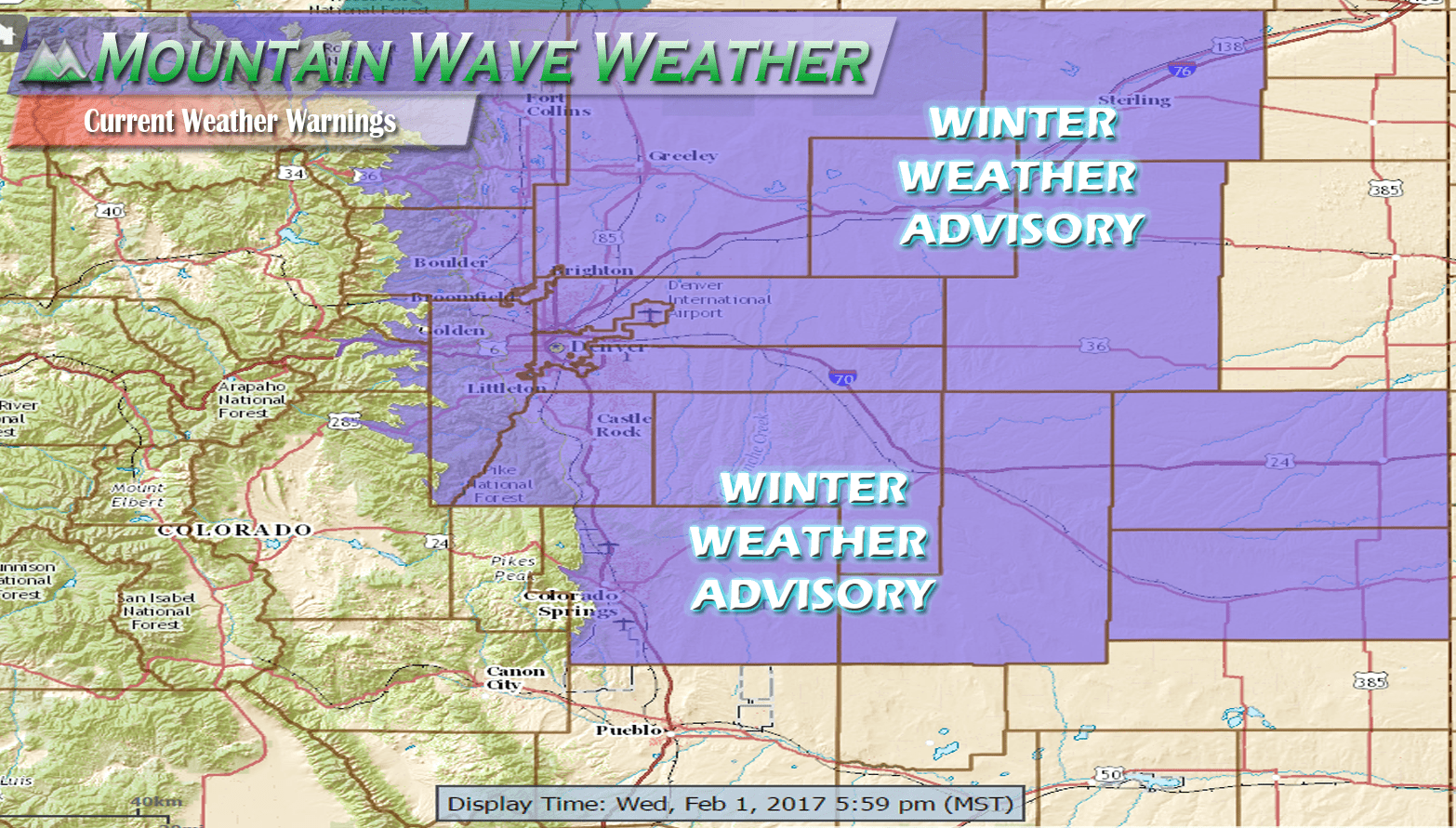
**Winter Weather Advisory**
Includes:
HIGHLANDS RANCH, LITTLETON, PARKER, CASTLE ROCK, ELBERT, FONDIS, KIOWA, LARKSPUR,
EATON, FORT LUPTON, GREELEY, ROGGEN, BENNETT, BYERS, DEER TRAIL, LEADER, AGATE, HUGO,
LIMON, MATHESON, FORDER, KARVAL, KUTCH, AND PUNKIN CENTER
This advisory has been issued for Freezing Rain, Freezing Fog and Ice accumulation. It has not been issued for snow. Expect road conditions to deteriorate throughout the evening with ice accumulation and flash freezing of roadways and sidewalks likely.
Castle Rock and Palmer Divide Specific Weather Watch/Warning/Advisory Information from Mountain Wave Weather. (This Info is updated every 5 minutes from the NWS)
What The Heck is Freezing Precipitation and How Does It Happen?
Most areas near the mountains along the front range do not experience freezing precipitation too often, the reason being is that most often our atmospheric conditions are not conducive to such things.

You'll notice in the image above how we can get certain types of precipitation. Along the front range and Palmer Divide we usually see snow, rain and sometimes sleet. What type of precipitation we get depends entirely on the atmosphere and how the temperature changes with altitude and how much moisture we have near the surface.
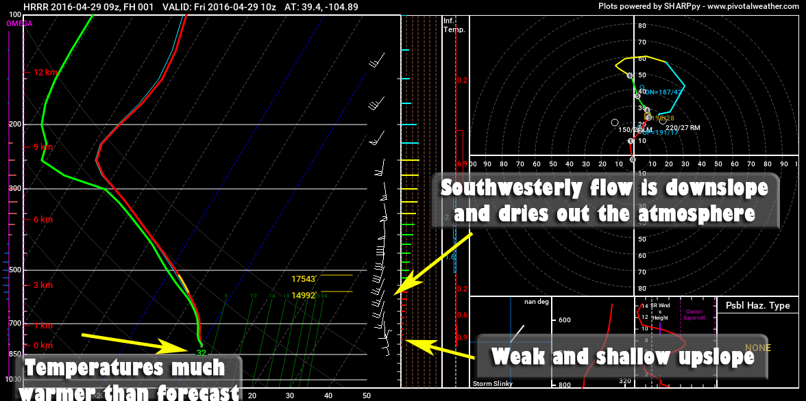
But just how do we know what the atmosphere's conditions is in different heights anyways? That's where our good friend, the Skew-T diagram comes in. This chart is created twice a day when the National Weather Service releases a weather balloon with scientific equipment into the air. Let's take a look at this sounding from Denver.
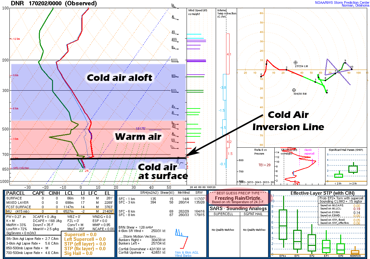
This is the 5PM Atmospheric Sounding for Denver
Notice how the Skew-T (with some of my notations for temperature) lines up pretty well with the "Freezing Rain" atmospheric profile above. Another key ingredient here is the red (temperature) and green (dewpoint) lines are very close together at the surface (near the bottom of the Skew-T) This means the atmosphere is nearly saturated (lots of humidity in the air) and is an important step because if the atmosphere were cold and dry, precipitation falling would have a better chance to re-freeze into ice pellets or snow.
The last key to freezing precipitation is the fact that it stays in a liquid state even though its temperature is below freezing. This is because it is super-cooled, in other words it is liquid precipitation in a non-frozen state and a temperature below freezing. Once this super-cooled water comes in contact with a surface, it instantly freezes into a solid and forms ice.
The atmosphere is set up perfectly tonight for precipitation aloft to form as snow in the initial cold layer, melt into rain in the mid-level warm layer and super-cool itself in the shallow cold surface layer, hence freezing rain.
What About Freezing Fog?
Freezing fog has the same principle as freezing rain but the process for it happens near the surface rather than falling through the atmosphere. At the end of the day, what fog basically consists of is water droplets, in essence its a cloud.

Freezing fog is when those water droplets are allowed to exist in a liquid, super-cooled state... much as the freezing rain discussion above. When the air is saturated enough and exists at a low enough temperature you can see these conditions. Freezing fog is dangerous just like freezing rain because it will exist in a liquid state only until it comes in contact with a surface...
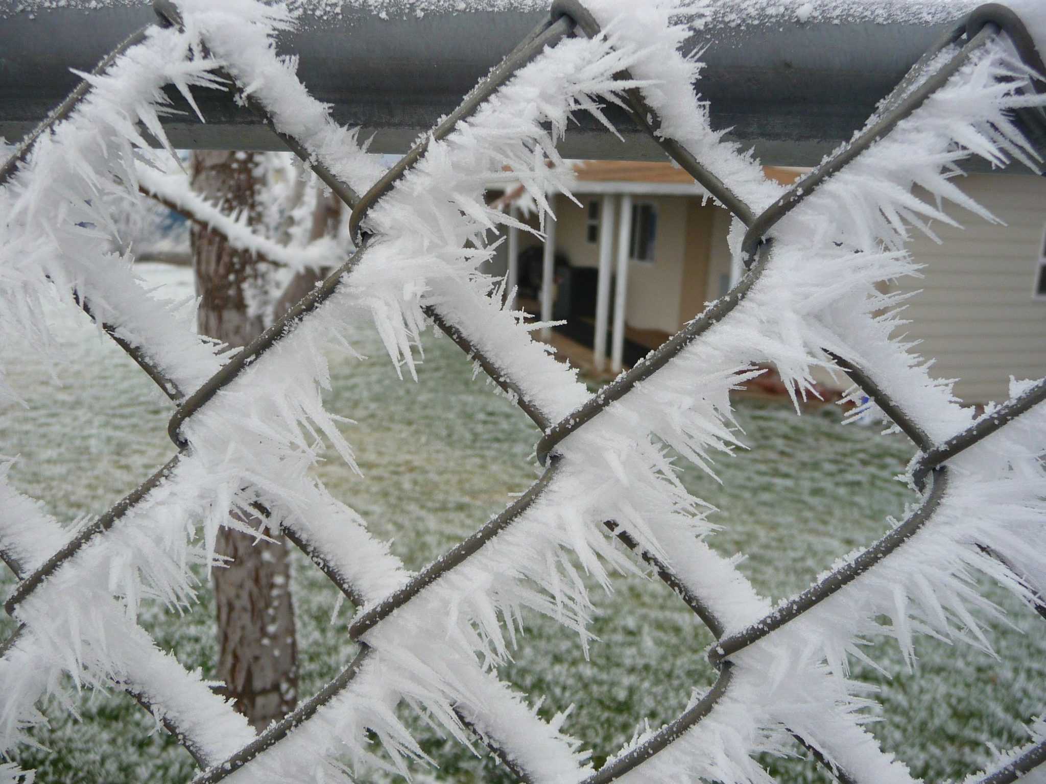
Once it hits that surface it will begin to freeze and form ice. This is why it can make travel conditions treacherous, once the roads cool enough they can very quickly flash freeze and begin to accumulate ice. Unlike snow, this ice can be invisible and catch people unaware, often leading to bad crashes.
Why Don't We See This Stuff Very Often?
As I said above, it takes very specific conditions for us to see freezing precipitation along the front range. It's not enough just to have the cold air aloft, warm air in the middle and cold air at the surface. These layers need to be certain heights and any variation can dramatically change the precipitation we see.
Additionally, we need the lower cold layer of air to be saturated with the proper warm and cold air layers in place. All of these things need to happen perfectly and often we are missing one or two of these closer to the front range, most of all because the air at our surface is usually much drier than areas on the Eastern plains.
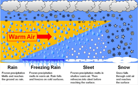
One more look at how we get different types of precipitation based on atmospheric temperatures.
