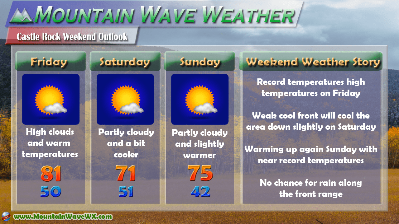
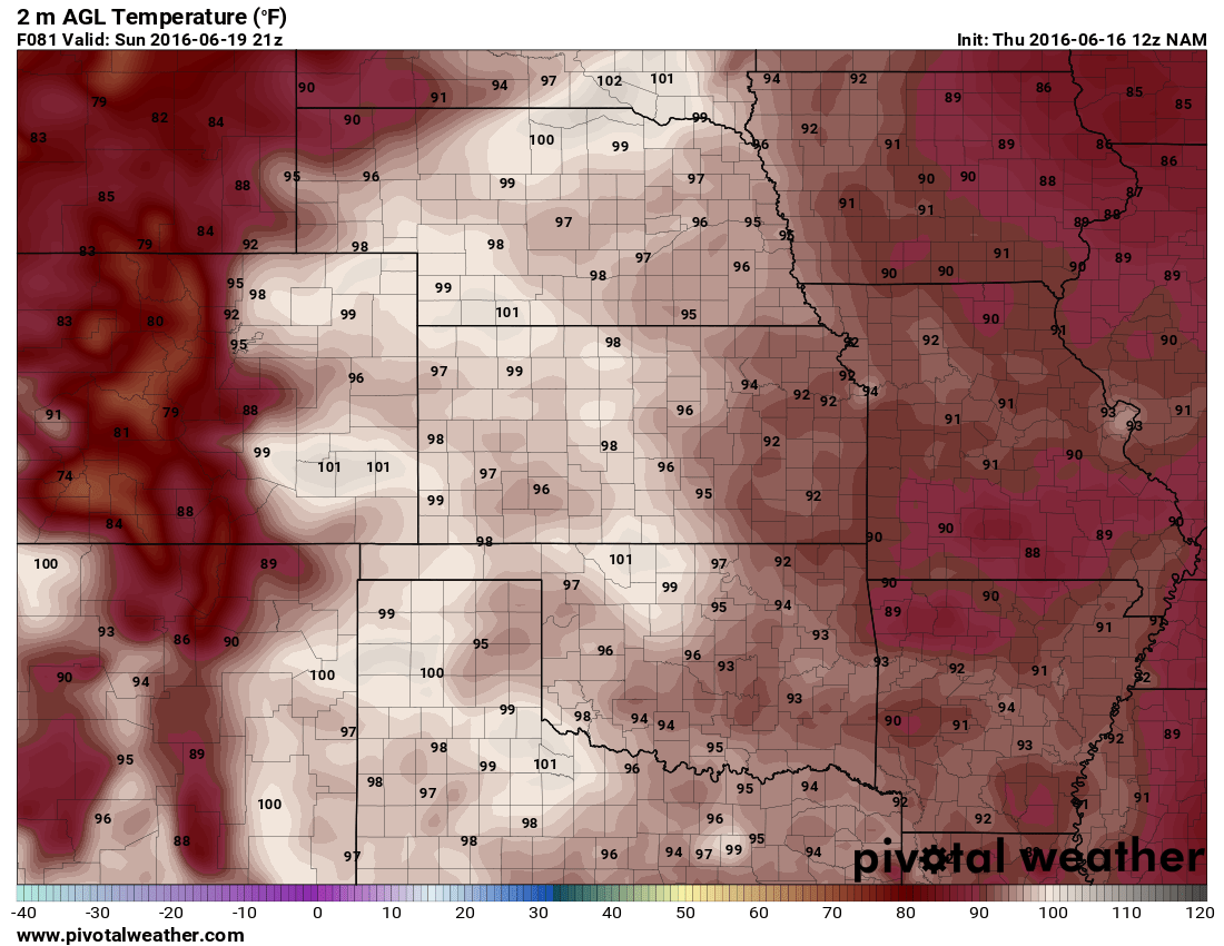
Our ridging weather pattern is still in place this weekend which means warm temperatures, dry conditions and light breezes across the area. We will continue to see record breaking warmth on Friday followed by slightly cooler but still mild conditions the rest of the weekend. Overall, a great weekend to get out and about!
The Blow Torch Continues!
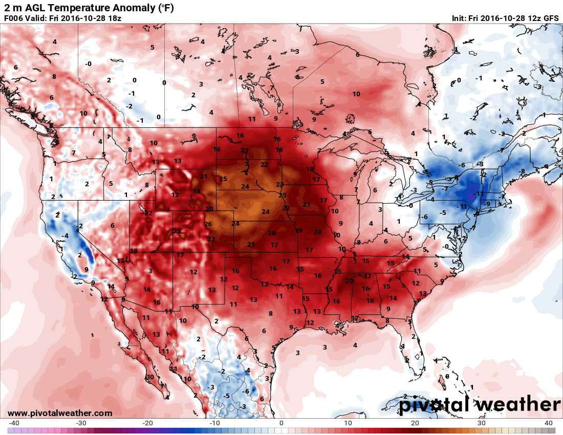
This temperature anomaly map shows how much over or under average temperatures are. The image above is for Friday at 12PM, notice the large swath of very warm air across the Central and Southeast United States. The heat is indicative of our large upper level high pressure system, drawing warm air out of the South and Southwest and into the country. The jet stream typically migrates Southward out of Canada this time of year, allowing cooler air and a more active storm track, so far it remains stuck well North of Colorado.
We don't anticipate any major changes to this pattern for the next 7-10 days in Colorado.
For those of you keeping track of our mean temperature vs. average for October and precipitation above or below average stats, here's the latest:
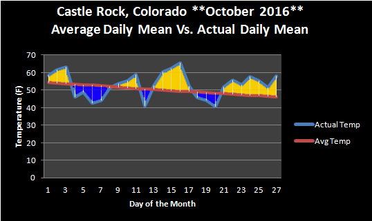 The last seven days have seen a mean temperature well above average. This is a combination of daytime high temperatures and nighttime low temperatures. The average is taken based on a 30 year mean of data from the National Weather Service. There is every indication that this tend will continue through the end of October
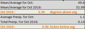
Currently Castle Rock is running about 3.39 degrees above average for mean temperature in October 2016
