
Southwesterly flow in the atmosphere is bringing smoke into Colorado today
Is this the beginning of fire season for Colorado this year? Time will tell, but it certainly seems to be for most areas of the Southwestern United States. If you've been outside today you've notice two things; how hot it is and how hazy it is.
A large ridge of high pressure is building in from the West, this is going to keep many areas in the Southwestern and West Central United States very warm and very dry for the next few days. This feature will also mean some areas will see very strong winds. The strong winds, combined with low humidities and very warm temperatures will start to notch up the fire danger and it could crank up very quickly over the next few days.
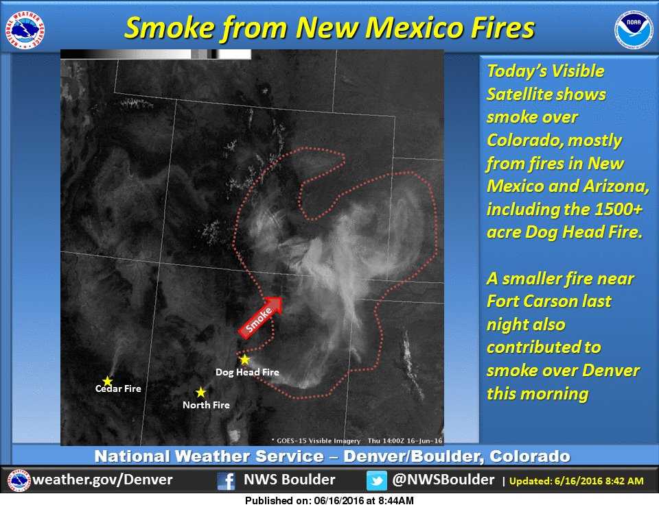
NWS graphic showing smoke on visible satellite this morning...
The Heat is On!
Thursday through about Monday look extremely toasty for all of Colorado. Some models even have us projected in the 100's along the front range for Sunday. This looks likely for a lot of places but areas South of Denver will probably top out in the mid to upper 90's, nonetheless that's a very hot day!
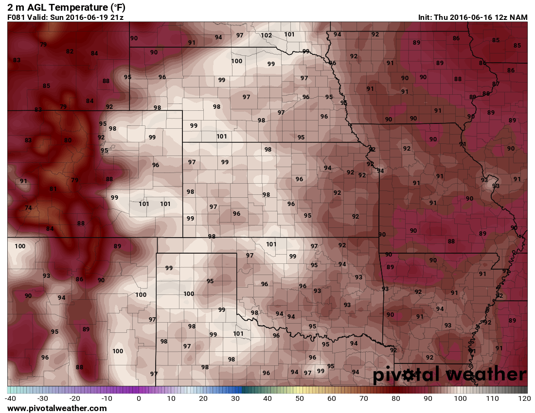
Scorching hot temperatures for Colorado projected on Sunday
All models agree pretty well on the heat making its way up from the South into the midwest and back into Colorado. As you can see from the image above, the hottest temperatures will be seen in Southeastern Colorado but a fair bit of 90's to near 100 will also extend in a line just North of the Palmer Divide.
I'll have a weekend outlook up for Friday but for right now, expect very hot temperatures through early next week. Make sure to drink lots of water as it will be very dry and don't forget sunscreen!
Happy Thursday!
