This interactive map shows the latest data from the National Weather Service and CoCoRaHS. To see additional data of each point, hover over the point or click on the point for an information window. Scrolling and zooming can be done with the mouse wheel or on-map control buttons.
Snowfall measurements made by trained observers, observers or CoCoRaHS volunteers follow strict guidelines to prevent outlying measurements caused by drifting and account for surface irregularities.
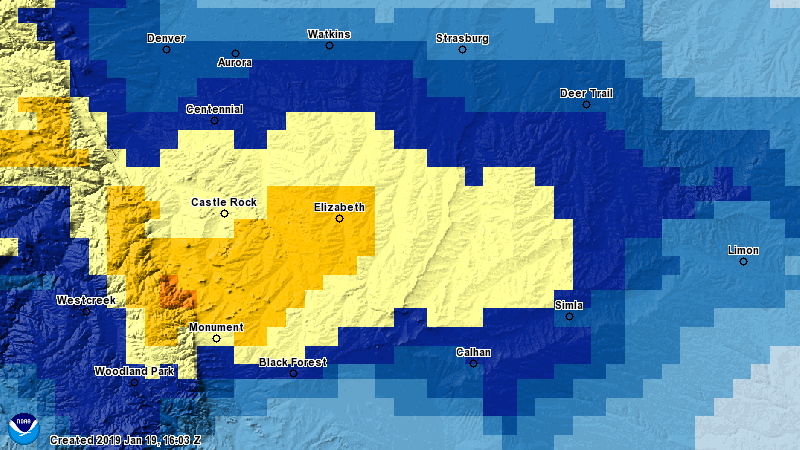
Official Measurement for Castle Rock Colorado From This Storm:
6.5 Inches of Snow Accumulation
See Our Forecast Articles Leading Up To This Storm
- Jan 21, 2018 - Winter Weather Alerts AM Update (5-10 inches snowfall forecast)
- Jan 20, 2018 - Latest Storm Update – January 22, 2018 Storm Update (3-7 inches snowfall forecast, emphasis on 5 to 6 inch range)
- Jan 19, 2018 - Winter Storm Watch Issued (3-7 inches snowfall forecast)
- Jan 18, 2018 - Potential for Larger Storm This Weekend (3-7 inches snowfall forecast)
Forecast Review and Analysis
- Snow accumulation forecast for Castle Rock area was finalized at 5-10 inches
- Based on the reported amounts in and around the Castle Rock area, we would call the snowfall forecast verified. In most cases, the 3-7 inch range would have sufficed as well.
- Main impacts were strong winds, icy and slushy road conditions through the day Sunday
- Based on the timing of snowfall, travel impacts and slick conditions, we would call the impacts forecast verified
Overall Forecast Grade for This Storm: Excellent
Summary
Even though the dry nature of the snow will limit moisture, we still got much more out of this storm than we have with any of the storms we've had this year. Sadly it looks like another drier period is beginning after this storm exits the region.
I did some digging, Castle Rock has not seen this much snow since April 17, 2016!
| 04/17/2016 | NA | 15.0 | NA | NA | NA |
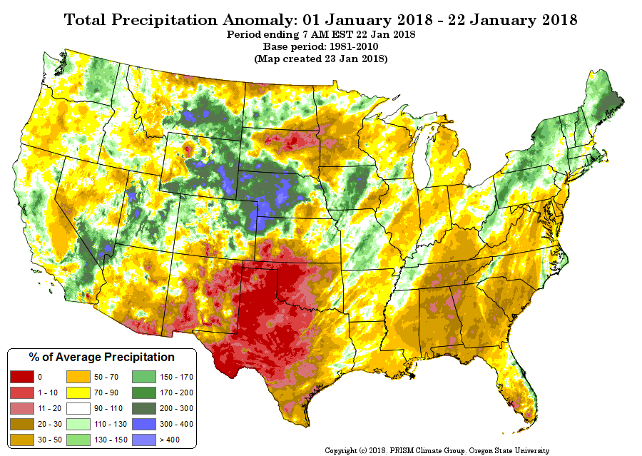
The latest round of snow moved some areas of Eastern and Northeastern Colorado into above average precipitation territory. Meanwhile the mountains are still very far behind!
Hopefully we can squeeze a bit more snow out of the atmosphere as we move into spring and into our snowier months of March and April. Hope everyone enjoyed the storm!

