As the storm begins to move into our area during the overnight hours, everything still looks pretty on track with our forecast. At this time most of the precipitation activity is still confined to the foothills and areas immediately North of Colorado Springs and the Southern Palmer Divide.
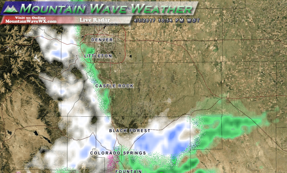
Live radar look just before 11PM
Let's take a quick look at some snowfall models with a bit of explanation...

NCEP SREF Snowfall Accumulation ensemble model
The graphic above is the NCEP SREF Plume showing a collection of models and their anticipated snowfall amounts. It displays all the model solutions it runs as lines depicting snowfall accumulation, of which we take a mean of and display it with a thick black line in the middle. The mean for this ensemble of model runs is 6.75 inches for a storm total accumulation. This product is not always the most accurate but it is useful to use it along with a few others to try to get an idea of snowfall.
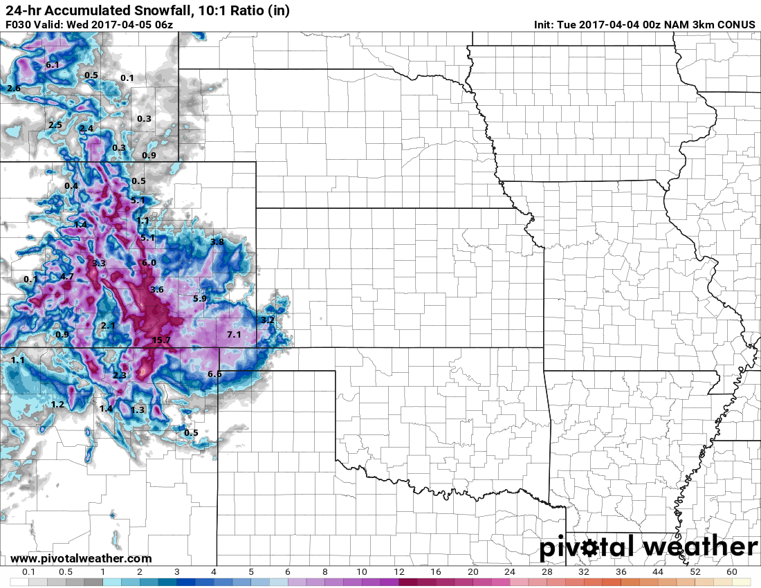
NAM3K Snowfall Total Prediction
The NAM predicted the last storm quite well so we'll keep that in mind when we are looking at this storm. On the past storm, the NAM dropped snowfall almost down to nothing in the final hours before the storm arrived. We have not seen that with the latest run, in fact the NAM 3K (a higher resolution version of the NAM) shows snowfall totals slightly higher than its previous run. The NAM 3K shows total snowfall around 5.1 inches, this still seems a bit high to me as models haven't done well with how much snow actually sticks to the ground due to temperature.
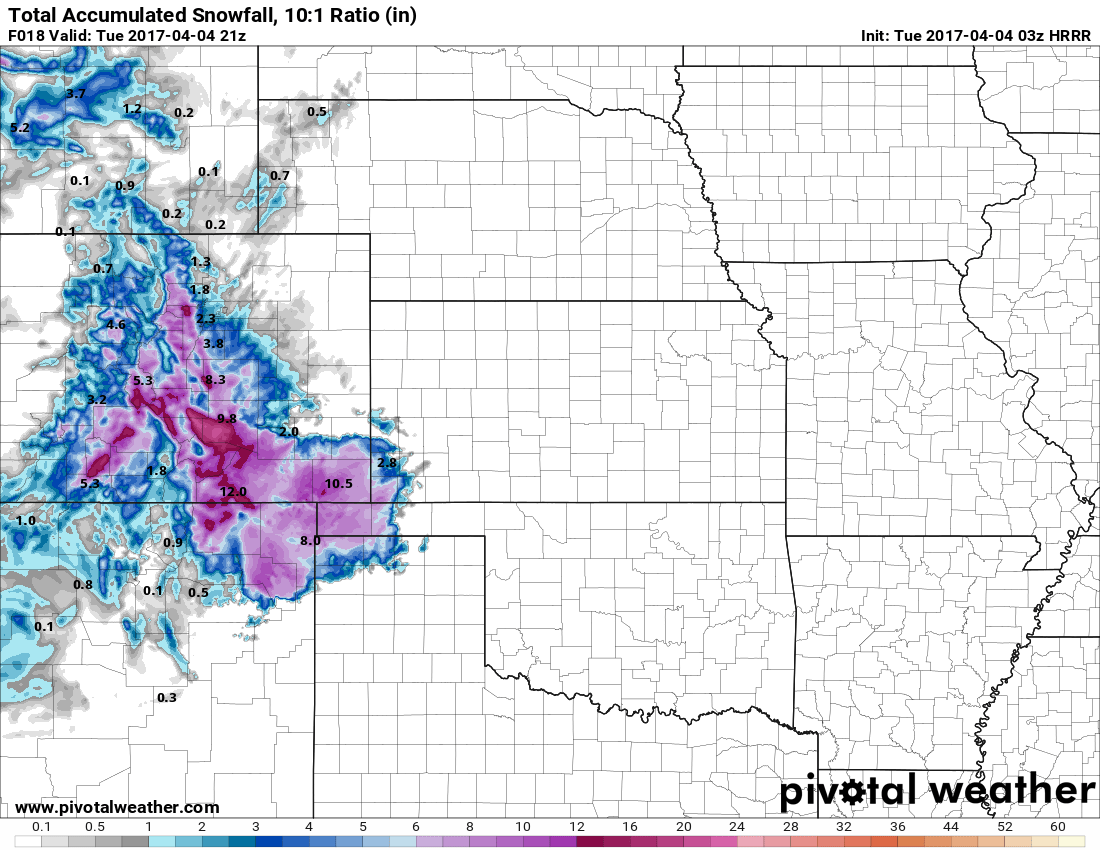
HRRR Model depiction for snowfall
The HRRR model (one of our shorter range and sometimes a bit more accurate models) shows a total of 3.8 inches by about 3PM Tuesday afternoon. So while there looks to be uncertainty among the ensembles the operational models (NAM, NAM3K, HRRR) all are in relative agreement. They may be slightly different on snowfall totals but they're all in the same ballpark.
Forecast and Impacts
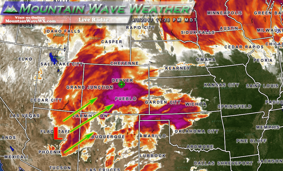
The center of the low pressure system is moving out of Arizona into the four corners area. It is already sending moisture up into Colorado. This combined with cold air coming in from the North will cause our snow to begin shortly. Once the winds shift to a more favorable pattern for upslope, snow will begin to fill in across the region.
Timing
- Snow is expected to begin around or shortly after midnight for the Castle Rock area
- Snow will continue through the morning hours, heavy at times throughout the early morning
- Heavier snow ends by afternoon but some areas may see lingering light snowshowers throughout the day
- Some models show a second wave of snow moving through later on Tuesday with minor accumulations
Snow Accumulations
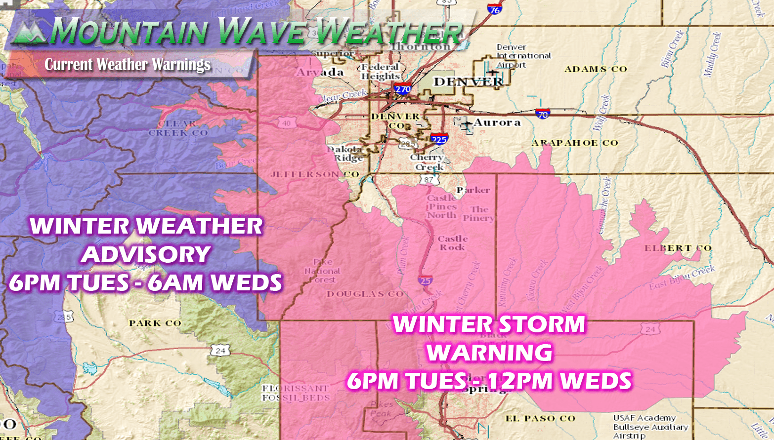
- Castle Rock and Northern Palmer Divide is currently forecast at 2-6 inches of snow accumulation for storm total accumulationg. Very specific, localized areas may see slightly higher totals, but this will be based on terrain and wind.
- Castle Rock, Pinery, Franktown, Elizabeth, Kiowa
- Areas over and near Monument hill can expect 4-8 inches of accumulation by Wednesday morning. Some localized areas could see snowfall totals in the 5-10 inc range.
- Larkspur, Palmer Lake, Monument, Black Forest
Wind/Visibility
- Winds look a bit breezy at times, especially on Tuesday. Visibiltiy may become and issue in some wind prone areas.
Impacts
- The Tuesday morning commute will be something to keep an eye on. Should the temperatures dip enough and should we get pockets of heavier snowfall with higher snowfall rates; those areas could be dealing with slushy roads. This is somewhat likely in areas South of C-470 and very likely in areas South of Castle Rock.
- At this time, travel impacts look low to moderate Tuesday and Wednesday mornings for Castle Rock and areas to the North. Areas to the South of Castle Rock could see moderate impacts.
- Areas under heavier snow and wind could experience slushy roads and a bit of snowpack. Be prepared to leave a bit of extra time if travelling between areas South of Denver and into Colorado Springs Tuesday morning.
We'll wake up and see how this one does tomorrow. I'll have updates on the snow and a live look at the radar and road conditions. Stay tuned!
