If you were up late enough last night for my 1AM post you noticed I started using the 'B' word in my posts. I'm usually cautious to start calling storms full-fledged blizzards, but that is exactly what we are now looking at. The computer models were sluggish with upping snow totals all day yesterday and then the models late last night began upping snow totals drastically.
See Also: 1AM Blizzard Update (Models Crank Up the Snow)
The Latest
For all intents and purposes this storm remains on track to be a major spring snow storm.

NAm4k total snowfall accumulation by Weds PM
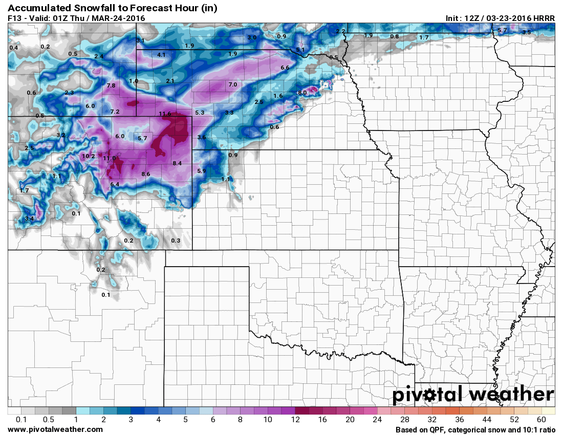
HRRR total snowfall accumulation forecast by Weds PM
The models this morning are pretty consistent with what we saw late last night. The storm track shifted slightly southward enough to bring good snowfall to the front range of Colorado.
Snowfall Forecast
Castle Rock: 7-14 inches
Palmer Divide (Eastern Douglas County and Elbert County towards Limon) : 8-16 inches
Denver: 6-12 inches
Impacts
We are already seeing these impacts
-
Heavy snowfall
-
Strong winds up to 60mph, sustained 30-40mph
-
Hazardous road conditions (expect road conditions to deteriorate through the day with improvement in the late evening hours)
-
Strongest impacts will be felt East of Castle Rock into Elbert County.
-
Road closures will be likely in some areas
-
Power outages have been reported
-
Traction laws are in effect for I-25 (means your car needs snow tires/chains, trucks need chains)
I'll be continuing to track this system throughout the day. Expect snowfall to come to an end late this afternoon and improving conditions by tomorrow.
At this time I would not recommend driving if you absolutely don't have to. Stay home, enjoy a movie!

