Thursday 6pm Projected Temperatures
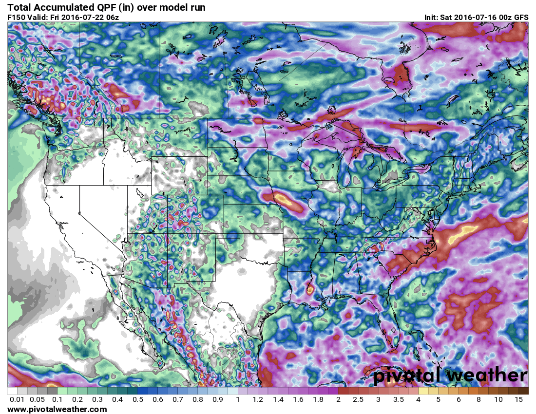
Total precip through Thursday
If you recall my post this weekend, we were expecting a very hot and dry week this week based on medium range and long range modeling (NAM and GFS models.) Both were predicting anywhere from 0.1-0.3 inches of rain total for the week into about midnight Thursday. We've seen a lot of backing of from both of these models on temperatures and a boost on precipitation, in short they've flip-flopped.
What Happened?
There are a few things going on here:
- The ridge looks to establish later in the week than initially anticipated, this means the door won't be shut on thunderstorm activity on Monday and Tuesday. By Wednesday though, the ridge looks to strengthen enough to keep storm activity minimal
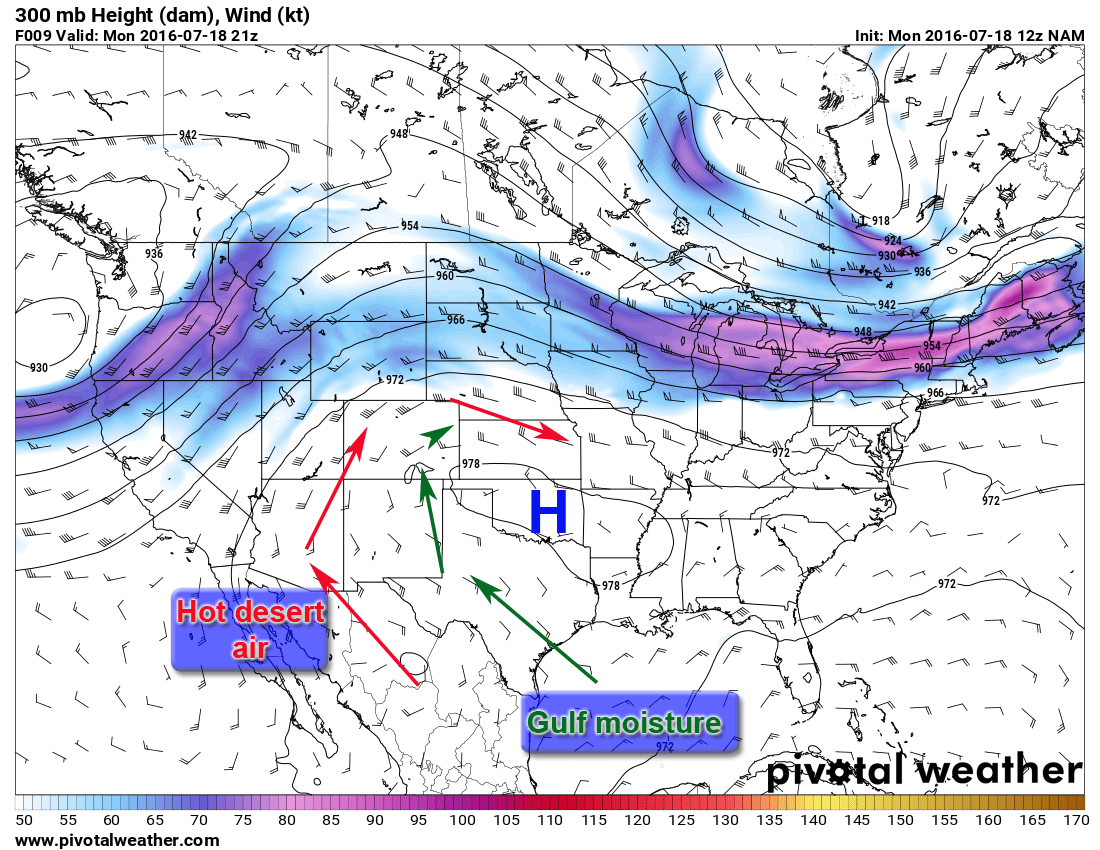
- Another factor at works is that many models showed this strong ridge establishing further west than it is on many models now. As the upper and lower level high pressure systems move to the East there will be brief period of monsoonal flow from the South and Southwest. For Monday and Tuesday this week, this mirrors a very familiar monsoon setup:

High pressure ridge to the Southeast; check. Jetstream to the North of Colorado; check. The low "monsoonal low" doesn't show up well but there is something, surface low pressure system over Arizona that could contribute to this pattern
Battle of the Models
It looks like monsoon conditions will be possible on Monday and Tuesday. I'm not 100% convinced on how strong this pattern will establish, some areas along the front range will see heavy rain but some areas will miss it. There is also a lot of discrepancy between models on total precipitation amounts over the next 24 hours. Take a look at the NAM4K and HRRR QPF (quantitative precipitation forecast) maps:
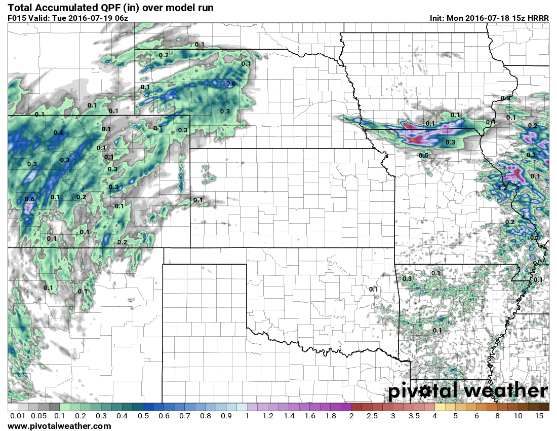
HRRR precipitation next 24 hours; much lesser amounts.
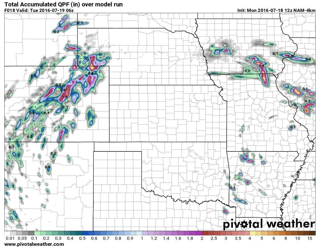
NAM4K shows much higher amounts!
I'm leaning on a more modest number and sparser coverage, so you could average out between these two amounts for a best guess.
What to Expect This Week
- Monday and Tuesday have the potential to be very wet
- Wet weather looks most likely on Monday, Tuesday is still questionable at best
- The caveat here is the coverage will be spotty, some areas will get dumped on and others may see nothing at all
- **Keep a closer eye on the Palmer Divide and a line up I-76 into Northeast Colorado especially
- The overall chance for any one area of getting rain is about 60%, those that do get rain will get a lot!
- This "monsoon" type pattern looks to be short lived, mainly limited to the first part of the week
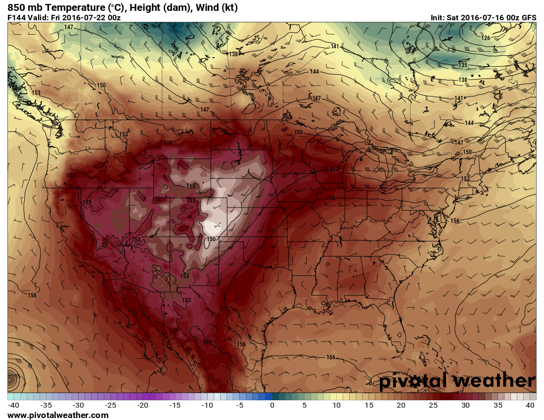
- Wednesday - Friday much drier and warming up
- Models still consistently show a hot and dry end to the week
- Thursday looks to be the warmest at this point
- Overall temperatures in the upper 80's to low 90's, luckily it doesn't look like as much as a scorcher as was predicted last week
- Keep a small chance for storms each day, the high pressure is far enough away that any surface based systems or fronts could fire scattered storms up along the front range.
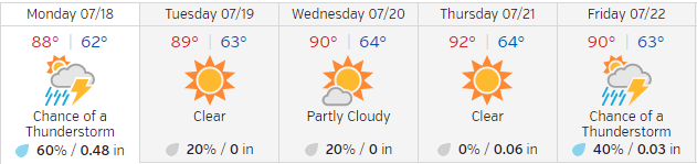
Here's a quick look at the Weather Underground forecast for the Meadows this week:
I'll have a close eye on the radar this afternoon and will have any severe weather alerts or information on my Facebook page.
Happy Monday!
Reminder!


Please Consider Sponsoring Me for This Event!
Visit my rider donation page to learn about my story and why I ride every year for Children’s Hospital:
John Braddock Courage Classic 2016
