Severe Weather Outbreak Likely for Southeastern U.S. Please Warn Your Friends and Family in the Area. The possibility of violent, long track tornadoes is high.
Summary
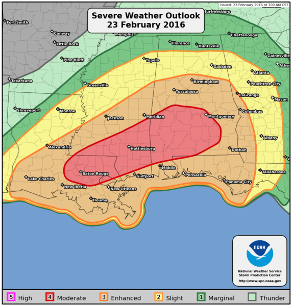
As the storm system responsible for our snow in Colorado moves off the Southeast it will spawn some pretty nasty weather on the front end of the system. The Storm Prediction Center has a moderate risk over portions of Southeastern Louisiana, South Alabaman and Mississippi. This is not entirely unusual for this time of year for these areas, we have seen several early seasons severe weather outbreaks in this area in the last few years.
I know this page is mainly dedicated to Colorado weather, however many of us have friends and family all across the country. This will be a serious situation as we head into the afternoon and overnight hours on Tuesday. If you have friends or loved ones in the area, please tell them to be very alert.
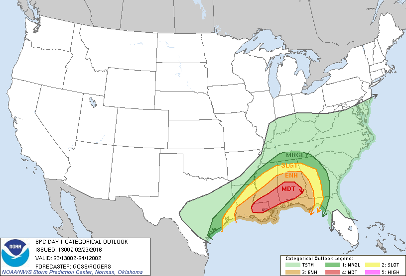
Here's a closer look at the affected areas:
Technical Synopsis
For those interested in more of the technical aspects of this severe weather setup, I will briefly go over a bit of that information right now. **Note all times I discuss are mountain so add 2 hours for Eastern... i.e. 8am is 10am and 8pm is 10pm.
Currently the storm system that moved through Colorado is intensifying over the Texas panhandle. A look at upper and lower level wind maps shows the upper low and closed surface low clearly:
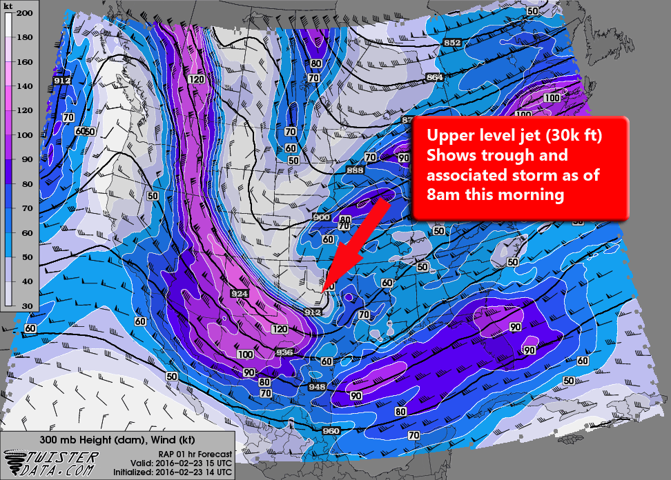
Upper level jet
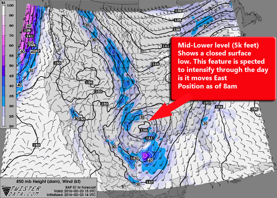
Mid-Low level winds
The two above images show the storm system as it was at 8am this morning.
The next two show the storm this afternoon as it has intensified and moved Eastward:
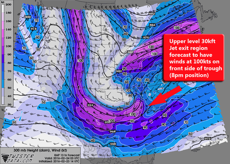
8pm storm position
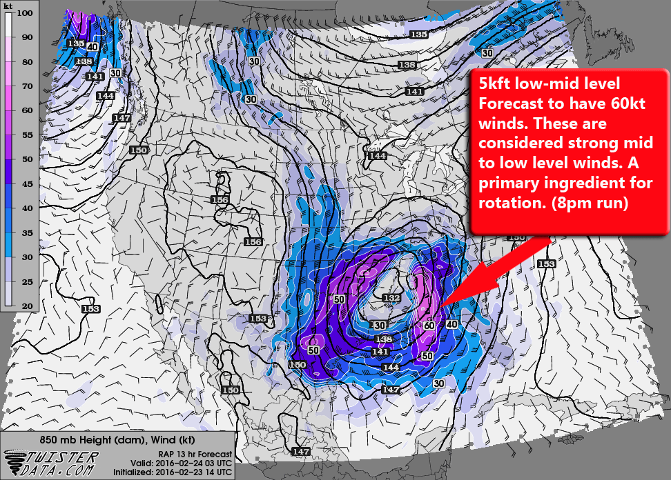
Low-mid level position as of 8pm
So as you can see, a strong upper level jet (100 kt winds) and strong wind motion at the mid levels (60kt winds) should create ample wind shear in the atmosphere. This is usually called vertical shear or speed shear. Winds travelling at different speeds in the same direction in the atmosphere create a rolling motion:
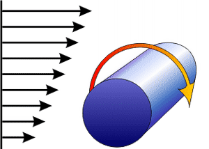
This is important as it is a critical component of creating and sustaining severe thunderstorms.
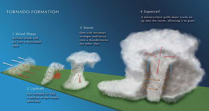
Image Credit: Chloreyweather.com
I'll describe this setup briefly:
- Just like the image above, vertical wind shear create a rolling motion in the atmosphere
- As daytime heating increases and destabilizes the atmosphere you begin to get lift in the atmosphere
- Once a thunderstorm forms or moves along this rotating column of air it lifts and stretches this tube of rotating air
- As the storm becomes a super cell it uses the rotating air to pull warmer air into the storm, causing it to intensify
There are a few other factors that will allow these storms to be very strong across the South today. There is a ton of moisture and instability along the front edge of this storm system. That coupled with strong low level winds means Tornadoes will be likely.
I don't want to get too much into the mechanics of severe weather in general yet, that's another longer post for another day. When we get towards severe weather season in Colorado I will have a much longer post with more detail on how severe weather and tornadoes form.
In the meantime, if anyone wants to discuss any of this or has any questions, I can always be reached in the comments below or my facebook page.
