Yesterday we saw a strong cold front move through the area dropping our temperatures considerably. As is often the case with these summer fronts that move through the state, we are always watching the Day 2 (day after the front moves through) for severe weather. This looks to be the case today but I'm more concerned primarily about areas East of Denver, this is where the atmosphere is most favorable for larger, nastier storms. Still, there is still a chance that areas closer to the foothills get in on some of the bigger storms, but the risk is overall low.
Storm Prediction Center Severe Weather Risk Outlooks
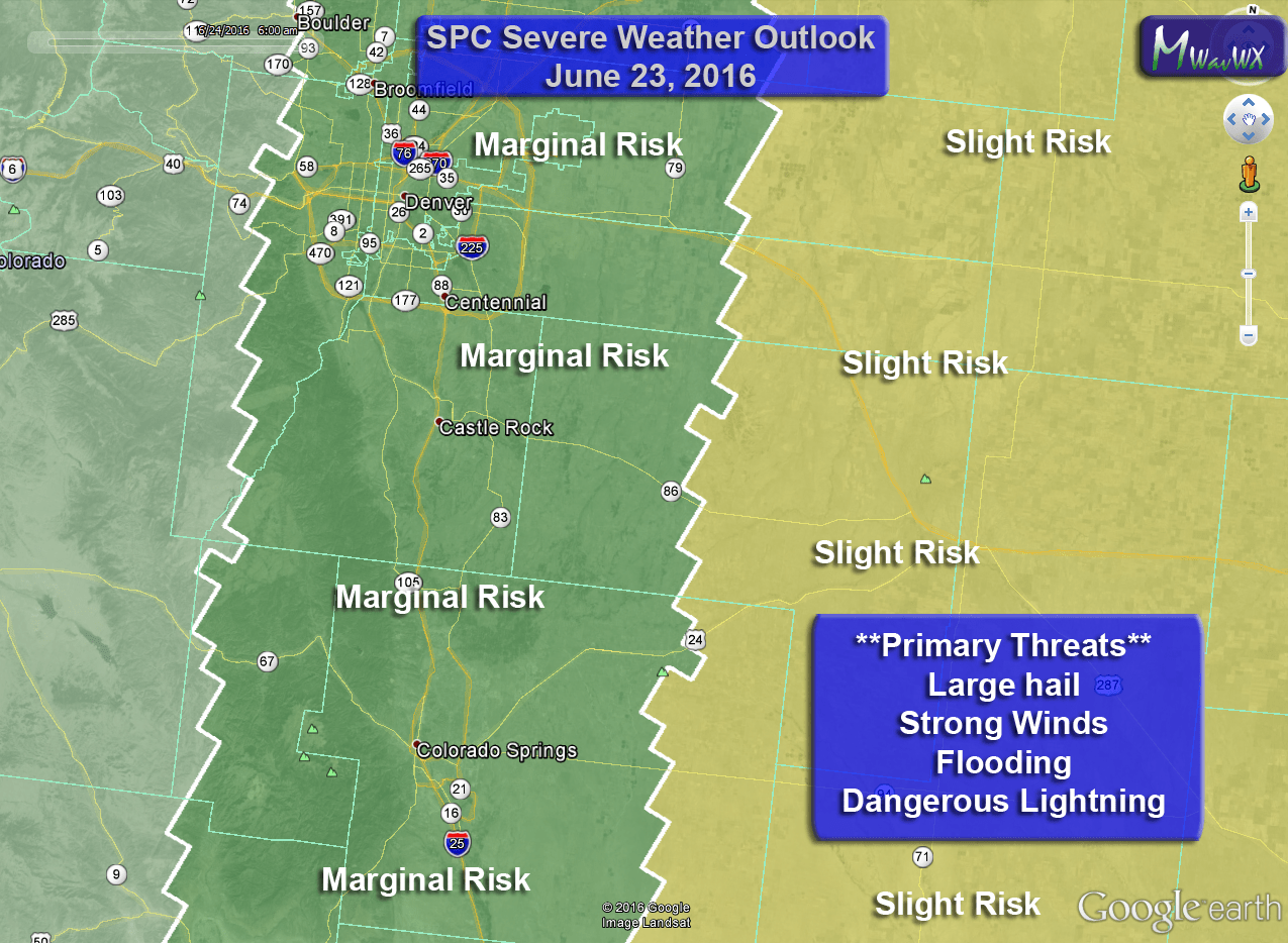
SPC General Outlook has marginal and slight risk areas across Colorado today
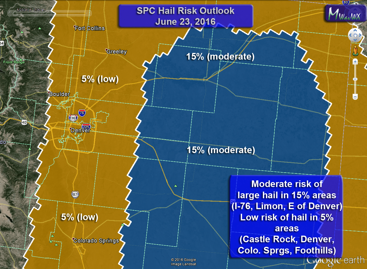
Hail risk encompasses most of Colorado. The best chance for hail will be East of Denver but a low risk area exists along the front range
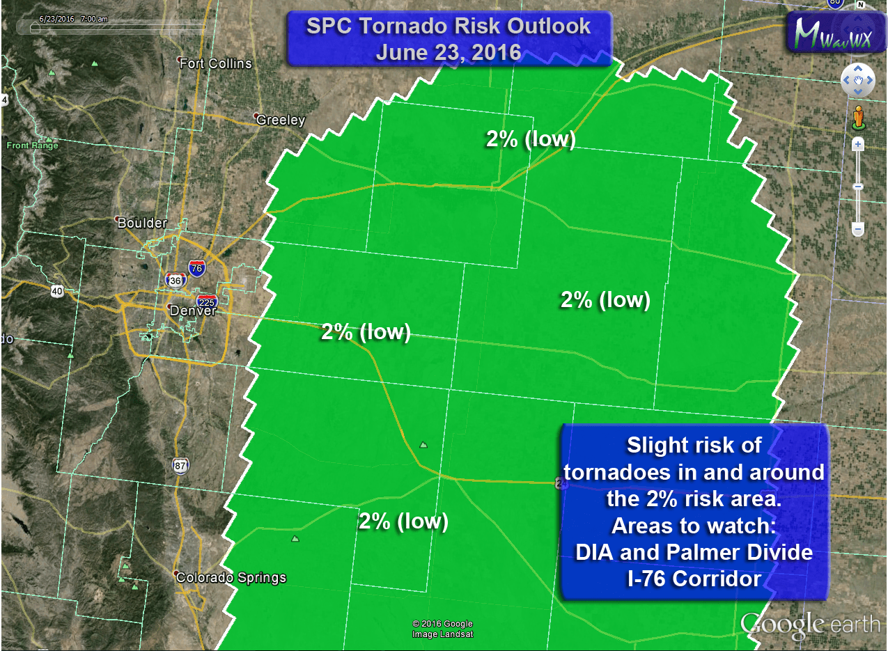
Tornado risk is low today but it is there. Highest chances East of Denver but I'd keep a close eye on DIA and Palmer Divide East of Castle Rock as it echoes a DCVZ day
Primary Threats
The most favorable environment for storms to become severe is East of Denver but given terrian and flow in the atmosphere I wouldn't rule out stronger storms over Douglas and El Paso counties through the afternoon:
- Hail
- Some storms may have larger hail that will cause them to be severe
- Wind
- Due to the high based nature of the storms, strong gusty winds and microbursts are possible
- Lightning
- These storms will be capable of a lot of lightning, keep an eye out!
- Flooding
- Wind shear is ample enough so that these storms should be moving, however there is quite a bit of available moisture in the atmopshere so heavy rain under the larger storms is likely
Timing
There is uncertainty between models on the exact timing oif thunderstorm initiation and strength
- Thunderstorm initiation
- HRRR shows storms developing around 12-1PM
- Nam4K shows storms developing after 2PM
- In short, be prepared for severe weather after 12PM today. Most likely time of storm initiation looks to be 12-3PM
- Front Range Severe Storm Window
- 12-3PM looks like the most likely time for storm initiation
- Storms look to be ongoing through 6-8PM with clearing afterwards
- Eastern/Northeastern Plains Severe Storm Window
- Storms that stay strong enough to move out onto the plains will affect those areas between 4-9PM
- There is a higher risk for larger hail and tornadoes for storms on the Eastern and Northeastern Plains.
What to Do/Expect Ahead of Today’s Storms
- Be prepared to move indoors if you are outside and storms begin to form
- If you hear thunder, you can be struck by lightning, don’t wait until it’s too late!
- Take actions to protect property that may be damaged by hail. (cars, plants, etc…)
- Keep an eye on local forecasts throughout the day, don’t be caught off gaurd!
- Do not attempt to drive through flooded roadways!
I'll pass along any updates throughout the day as I see them come in. Stay aware!