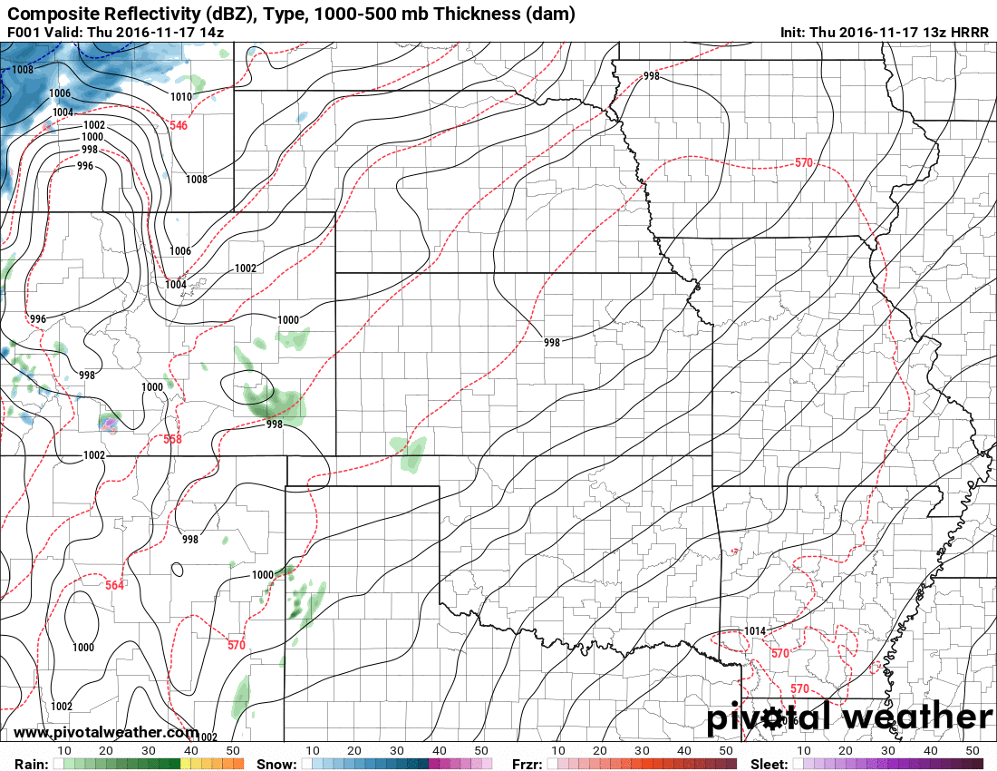
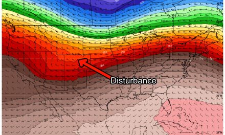
Our first significant storm system in months is set to move into Eastern Colorado throughout the day today. The HRRR shot below shows the progression of the storm as the low moves across the mountains and re-organizes in Eastern Colorado before moving quickly off to the East.
Model Forecast Snowfall
All the models I show below are for total snowfall accumulation by 11PM Thursday night. The GFS is a longer-medium range low resolution model while the NAM4k and HRRR are shorter range higher resolution models. The higher resolution models are not necessarily more accurate, they just see finer details with each model run.
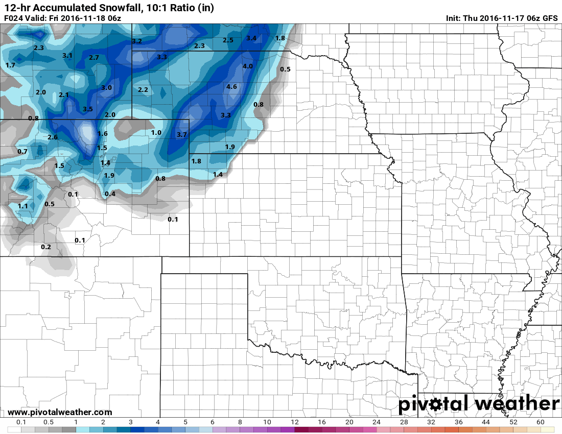
GFS predicts 1.9 inches of snowfall accumulation for the Castle Rock area by 11PM.

NAM4K snowfall accumulation through 11PM. It shows a stronger downslope signal and less snow

HRRR shows 1.8 inches for the Castle Rock area by 11PM.
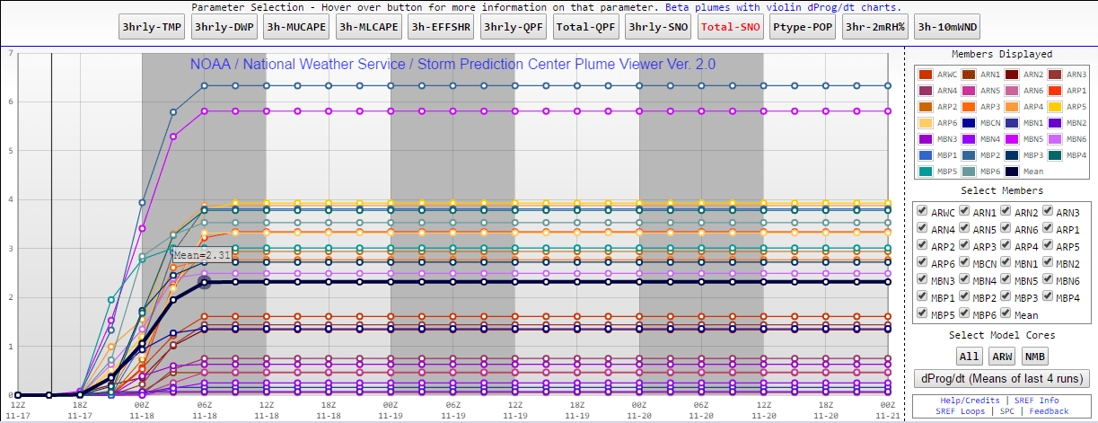
SREF ensembles show a mean of 2.32 inches by 11PM Thursday for the Centennial Airport area.
All of these models have been uptick-ing the snow totals slightly over the last few runs. This could mean we could see a bit colder air than anticipated which would mean slightly more snow accumulating on the ground. The ground is still quite warm however and sometimes models can struggle with melting. Interestingly, the NAM has consistently shown a stronger downslope signal which could mean significantly less moisture making it into our area. Either that or it is picking up on the melting on the ground better than the other models are.
Forecast and Probabilistic Snowfall Amounts
Snow is looking likely with this storm, that's not really a question anymore but how much do we get?

Probabilistic forecasting for snow shows percentage chance of a certain amount of snowfall accumulating. I tend to like it more as it gives more detail and compensates for uncertainty
- Rain will begin in the morning hours and change to snow later in the day as temperatures drop. Snowfall accumulation looks likely, especially in areas West of Denver and along the Northern sections of the Palmer Divide.
- Winds with this storm could gust to 40MPH or higher. Be prepared for strong winds throughout the day on Thursday!
- Chance for snow falling with this storm system as of today: 80-99% chance
- Given the newer model data, the chance that the Castle Rock area sees snowflakes falling today is pretty high. I have adjusted the forecast up for this.
- Chance for snow accumulating with this storm system as of today: 70-90% chance
- Nearly every model has some snow accumulating for us, even the NAM that has held off quite a bit shows 0.4 inches. I think it's a pretty decent chance we see at least a dusting off snow, but it is possible that the other models are picking up on colder air that could aid in snow accumulating on the ground.
- Total Snow Accumulation: 0.5-2.0 inches
- Melting is still a big concern as the ground is very warm. That being said, I think snow does accumulate for the Castle Rock area, somewhere in the range above. Right now I am still leaning around 0.5 to 1 inch as the most likely range but colder air could see up to 2 inches accumulate.
- Expect clearing on Friday but a very chilly day with highs only in the upper 30’s to low 40’s. No snow is expected to linger on Friday during the day.
- This storm does not look to be a major snowmaker for Colorado at this point. We are not expecting major travel issues around the Castle Rock area as roads and the ground is still quite warm. Areas South of Castle Rock over Monument Hill may experience some slick spots as temperatures drop. Be careful when driving, if temperatures trend colder the roads could "flash freeze" at some point. We'll keep an eye out for this!

