This is a bit of a long post, but there are several interesting weather features moving through Colorado this week that will bring us a host of different weather conditions. We will see a mixture of everything from strong winds, to high fire danger, to cold temperatures and even a chance of snow!
Here's a look at everything possibly coming our way this week...
Monday October 3
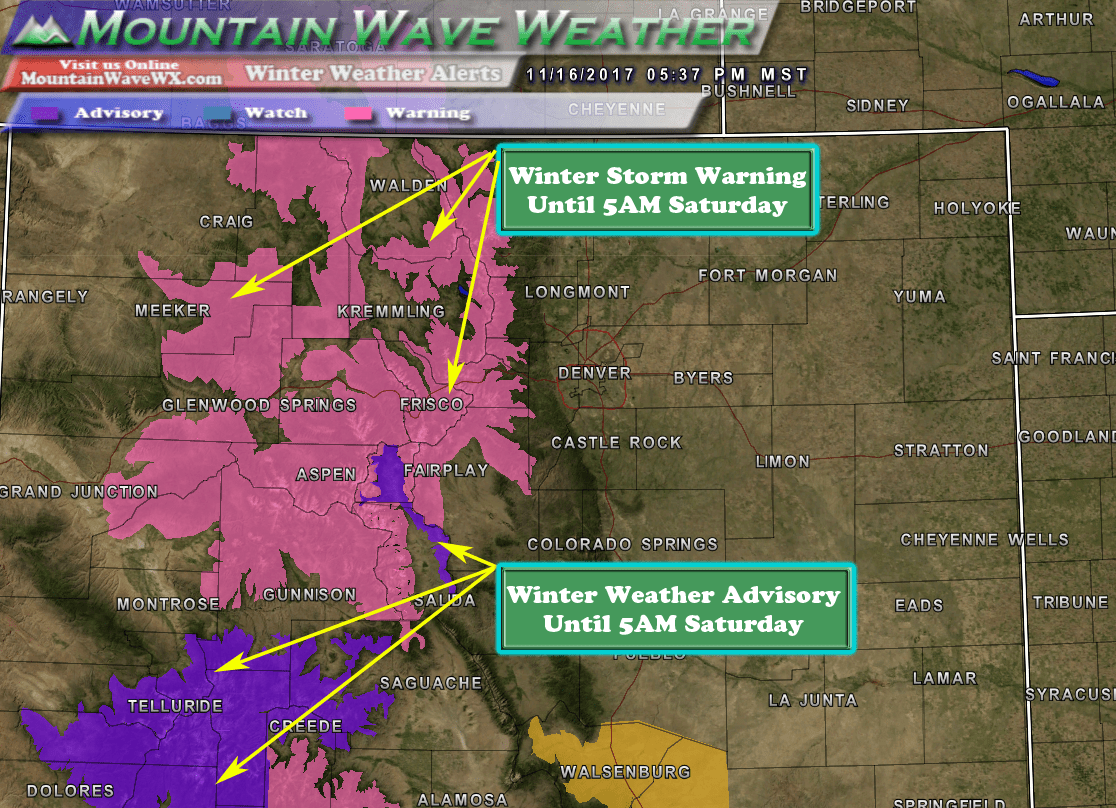
Official Alert/Advisory Text from the National Weather Service
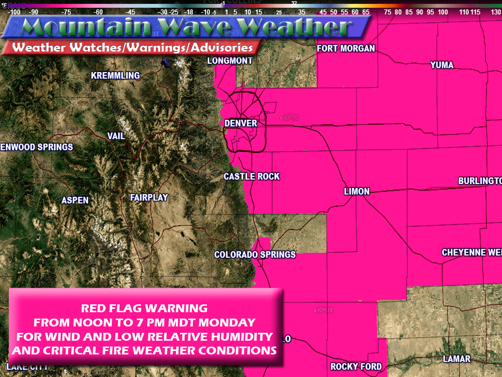
Monday will feature warm temperatures, very similar what we've seen the past several weeks along the front range of Colorado. However, in advance of a front slated to move through throughout the day and into Tuesday we will see strong winds and very dry conditions. Dewpoints will be extremely low with relative humidity values near 10-12%. This means that anything that can create a fire or spark should be avoided. With how dry our conditions have been the past several weeks combined with the conditions Monday means fires could grow quickly out of control.
As such the National Weather Service has issued a Red Flag Warning for Monday between noon and 7PM. The official warning text follow below but as you can see, many front range locations out onto the plains are included in the warning. Castle Rock and most of the Palmer Divide is also included.
Expect temperatures in and around Castle Rock to be in the mid to upper 70's with stronger winds developing by mid to late morning. The winds should stay pretty strong throughout the day and into the evening hours.
Tuesday and Wednesday October 4 and 5, 2016

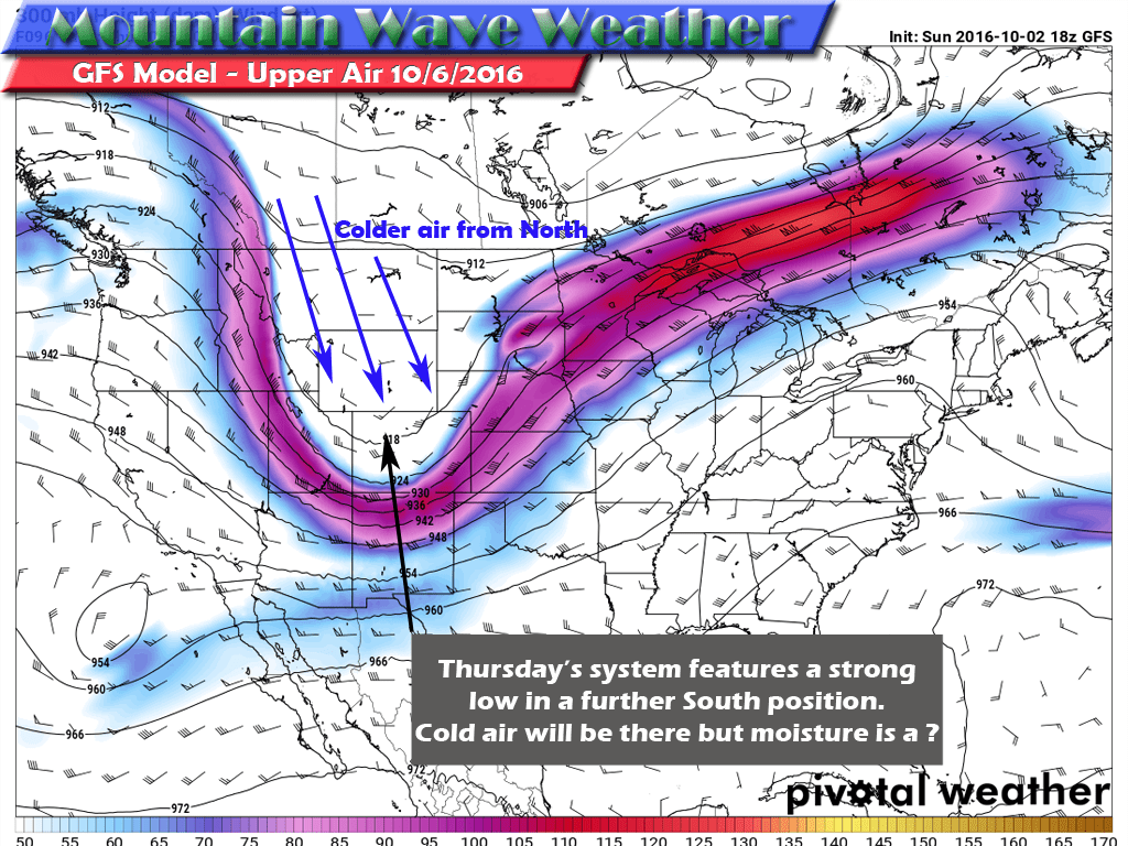
Initially this looked like the storm system that might have brought us our first snow of the season, with latest model runs this no longer seems to be the case. Models are in agreement that the low pressure system will track too far North to bring much moisture to Eastern Colorado. In the image above, the red arrows show the projected track and the orange arrows the flow of winds around the system. By having the system tracking to the North the orange arrows show winds out of the West and Southwest. This means downsloping conditions along the front range which rarely brings us decent moisture. There will however be enough colder air around the system to cool our temperatures down into the low to mid 60's during the day and mid to upper 30's at night.
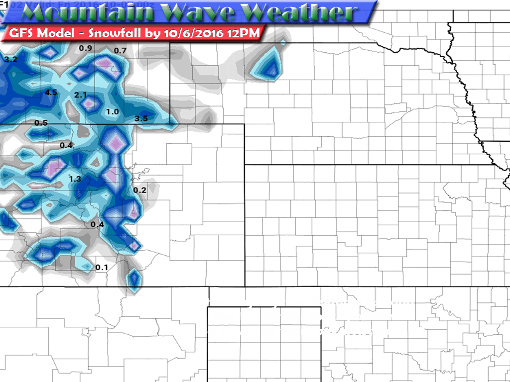
The mountains may receive a bit of snow, but at this time models show a dusting for most areas. Expect cooler temps and breezy conditions along the front range both Tuesday and Wednesday.
Thursday and Friday October 6 and 7, 2016
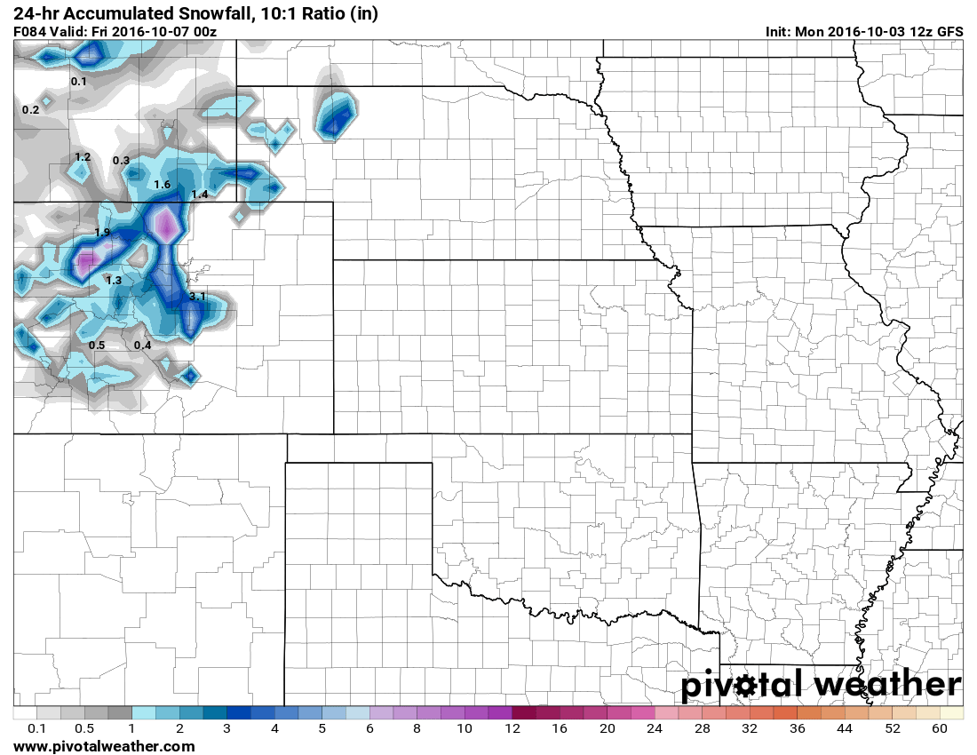
Thursday morning is the time that has our eye the most this week. Another strong upper level low pressure system will move in from the West. There is still considerable uncertainty about that track it takes but as is the case with so many storm system this time of year... position is everything.
Lets take a close look at the setup, just like Tuesday's system... a low pressure system will move into Colorado from the West. This system will tap into deep cold air from the North but my main concern is the location of the low. Again it looks to be a bit far North for decent moisture for the front range. I fully expect the colder air to move into the area but the moisture associated with it is still a question mark to me...
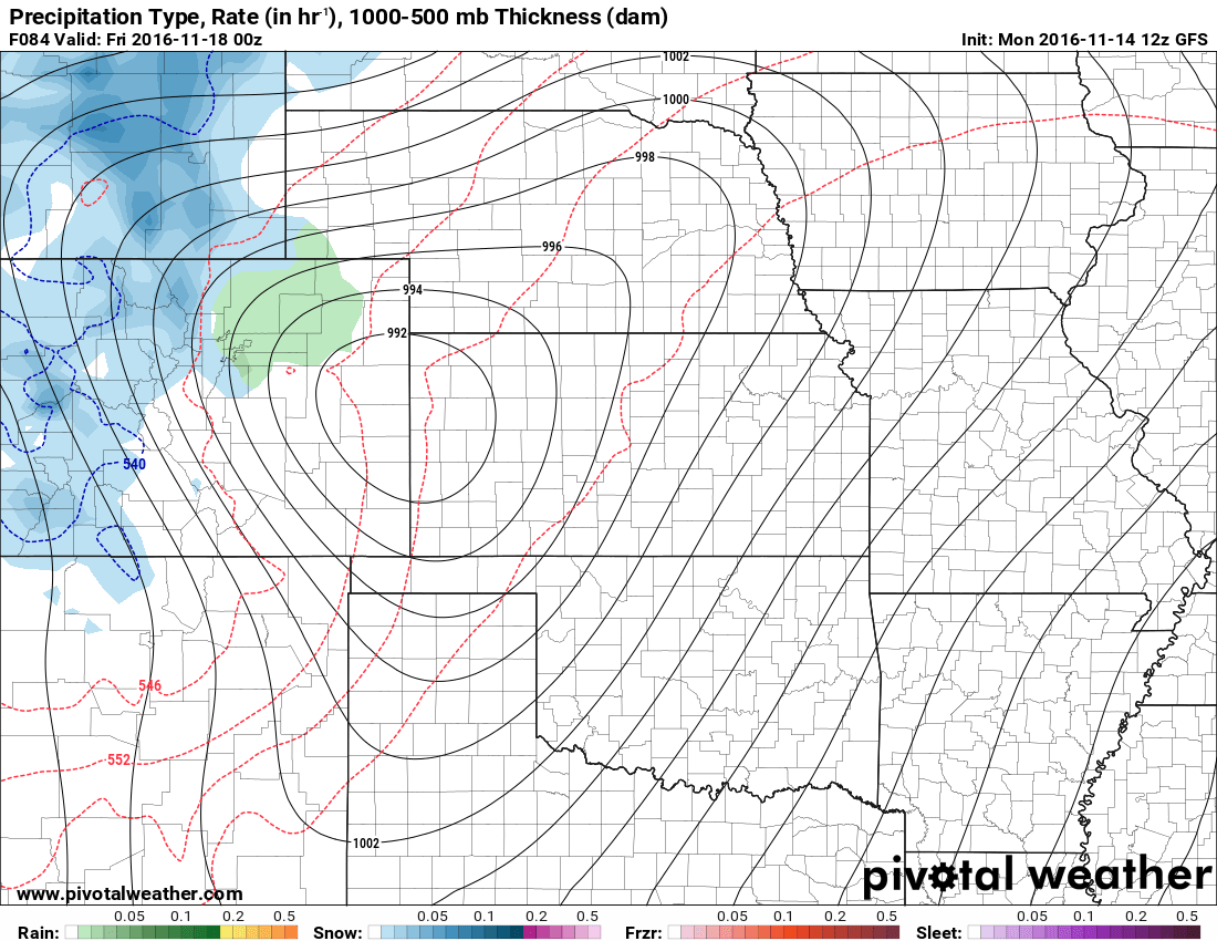
I took a quick look at the GFS, a longer range model who's accuracy is a bit sketchy more than 3-4 days out and saw the snowfall accumulations it expected. It confirmed that most of the snow will fall along the western side of the divide, but notice the light accumulations along the higher elevations of the Palmer Divide.
Due to us being out of range of the medium and short term models, it is something to keep an eye out for but in no way are we guaranteed to see snow in Castle Rock. It's a bit early to tell overall if we see snow and how much if we do.
For right now, we'll call it about a 40-50% chance of snowflakes flying early Thursday morning in Castle Rock. Unless something changes over the next few days (significantly colder temperatures or a more favorable storm track) I don't see any of it accumulating.
Stay tuned throughout the week, you'll be hearing from me a lot as I track this storm. I will pass along any updates to the forecast as it comes in .

Trackbacks/Pingbacks