A series of weather systems will move through this week keeping our weather cloudy, cool and wet with decent chances of thunderstorms and even chances of snow, especially for areas along the Palmer Divide.
Tuesday April 26

Forecast radar as of 3PM
The first our disturbances began to move through on Monday night, touching off a few thunderstorms late into the evening and into Tuesday morning with the passage of a cold front. Because of this front, temperatures along the front range will struggle to hit 60 degrees.
Thunderstorms will become likely, especially for areas South of Denver in the afternoon hours. While we are not expecting severe weather, we cannot rule out the possibility of a strong or severe storm along the Palmer Divide. The greatest chances of thunderstorms based on modeling is between 2pm-6pm.
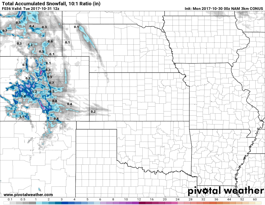
Chance of Snow?
There is the possibility of snow Tuesday night. As temperatures cool into the low 30's during the overnight hours, precipitation falling as rain may mix with snow. Some models show accumulating snow and some do not, but anything that falls will melt quickly. Along the Palmer Divide, some of the Western areas will see some snow accumulation while most other areas will see anywhere from 0-2 inches.
Castle Rock can expect 0-2 inches, but will vary greatly depending on elevation and which areas see precipitation. So all in all, not a major snow producer.
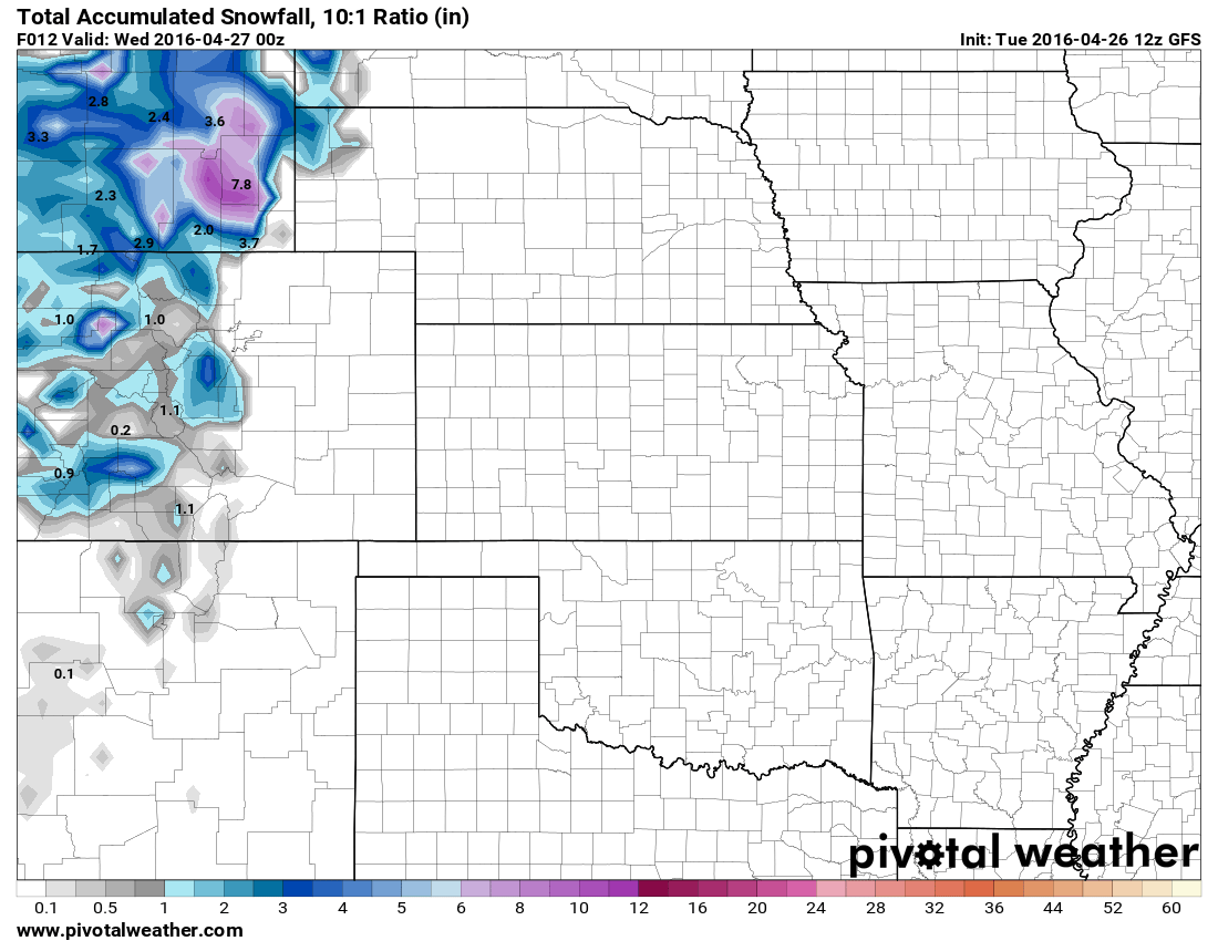
GFS predicted snowfall by Weds AM
Wednesday April 27 - Friday April 29
Wednesday will be a bit of a transition period between storm systems.
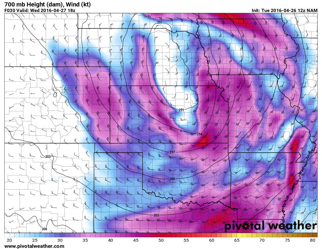
Predicted surface-mid level winds on Wednesday. Note the tail end of the jet over Colorado, this means breezy/windy conditions will be likely
As the last storm system departs Colorado will find itself on the tail end. This will mean dry but cool weather, it should also be quite breezy as well. High temperatures will once again be in the 50's to near 60 but skies should be mostly clear through the day.
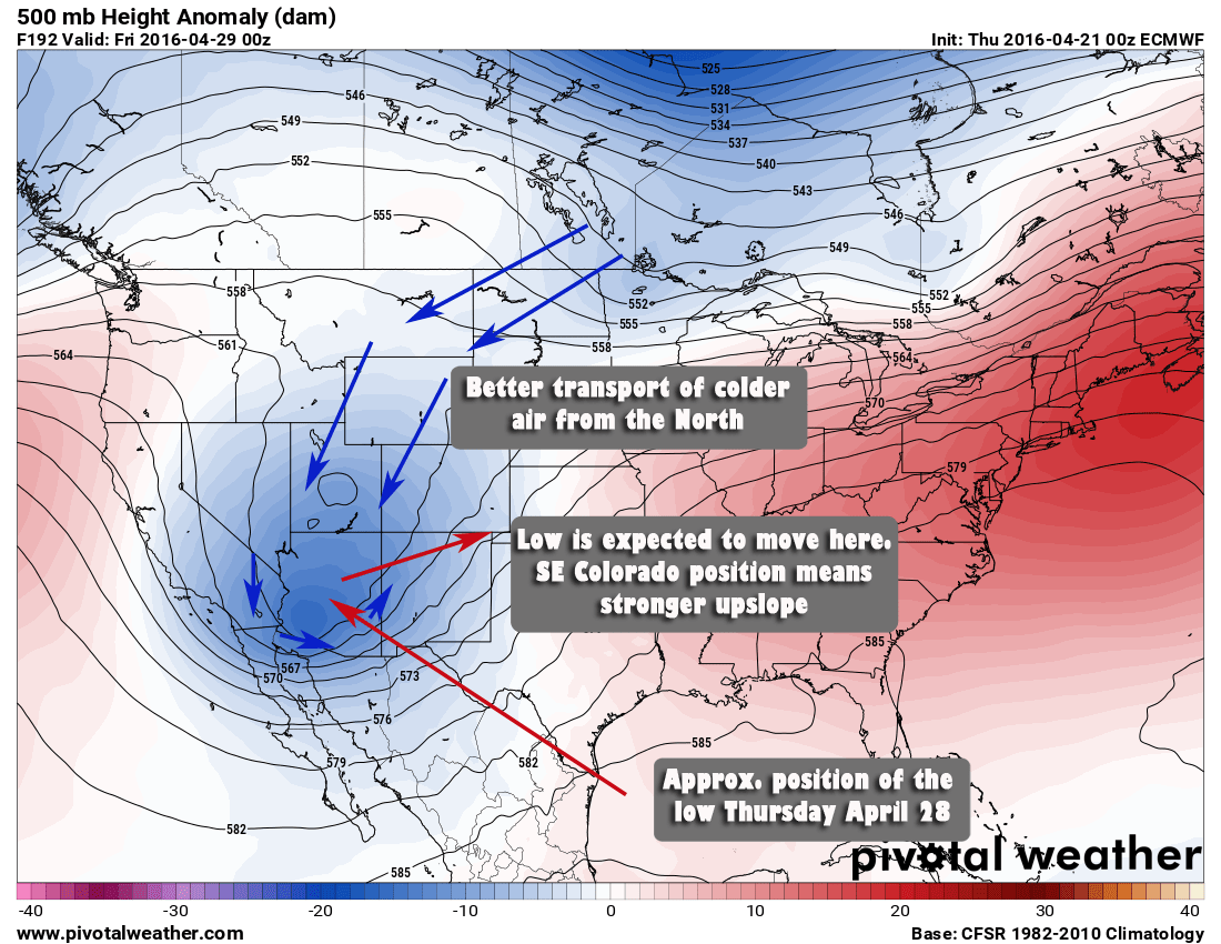
By Thursday and Friday we see more energy and moisture move into the area.
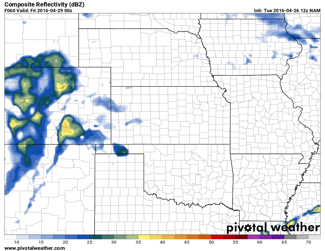
Predicted radar image from Thursday evening, moisture streams in from the South combined with the energy behind a cold front will mean thunderstorms are possible
Severe weather is not anticipated at this point but expect rain and thunderstorms behind the initial front moving through Thursday evening/night. By Friday, expect much cooler temperatures in the 40's with rain showers throughout the day. There is also still some question between models as to whether snow starts falling on the Thursday-Friday time-frame instead of the Saturday - Sunday time-frame.
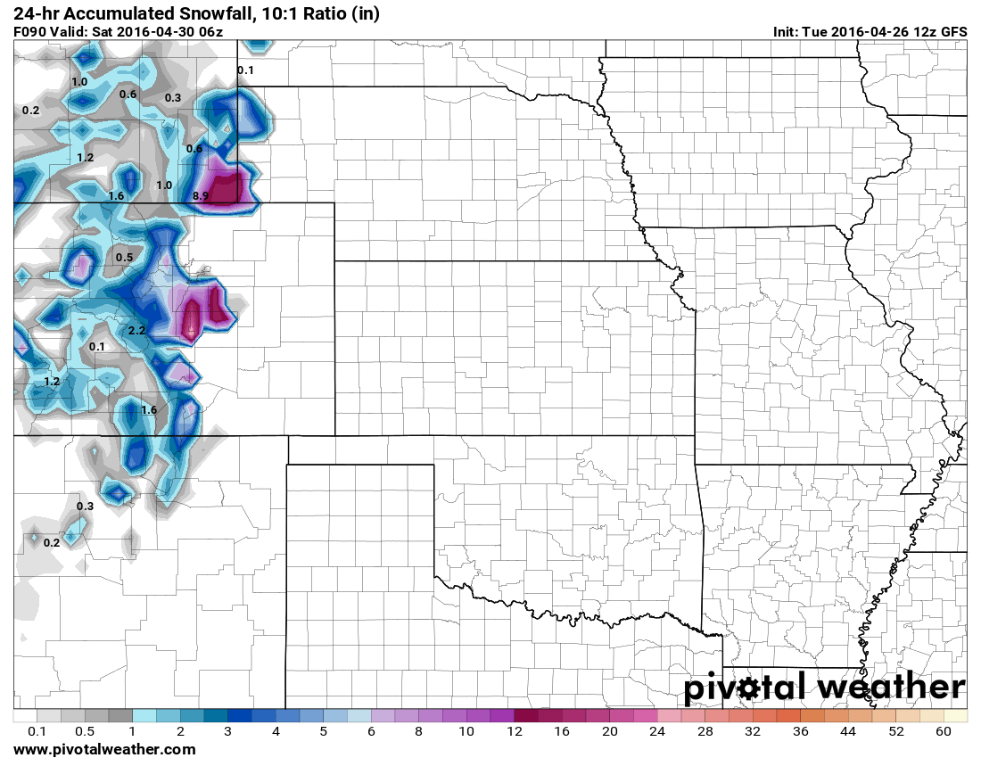
Saturday April 30 - Sunday May 1
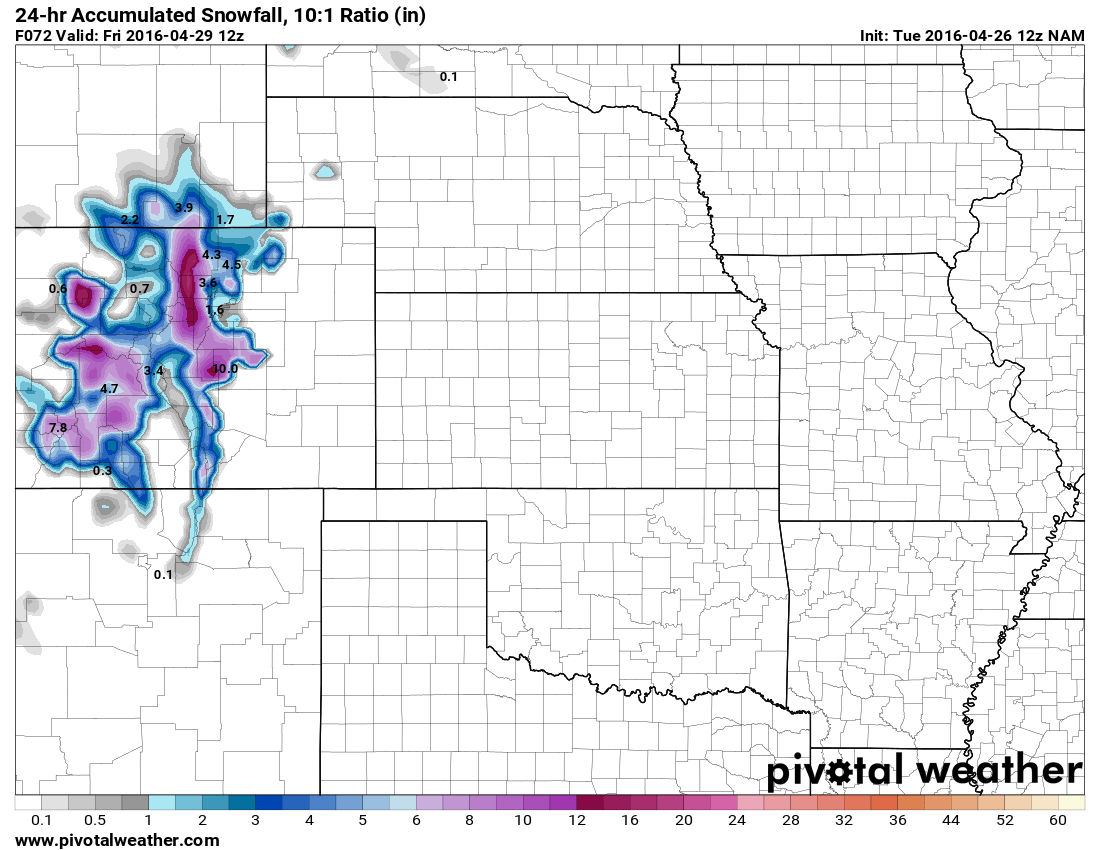
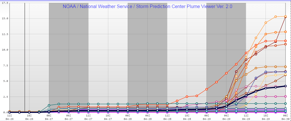
As of this posting snowfall is looking likely during this time-frame, especially South of Denver. Models are picking up on some decent snow totals along the Palmer Divide and foothills as of this morning's runs.
Here's what we are seeing so far (Please Note: this is not an official forecast, just a look at what models are predicting at this time!)
For the Castle Rock Area:
- GFS
- 8-12 inches total accumulation

- NAM
- 6-10 inches total accumulation
- SREF Ensemble
- 4-6 inches total accumulation

Summary
There is still a ton of uncertainty with the snow chances later this week and into the weekend. Most models across the board are predicting some type of snowfall accumulation but they can't agree on what time it gets here. Some models have snow falling as early as Thursday night along the Palmer Divide, others don't have any until Saturday. This is another one of those, "too early to call" situations, but that being said I will be watching the models very closely the rest of this week.
Plan for
- Snowfall likely later this week into the weekend
- Snowfall accumulations cannot yet be determined, so if you here forecast amounts yet take them with a huge grain of salt.
- Snowfall accumulations look less than our blizzard at this time, but could be significant enough to impact travel
Stay tuned with us throughout the week as we will have updates when the models give us a better clue as to this storm's behavior.

Are there any update weather models you can share?
Just put one up!
https://mountainwaveweather.com/2016/04/27/tracking-weeks-possible-snow-storm-april-28-30-2016/