
There was a lot to be excited about last week, models were predicting a major weather pattern shift and with it the chances of the first big snows of the season. Phone apps promised 4-8 to 6-12 inches of snow on Thursday and another healthy dose of the white stuff on Saturday. We were a little bit more skeptical here at Mountain Wave Weather (as we tend to be most times.) The problem with models is that the further out they are, the more difficult it is for them to pick up on subtle details and as we know in Colorado a shift in a storm system 50 miles North or South can be the difference between several feet of snow or nothing at all. Additionally, phone apps are not consistent, they are forecasts put together by computers with no human interaction to throw out the outliers, this often results in a lot of "bouncing" forecasts.
The overall weather pattern for the Western United States and Colorado has been a large ridge of high pressure centered over our area. This feature has brought us a ton of warm and dry weather and very few solid snow storms, most leaving only a dusting to maybe an inch or two of snow on the ground. The problem is when these types of things settle in, they can be very difficult to break.
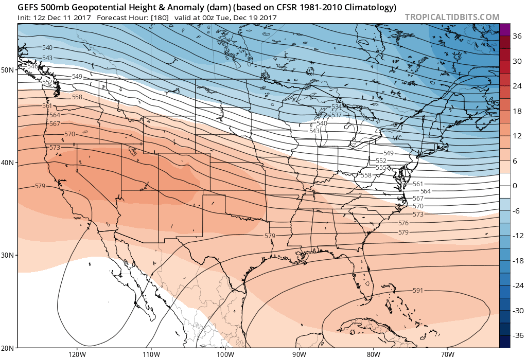
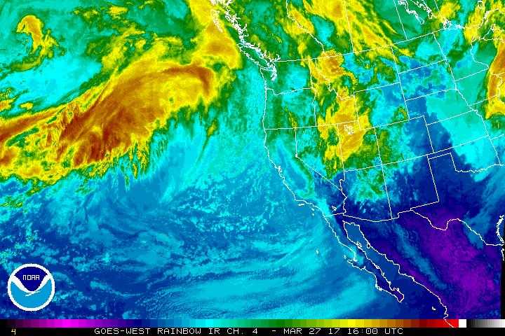
A look at the predicted setup for last week, warmer and drier air along with the jet to our North kept most of the storms away from us.
Thursday Storm System
Analysis:
I just had to share this graphic that our friends over at Weather5280 put together and posted today. It shows an excellent example of how this storm system has evolved and why it's not looking too impressive anymore...
Credit: Weather5280 | Click the image to see it animate.
You can see how the trough continues to shift Northeast of Colorado from the starting point last Sunday and into Monday and finally today. The problem is, this entire storm system depends on our high pressure braking down and moving far enough South or West for the trough to dig into Colorado. When you have such a stubborn high pressure ridge as we have, it gets difficult to break them down and move them out. So all in all, this the main reason we've remained pessimistic about a decent snow out of this storm system. The snowfall falling apart for this system was more likely than it becoming a monster storm for us, so this wasn't exactly surprising.
What to Expect:
Timing
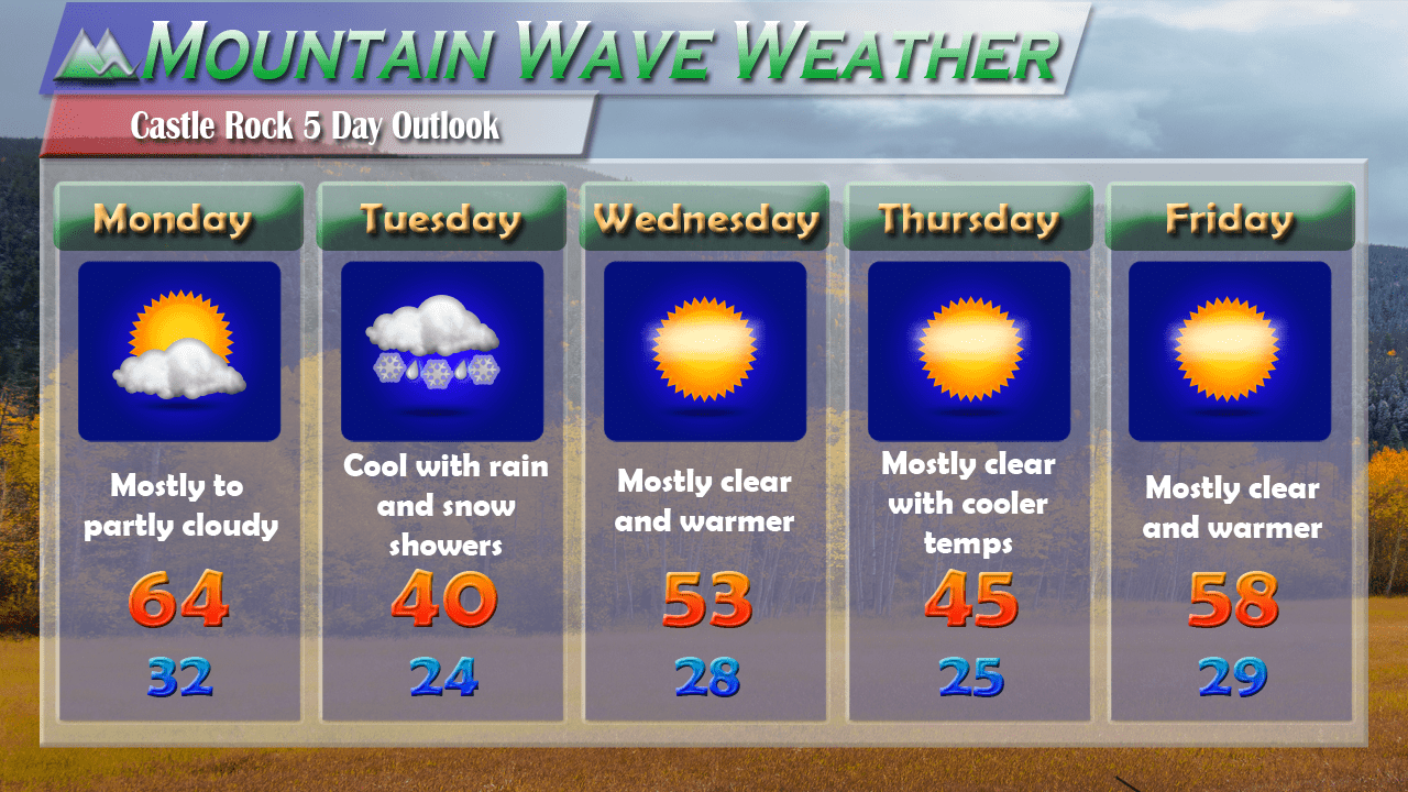
Snow looks to move into the area beginning early Thursday morning. The latest run of the HRRR shows snow beginning sometime between 4-6 AM, so expect that for the morning commute on Thursday.
Hazards
Again with this storm, we are not expecting huge snow totals. With the very cold temperatures, wind and snowfall we will see slick spots on the roads potentially Thursday morning. Be prepared for icy conditions especially along the foothills and Western areas of the Palmer Divide.
Impacts
We expect minor to moderate travel impacts, but not widespread issues. Roads that get stuck under snow the longest will have the best potential for becoming icy. Keep this in mind for your Thursday morning commute, leave a little bit of extra time if need be.
Snowfall Amounts
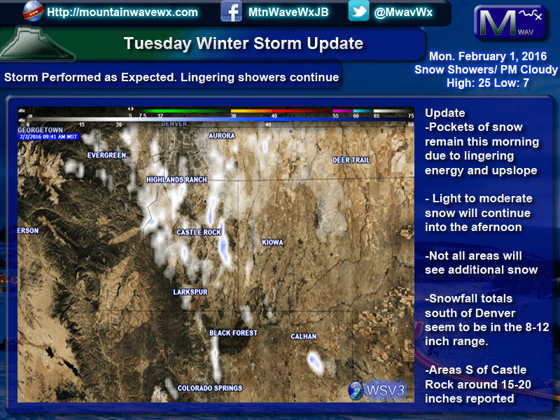
Our forecast generally agrees with what the NWS is expecting so we have posted that graphic along with some of our own details below:
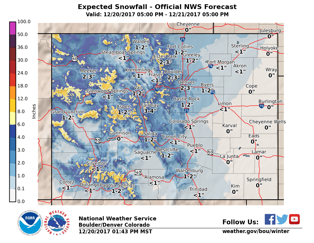
- Castle Rock
- 1-3 inches total accumulation looks good as of right now. Models have been pretty consistent showing snowfall ending up right around 1 to 2 inches.
- Areas South and West of Castle Rock (Palmer Divide, Sedalia, etc…)
- 1-4 inch range for snowfall
- South Denver Suburbs
- 1-3 inch, should see similar amounts to Castle Rock but this storm will have a Northern bias. Expect slightly higher snow totals in and around the Denver/Boulder area
- Elbert Area (Southeast of Castle Rock)
- 0-3 inches, don't be surprised to see little to no snowfall as you begin to move East of the urban corridor.
A Quick Note about Saturday's Storm

A lot of folks have reached out to me regarding travel conditions on Saturday/Sunday. The storm Saturday looks even less impressive than Thursday's and models have been consistently phasing out snowfall in many locations. Does this mean it won't snow or there will be no problems? Not necessarily, but with the data we are seeing right now along with the combination of the stubborn weather pattern we are in; I'm not terrible concerned about folks travelling around on Saturday or Sunday.
My suggestion would be, stay tuned to your favorite, reliable weather source for any forecast flips or changes (whether that is us or anyone else) and we will be sure to keep an eye on it. But we don't anticipate any major flight problems or road issues at this time.
Reach out to us with any additional questions, we know weather and travel are quite the concern this time of year! We may even do a facebook live session this week and answer any questions related to the weather over the next 3-5 days. We'll see where that goes, for now stay warm and stay safe!
