As we tick the final few days of 2016 away we will experience relatively nice weather along the front range including in and around the Castle Rock Area.
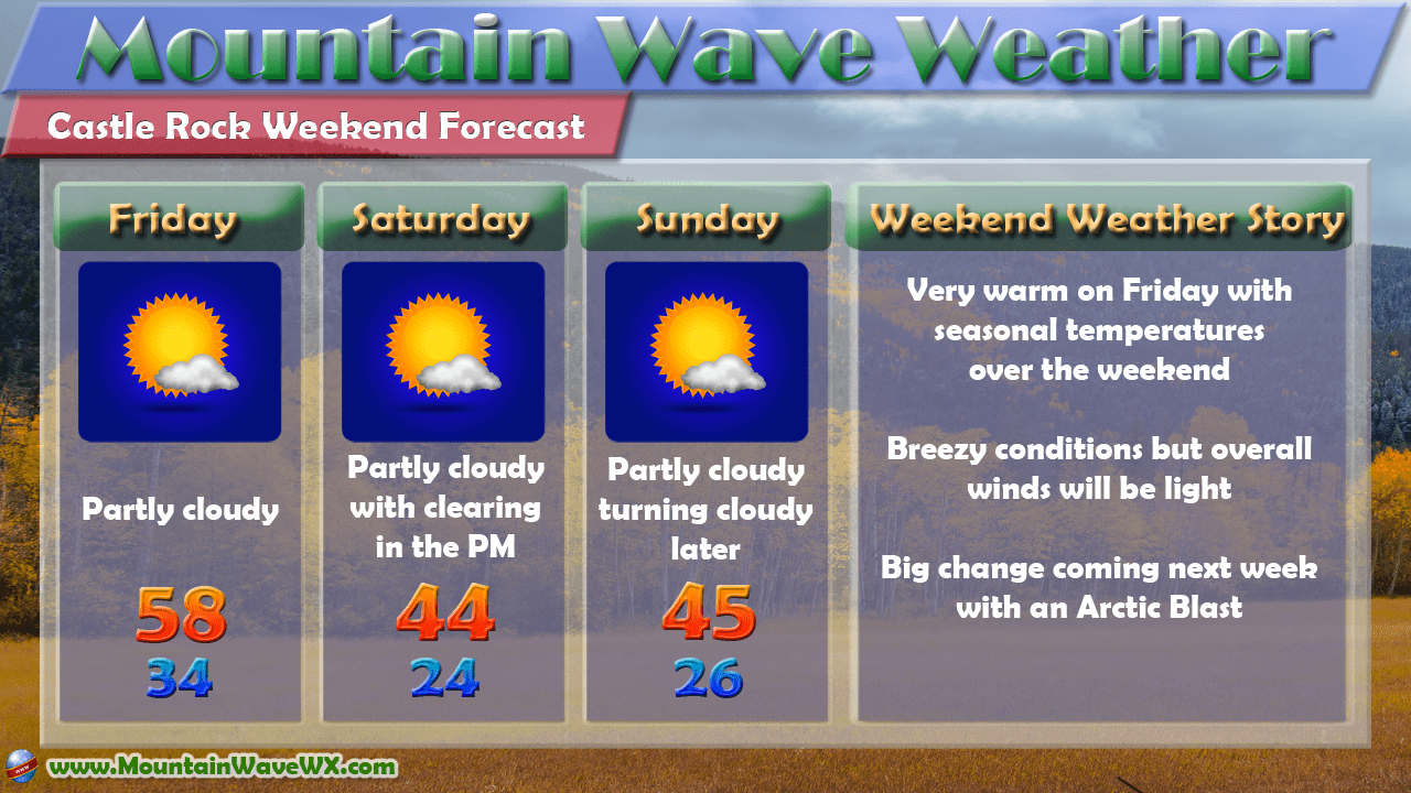
A quick look at Castle Rock's weather for the next 3 days
Warm downslope winds will help temperature reach nearly 60 degrees on Friday followed by a slight cooldown over the weekend. Temperatures will be seasonal on Saturday and Sunday with highs topping out right around the mid 40's and lows in the mid 20's. Enjoy this while you can because indications are that we will be in for a prolonged pattern shift starting as early as next week.
Big Change Coming Next Week!
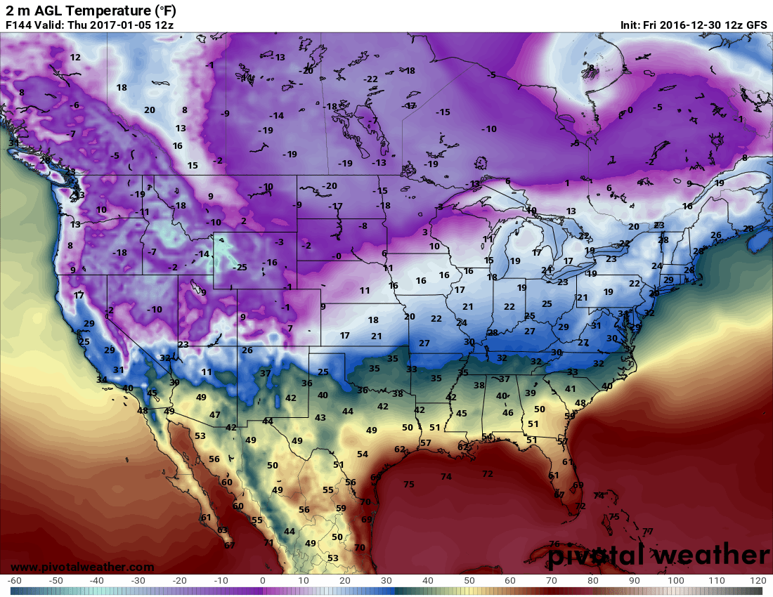
Just like many of the past few storm systems we've seen, there will be 2 main impacts with next week's storm: the cold and the possibility of snow. It's too early to talk about snow being this far out but it will be something we will keep a close eye on throughout the weekend and into next week.
The cold air moving into the state is something we are fairly certain about, not just from modeling but from probabilistic as well. The Climate Prediction Center's latest 6-10 day outlook shows a 90% probability for colder than average air... we'll take those odds. Not to mention, that's a lot of dark blue!
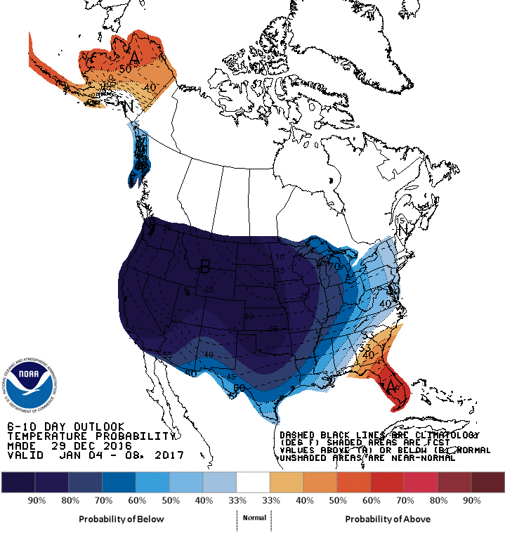
CPC 6-10 Temperature outlook
The CPC's outlook is not something I look at a ton these days but there is some strong correlation between their product and what next weeks' models are showing. Notice the image below; the warmer air we experience today and over the weekend is replaced by a blob of very cold, arctic air into next week.
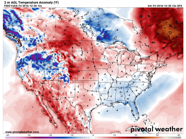
Temperature anomalies for next 7 days
Temperature anomalies for the next 7 days are snow above, these are how much above or below normal the temperatures are expected to be for a specific time, they are not the actual forecast temperatures.
Keep A Close Eye on Next Week
With the latest data we have in, here is what we are watching closely for and folks should be prepared for next week:
- Cold air
- Expect an initial cooldown on Monday
- A re-enforcing shot of arctic air by the Tuesday/Wednesday time-frame
- Temperatures won't be extreme, but very chilly with possible overnight lows at or slightly below zero
- Snow
- Snow is possible, some models show snow accumulation with the arrival of arctic air on Tuesday/Wednesday
- Too early for specific totals, just be prepared for snow around that time period next week
- This will be another "clipper" type storm, similar to the past few we've seen. We usually don't pick up a ton of snow with these types of systems but the possibility exists for decent accumulation if everything comes together (like the last storm we had.) Fear not though, it is way too early to tell how much snow will impact our area!
For now, we will keep a close eye on how this storm evolves over the weekend and pass along any important forecast changes or updates.
Happy New Year!
I hope everyone has a happy and safe holiday weekend to celebrate the new year. We are working hard to bring some cool new features to our site into next year!

We have a whole host of new things we are going to try to build into next year including a new real-time weather dashboard for Castle Rock's weather. I'm super excited about this especially since it will allow folks to see real-time weather conditions in Castle Rock easier, along with trends, graphs, graphics and a whole host of cool stuff to see Castle Rock's weather conditions and stats.
We are adding a few other new things as well that I'll discuss as we get closer, but the big question is what else do you want to see on MountainWaveWeather? We are taking any and all suggestions, so feel free to chime in on our Facebook page or here on the site comments!
Additionally, MountainWaveWeather has been going for 2 years now and I want to thank everyone for following along with us and talking weather. It has been really fun being able to write about and interact with folks about the weather over the past couple of years, and here's to many more!
~John Braddock
