After several weeks of well above average temperatures and incredibly dry conditions, it looks like we may finally see a fall weather pattern change on the horizon!
Ridge of Doom is Breaking Down!
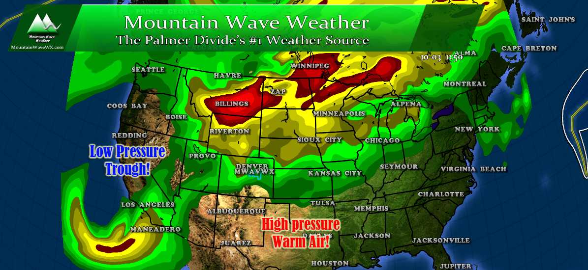 For the past several weeks a high pressure ridge has been fairly efficient at keeping warm dry air over Colorado and keeping the storm track away from us. Signs that this is changing are beginning to appear as early as today. 500mb (upper air pattern) shows a trough digging into the Western United States and pushing the ridge responsible for our stagnant weather pattern eastwards.
In simplest terms, this means warm and dry air will dominate the weather pattern for the Eastern U.S. but things in the west will be changing! The trough to our west will finally allow cold air pooling in Alaska and Canada to make its way down to the western and central part of the U.S.
Is Snow in our Near Future?
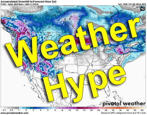
You've no doubt heard the hype already on a lot of weather websites, social media platforms and TV stations; but snow early next week is looking like a sure thing for the mountains of Colorado... and yes the possibility exists even for the front range to see something as well, but as with a lot of these early season storms; the devil is in the details!
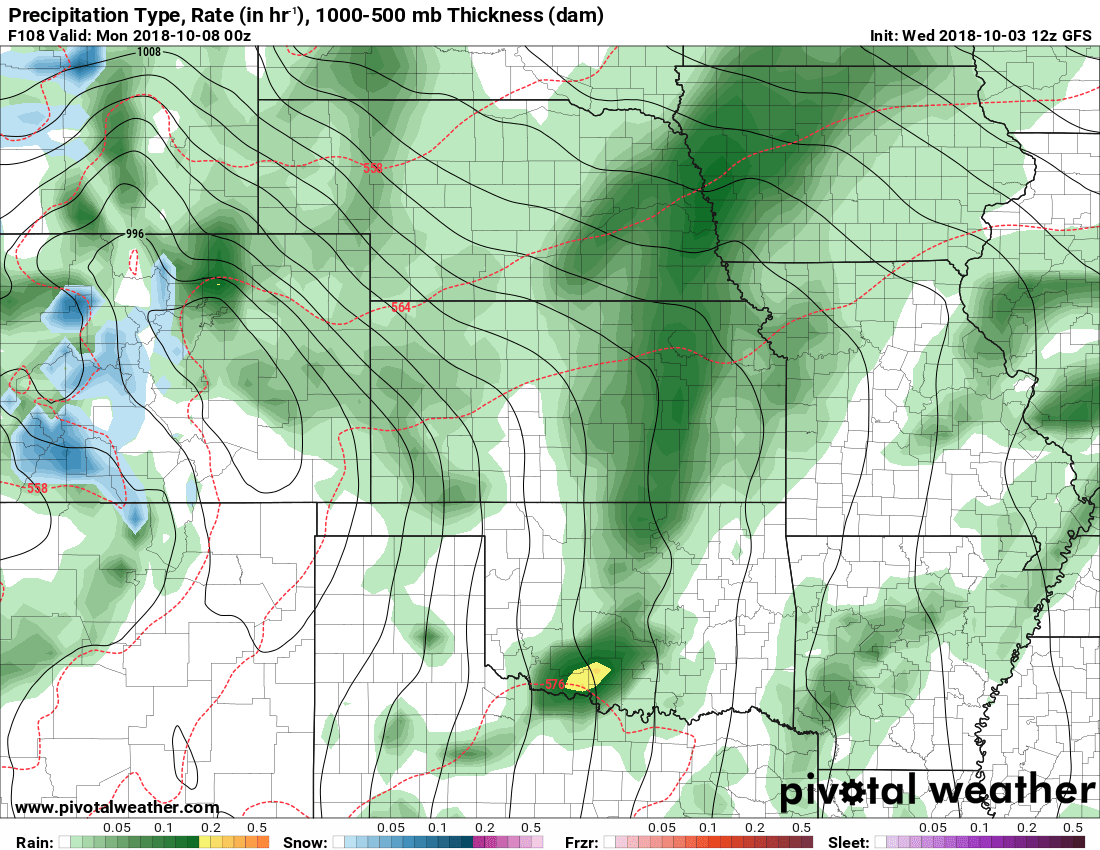
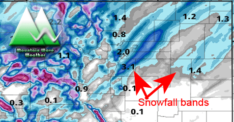
GFS Precipitation type and intensity for Sunday 6PM
Looking at some of the longer range (read: less accurate in this time frame) models we see a strong upslope signal showing itself on Sunday and into Monday. The trough should be fairly efficient at bringing cooler air and moisture into the area. But, just like a lot of our "fall/winter" type storms; exactly where and how things set up will make all of the difference.
Don't get too excited about snow flying around Castle Rock just yet, but this is something to definitely keep an eye on over the next few days. Here's a few things we will be watching:
- Cooler and more unsettled pattern for the rest of the week into the weekend is looking very likely
- Expect cooler temperatures and precipitation Wednesday and again over the weekend
- Snowfall is not expected along the Palmer Divide for the next 3-4ish days.
- Weekend has a reinforcing shot of cold air and may be able to tap into decent moisture
- Where the trough sets up will determine moisture availability and upslope possibility
- Will the air be cold enough for snow? We think it is a strong possibility but may be too warm for much to stick
- Timing! Some models shows this stuff cranking by mid-day Saturday while others hold off until later Sunday into Monday
So obviously, still a lot of unanswered questions that need to flesh out in the next few days.
For now, anticipate cool and unsettled weather for the next 5-7 days beginning with a cold front late in the day Wednesday. Be prepared to move sensitive vegetation indoors this weekend and possibility of needing to cover above ground irrigation equipment if it's not already drained late in the weekend (think Saturday night - Monday night timeframe)
We do not yet have answers on if it will snow (50% probability at this time) and/or what the impacts will be, stay tuned for further updates on that information!
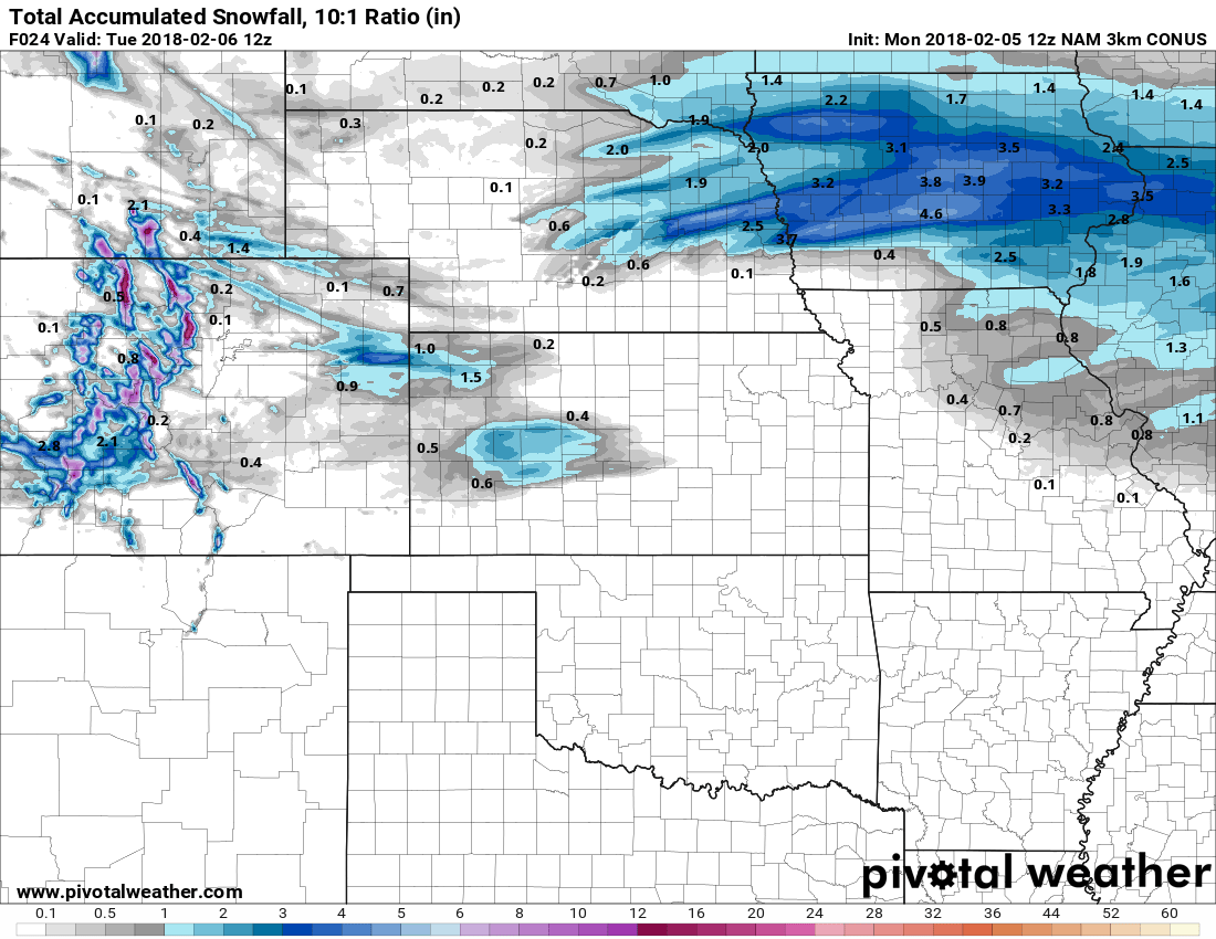
Obligatory Snowfall Model for Late This Weekend
You all know I hate sharing snowfall models this far out... the reason I'm doing it right now is I just want to show you all what models are picking up on as of this morning.
Keep in mind with this image: It is not a forecast, it is very early and preliminary, these numbers WILL change higher or lower as we get more data in and get closer to the storm's arrival.
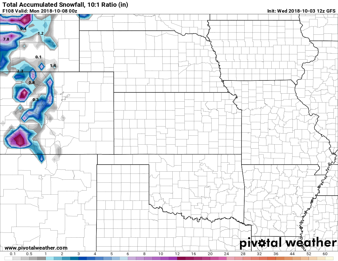
GFS total accumulated snowfall from now through Sunday 6PM
This is also why I caution about anyone trying to forecast we definitely will or will not have snow next week. This model was showing 4-8 inches of snow for the Palmer Divide last night and this morning's run shows 0!
