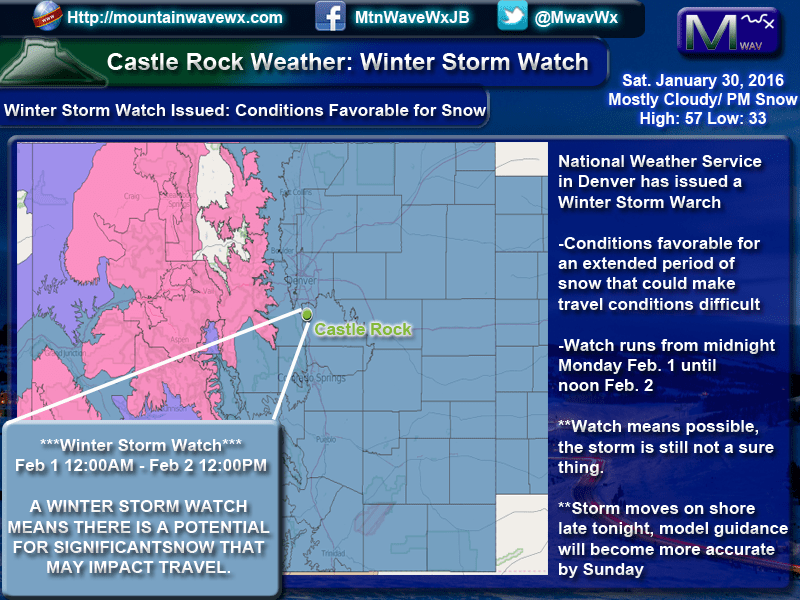
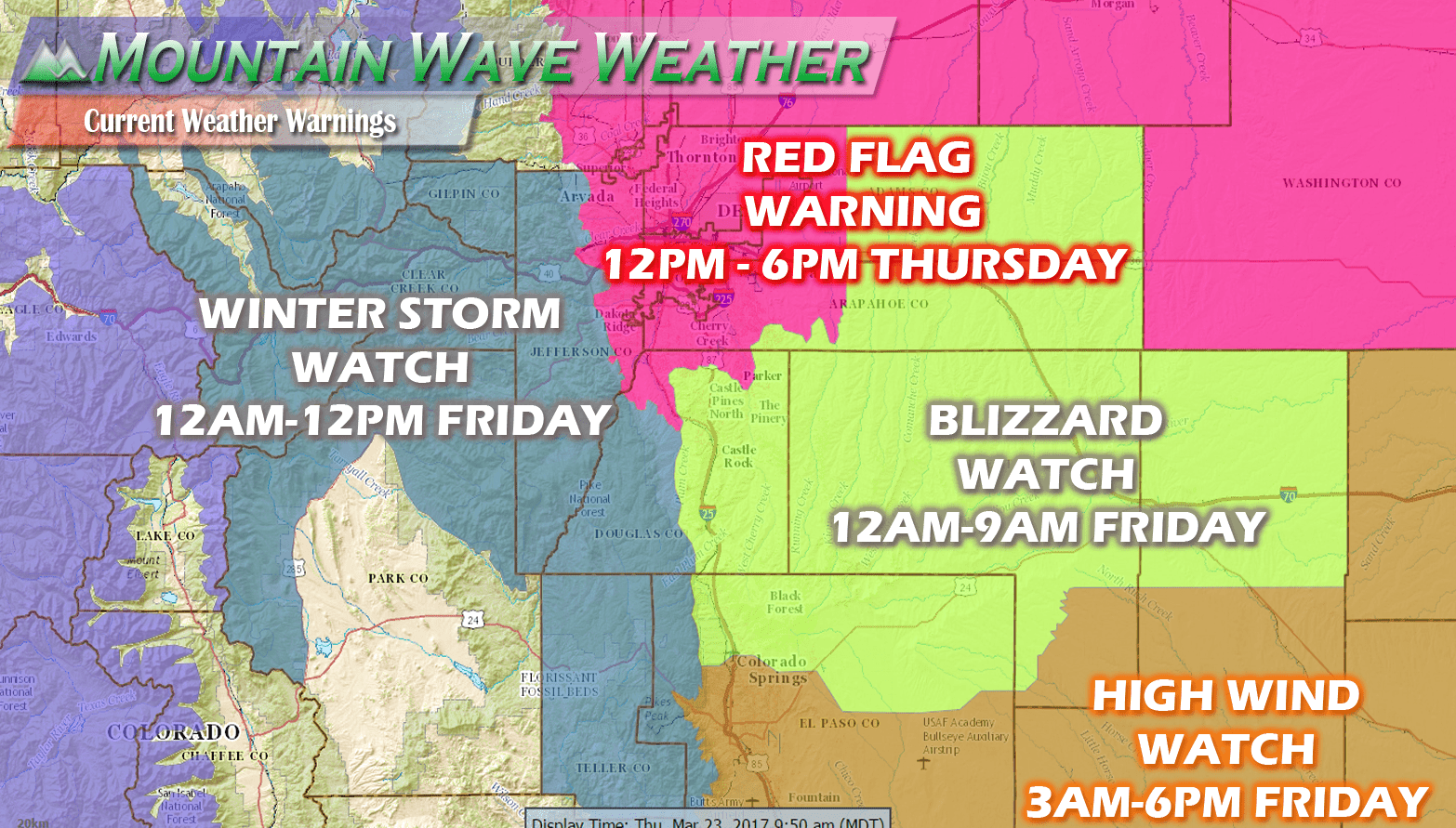
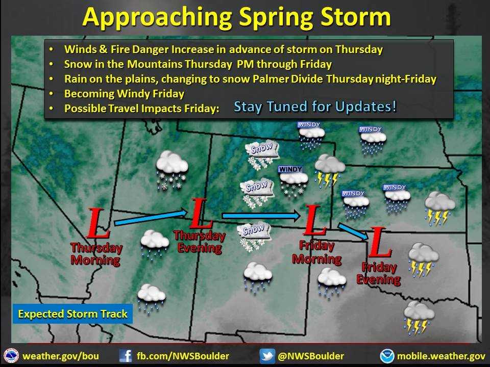
The National Weather Service in Denver has issued a Winter Storm Watch for much of Colorado including areas South of Denver, along the Palmer Divide and for Castle Rock proper. The watch means conditions are favorable for a storm that could make travel conditions difficult.
The watch runs from midnight Monday through about noon on Tuesday, the heaviest snowfall is expected during this period.
A Watch means conditions are favorable, we will look for a warning before deciding this storm is a sure thing. There is still considerable uncertainty with the storm track overall and that can make a huge difference in how much snow the front range sees.
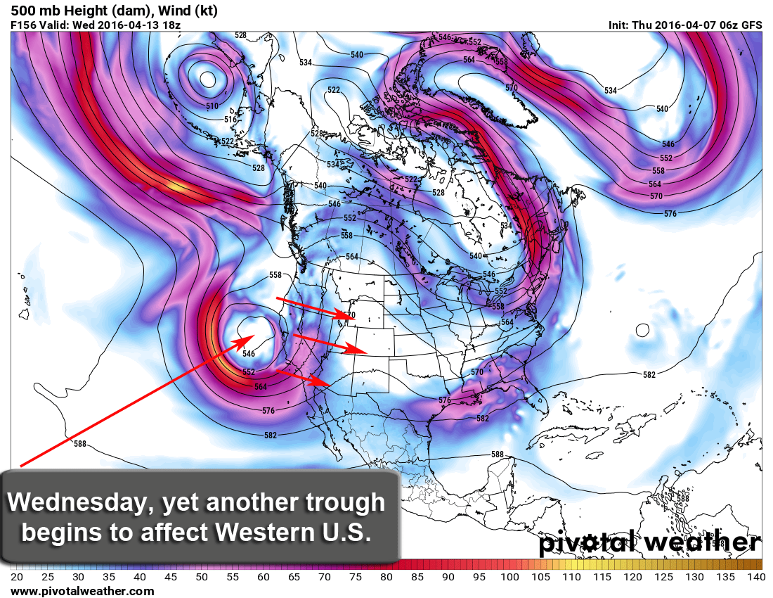
Speaking of how the models are doing:
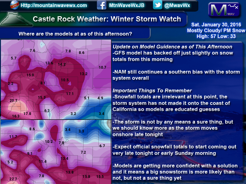
In the image above, the GFS is on the top and the NAM on the bottom. The GFS has backed down, just slightly this morning but model bouncing is still in play here. The NAM favors a more southern track to the storm which would mean less snow for Denver, but not necessarily less for those of us along the Palmer Divide.
The storm system has not moved onshore for the U.S. yet so models are still having trouble with the track. Any wobble could make a huge difference in the total snowfall.
