The week ahead looks to transition back into a more summer pattern for Colorado and most of the Southwest and South. As the storm system responsible for our cooler air and rainy conditions departs off to the Northeast, a high pressure system moves in from the Southwest. High pressure generally means the storm track gets steered away from Colorado and hot, dry, desert air from the Southwest gets pushed into Colorado and the Southern and Western United States.
On the 500mb (upper level air) model below, we can plainly see the low off to the East and the high building in over SW Colorado. This model run is for Tuesday and subsequent model runs show this feature strengthening through Wednesday and Thursday.
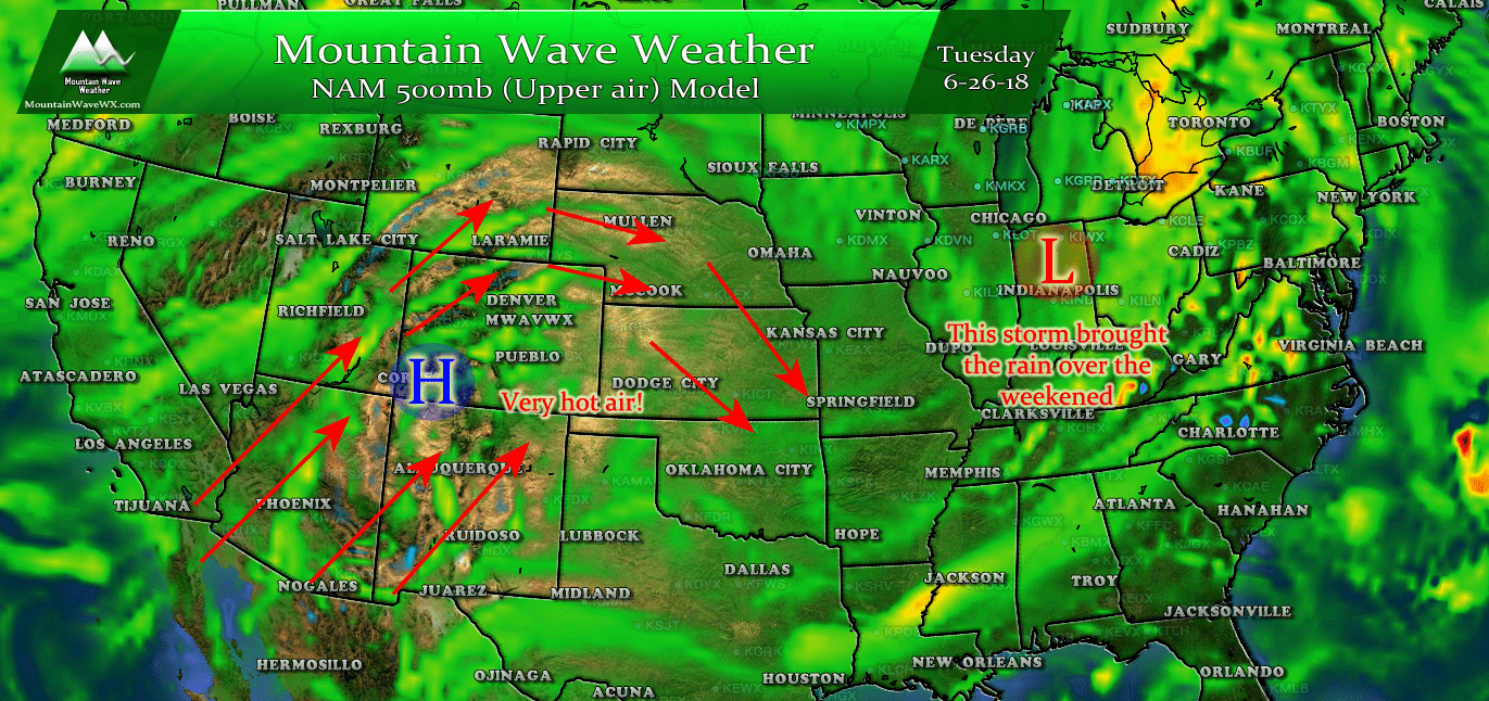
Upper level ridge (high pressure system) seen building over Southwest Colorado for this model run on Tuesday June 26.
So what does this mean for our weather this week? Plainly put... it's going to get very hot. Possibly some of the warmest temperatures we've seen in at least a year and possible a couple of years. Here's a look at forecast high temperatures for Tuesday - Thursday this week.
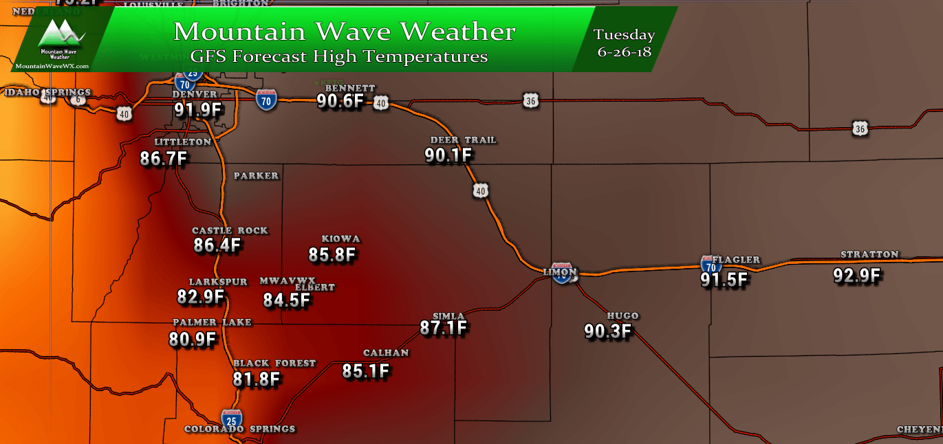
Tuesday High Temperatures
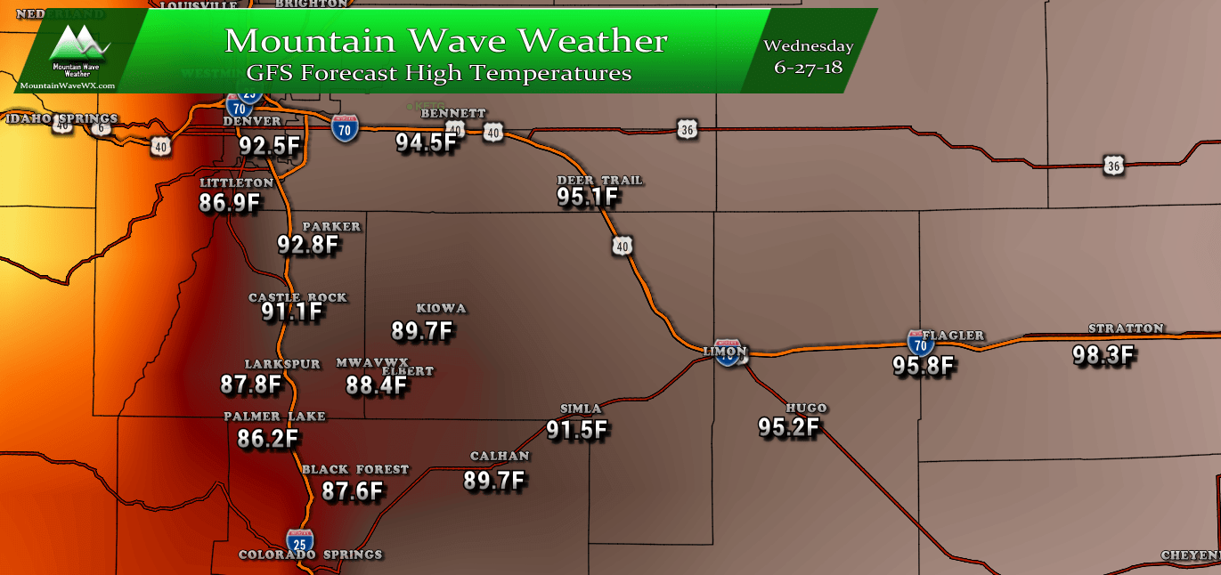
Wednesday High Temperatures
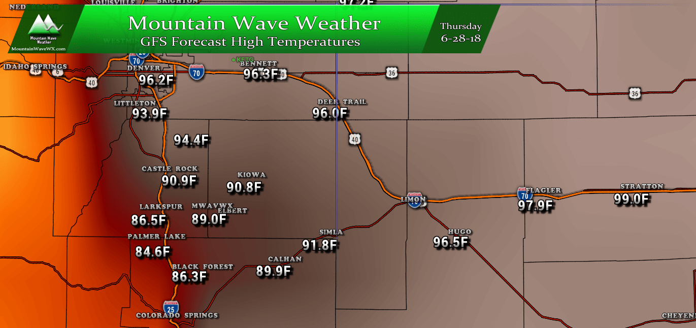
Thursday High Temperatures
Toasty to be sure, but honestly I think the temperatures from this model for Wednesday and Thursday are a bit cooler than they will end up. A lot of the model ensembles show temperatures pushing or exceeding 100 degrees in Denver for Wednesday and Thursday. If that occurs, expect temperatures along the Palmer Divide to trend upwards a few degrees from what you see above as well.
Summary
Expect mild conditions on Monday as the ridge hasn't quite built in yet. By Tuesday we begin to crank the heat up a bit but the hottest days will be Wednesday and Thursday by far. Chances for rain or thunderstorms look low (generally 10% or below) through Thursday.
If you have outdoor activities this week, stay cool and hydrated. Sunscreen will also be an absolute must!
