Colorado will continue to see dry and warm conditions mainly along the front range with the best chances for storms holding mainly to mountain areas through the week. We see a bit of a chance of rain towards the end of the week but overall coverage from those storms looks pretty sparse. We are eyeing a larger storm system at the beginning of next week but it looks less than impressive at this time for moisture. Here's a look at what to expect the rest of this last week of September:
Forecast for this Week
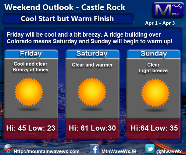
Keep in mind, average high temperatures for Castle Rock this time of year are in the lower 70's and will soon be upper 60's!
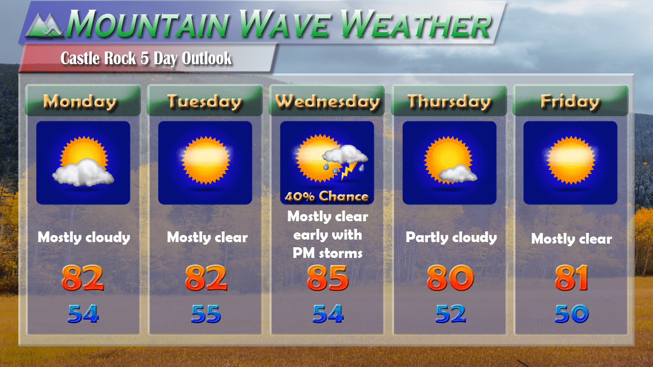
Castle Rock
Wednesday Sept. 28
Mostly clear through the day with above average temperatures. Winds should remain light and no precipitation is expected.
High temperature: 79 degrees Low Temperature: 44
Thursday Sept. 29
Mostly sunny with a few clouds in the afternoon. Breezy conditions may develop by the afternoon and evening hours.
High temperature: 80 degrees Low Temperature: 46
Friday Sept. 30
A weak upper level disturbance will move through. Mostly to partly cloudy conditions in the morning will transition to cloudy with a slight chance of thunderstorms in the afternoon hours. Areas South of Denver will have a slightly higher chance of thunderstorms but most storms will remain scattered in nature.
High temperature: 76 degrees Low Temperature: 44
Summary
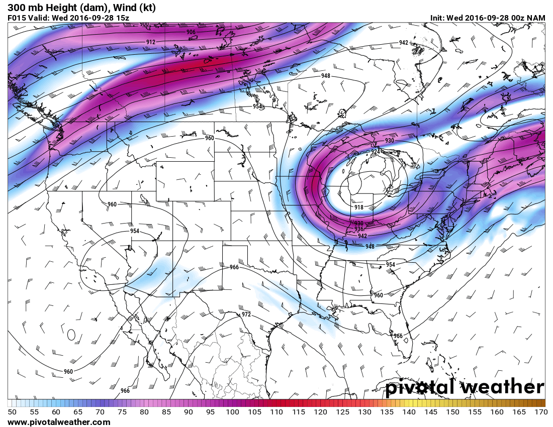
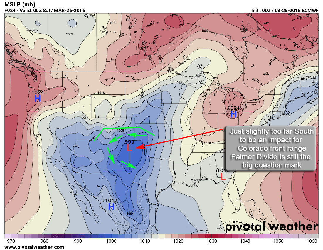
Upper air pattern this week, notice the high pressure over the Western U.S. This means a continuation of a warm dry pattern for Colorado in the near term.
The weather pattern is relatively docile this week with a high pressure ridge hanging over Colorado. This will keep colder air and storm systems generally away form the state for most of the week. A bit of instability may form a few storms in the mountains but the front range's best chance for rain looks to be Thursday and Friday. Overall though, the rain chances look to be in the 30-40% range at best, not very promising.
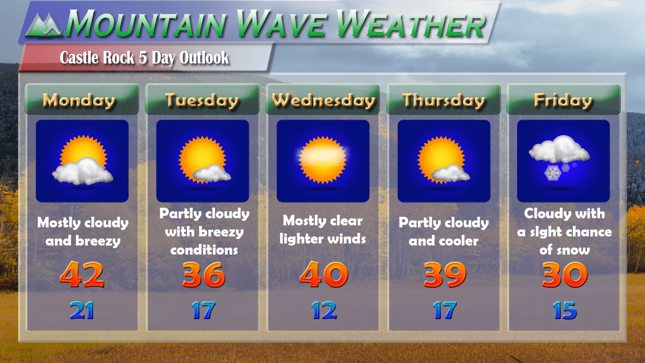
We are keeping an eye on a larger storm system coming into town early next week. At this time, the storm system looks pretty weak as well with limited moisture to work with. Should this verify, we could see a dry start to October after three dry months in a row now... hopefully we see a larger scale pattern shift soon!
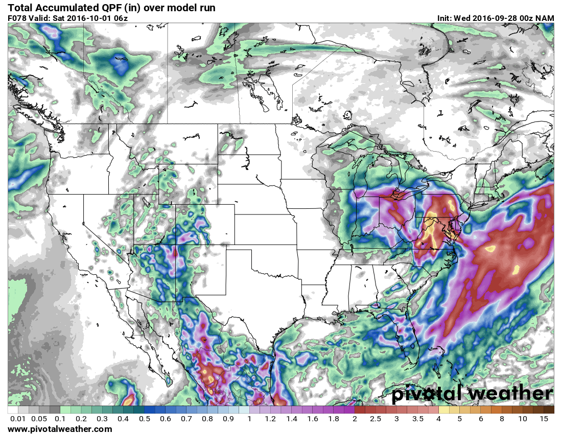
QPF or quantitative precip expected through Saturday. Notice is shows the bulk of moisture staying West of the divide through the week
I'll keep watching and will have more details on next week's storm system with the weekend outlook on Friday. Happy Wednesday!
