A quick update on the storm system moving through this evening and into tomorrow; this is what we like to call a classic "back door" cold front. Cold temperatures to our Northeast will back into Colorado along the front range. With this storm system there's enough moisture that lift associated with the cold front should be able to saturate the atmosphere and squeeze a bit of snow out.
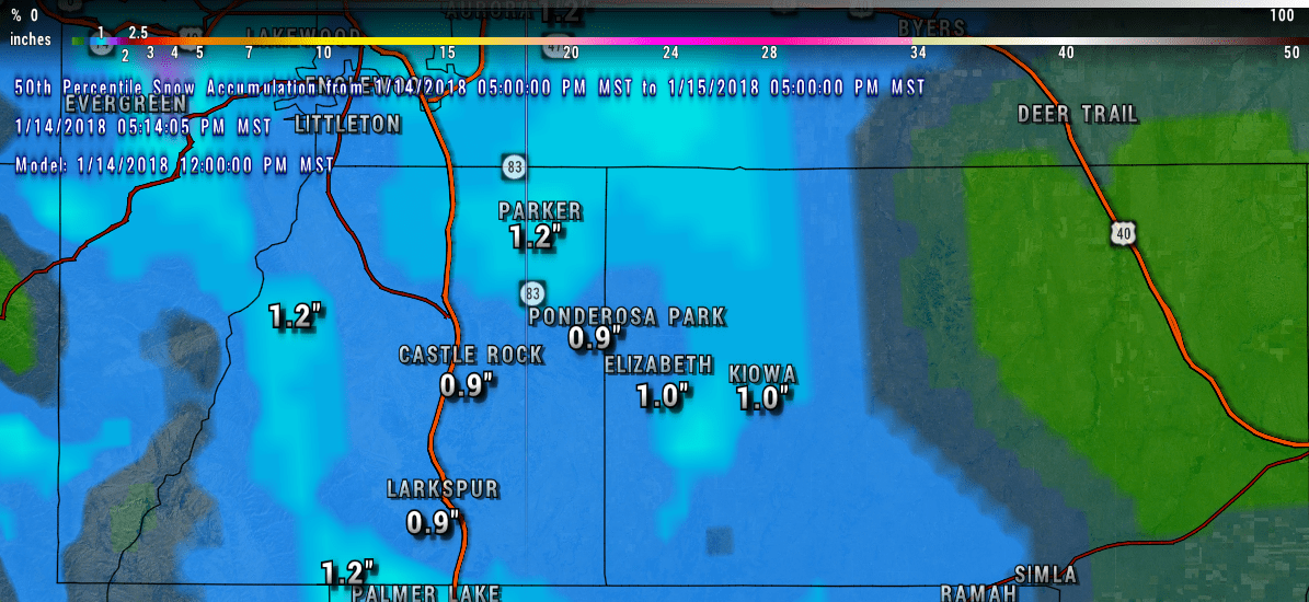
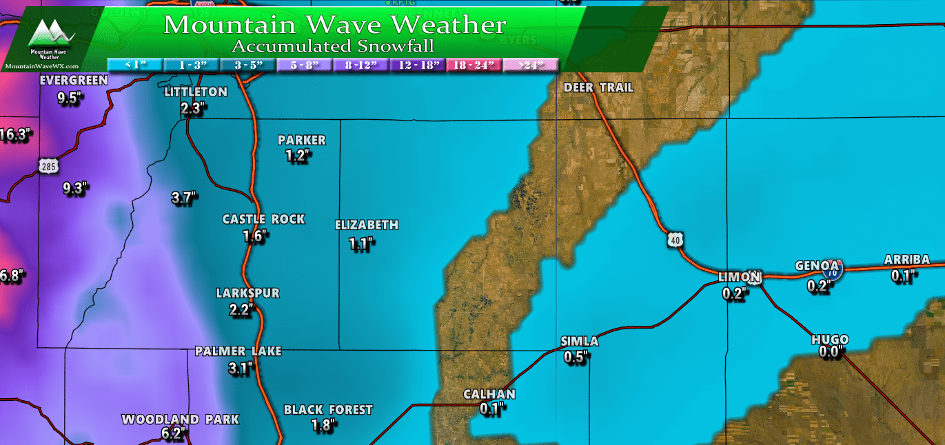
Expected snowfall totals for the Palmer Divide area through Monday afternoon.
As you can see from above, the snowfall accumulations shown by the models are pretty light. This is what we'd expect with this type of storm system, we just don't see big snowfalls from these types of storms. In fact, most of our storms this year have shown similar characteristics to this one, so don't expect heavy snowfall or high accumulations with this one.
What to Expect for this Storm
When
Snow should begin during the late night and early morning hours, Monday morning will see snowfall by dawn and continuing into the afternoon hours. Most models are showing snow accumulation beginning around 5AM, so expect snowfall to start between 3AM-6AM, this means the morning commute may need to be watched.
Hazards
Slick roads will be possible for some areas as snow begins to accumulate in the morning. We've seen several instances this year where even a small amount of snow can cause issues if it has a layer of ice underneath. Icy conditions will be possible so expect the potential for minor to moderate travel issues during the Monday morning commute.
Snowfall Accumulation
- Castle Rock
- 0-2 inches total accumulation expected for the immediate Castle Rock area
- Areas South and West of Castle Rock (Palmer Divide, Sedalia, etc…)
- 1-3 inch range for snowfall
- South Denver Suburbs
- 0-2 inches of accumulation expected, some of the Southeastern parts of Denver may fall in the 1=3 inch range
- Elbert Area (Southeast of Castle Rock )
- 0-3 inches, models are a bit more spread for these areas with some in the 0.5 - 1 inch range with others in the 1-3 inch range. Total snowfall should fall between the 0-3 inch range with higher bias towards accumulations around 1 inch or less.
